


Gloucester Harbor
Gloucester, Massachusetts United States
Marinas near Gloucester Harbor
| Name | Reviews | Max LOA | VHF | Dock Depth | Gas / Diesel | Lift / Crane | Wifi | Amps |
|---|---|---|---|---|---|---|---|---|
| Ocean Alliance Docks-Gloucester | 150.0' | - | Low 11.0' | - | - | 30 | ||
| Bickford Marine Inc | - | - | - | - | - | - | - | - |
| The Studio | - | - | - | - | - | - | - | - |
| The Rudder Restaurant | - | - | - | - | - | - | - | - |
| 7 Seas Wharf | 70.0' | - | Low 8.0' | - | - | - | 30 | |
| Gloucester Marine Railways | - | 0.0' | - | Low 0.0 mHigh 0.0' | DYes | LYes | - | - |
| Gloucester Harbormaster | 60.0' | 14 | - | - | - | - | ||
| Beacon Marine Basin | - | 0.0 m | - | Low 0.0 mHigh 0.0 m | - | - | - | - |
| Eastern Point Yacht Club | 150.0' | 71 | - | - | - | - | ||
| Glasstech Boat Service, LLC | - | - | - | - | - | - | - | - |
| Eastside Marina LLC | 0.0' | - | Low 0.0 mHigh 0.0' | - | - | - | 30, 50 | |
| Cape Ann Marina | 150.0' | 10 | Low 7.0' | G$3.77D$3.76 | LYesCYes | 30, 50, 100 | ||
| Brown's Yacht Yard | - | 70.0' | 19 | - | G$4.459D$4.309 | LYes | - | - |
| Cruiseport Gloucester Marine Terminal | - | 0.0 m | - | Low 0.0'High 0.0' | - | - | - | - |
| Rose's Oil Service | - | - | 10 | - | DYes | LYes | - | - |
Introduction:
Gloucester is a located in Essex County, Massachusetts, with a city population of 30,273. A popular summer resort, Gloucester includes the villages of Annisquam, Bay View, Lanesville, Magnolia, Riverdale, East Gloucester and West Gloucester.
Located about 25 miles northeast of Boston, Gloucester is a major fishing village that also has a decent array of recreational boating services available for the cruising mariner. Gloucester was made famous by the book and movie "The Perfect Storm," which told he tale of the Andrea Gale, a swordfishing boat lost out of Gloucester with all aboard in 1991.
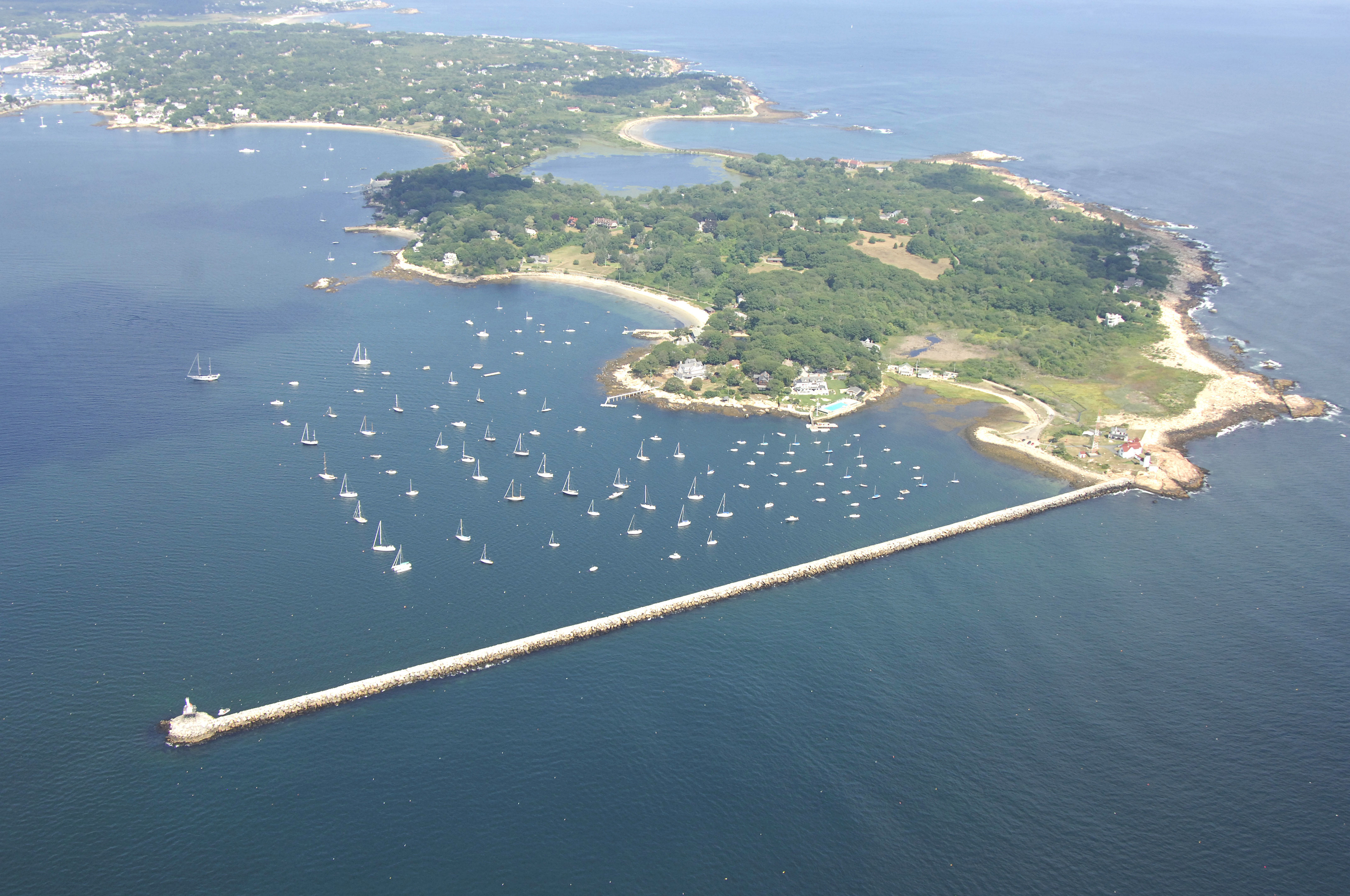
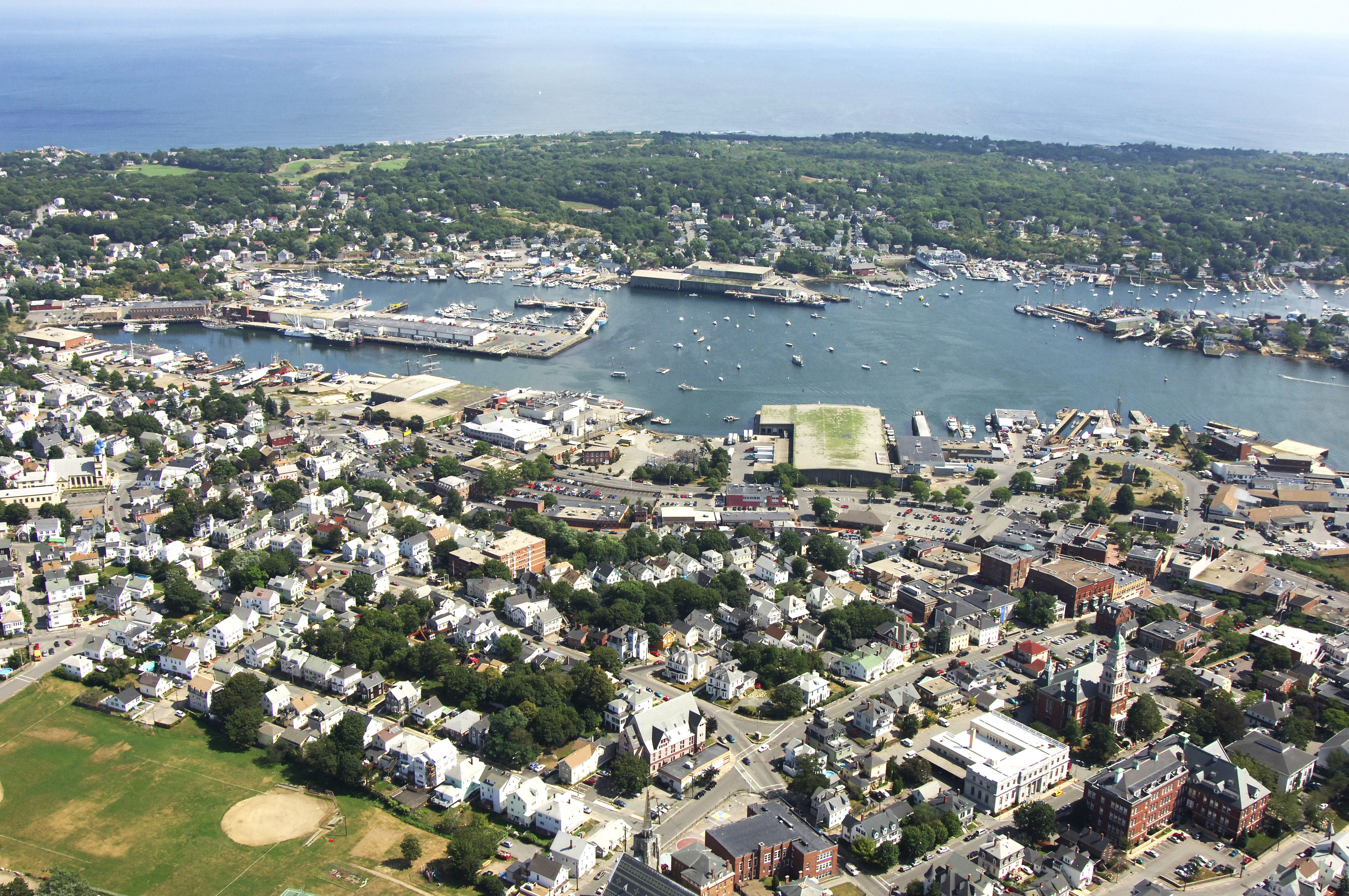
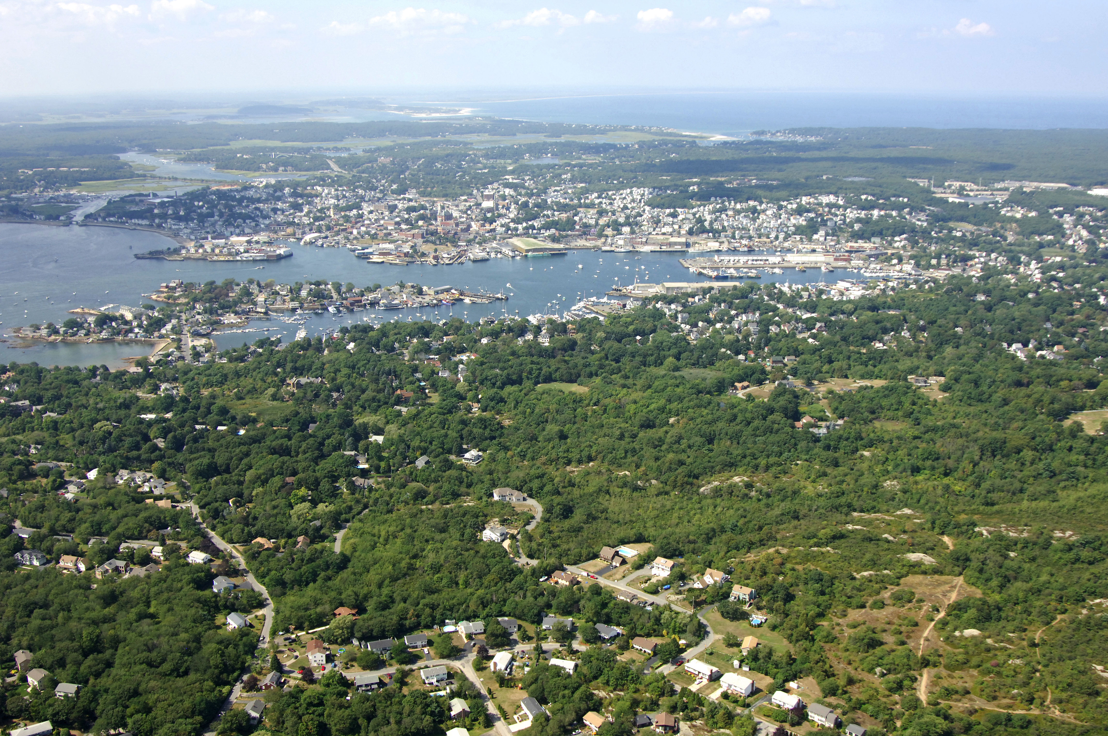
The town has a warm and typically northeastern feel to it, and is interesting to explore from shore. Most of the marine facilities here are located in Smith Cove, which breaks off Gloucester Inner Harbor to the east behind Rocky Neck.
History:
The town was an important shipbuilding center, and the first schooner was reputedly built there in 1713. The community developed into an important fishing port, largely due to its proximity to Georges Bank and other fishing banks off the east coast of Nova Scotia and Newfoundland. Gloucester's most famous (and nationally recognized) seafood business was founded in 1849 -- John Pew & Sons. It became Gorton-Pew Fisheries in 1906, and in 1957 changed its name to Gorton's of Gloucester. The iconic image of the "Gorton's Fisherman", and the products he represents, are known throughout the country and beyond. Besides catching and processing seafood, Gloucester is also a center for fish research.
Navigating the Water:
Use NOAA Chart 13279.
Harbor Cove and the other branches of Gloucester Harbor that make up the Inner harbor in the town of Gloucester are reached via a passage up Gloucester Harbor from the Atlantic Ocean. From the Atlantic, set a course for flashing red and green buoy "RR," just west of the Gloucester Breakwater Light. From here, you can either pass through Dog Bar Channel, which runs between Round Rock Shoal and the Gloucester Breakwater (20-foot depths, well marked), or if you are a bit skittish, you can travel around Round Rock Shoal to the west, and then make your course for Tenpound Island Ledge south of Gloucester.
Tenpound Ledge is marked by red nun "6" at its southern end. From red nun "6," you will proceed northeastward to red nun "8," marking Mayflower Ledge, and then flashing green buoy "11"west of Rocky Neck. The Gloucester Entrance Channel has a width of 300 feet and 18.5-foot depths.
Once you have entered the channel leading to Gloucester, set a course for red and green nun buoy "GH," which leads you into the middle of the South Channel and on to the Inner Harbor at green can "3."
Local Notices to Mariners:
Local Notices to Mariners are available online from the U.S. Coast Guard.