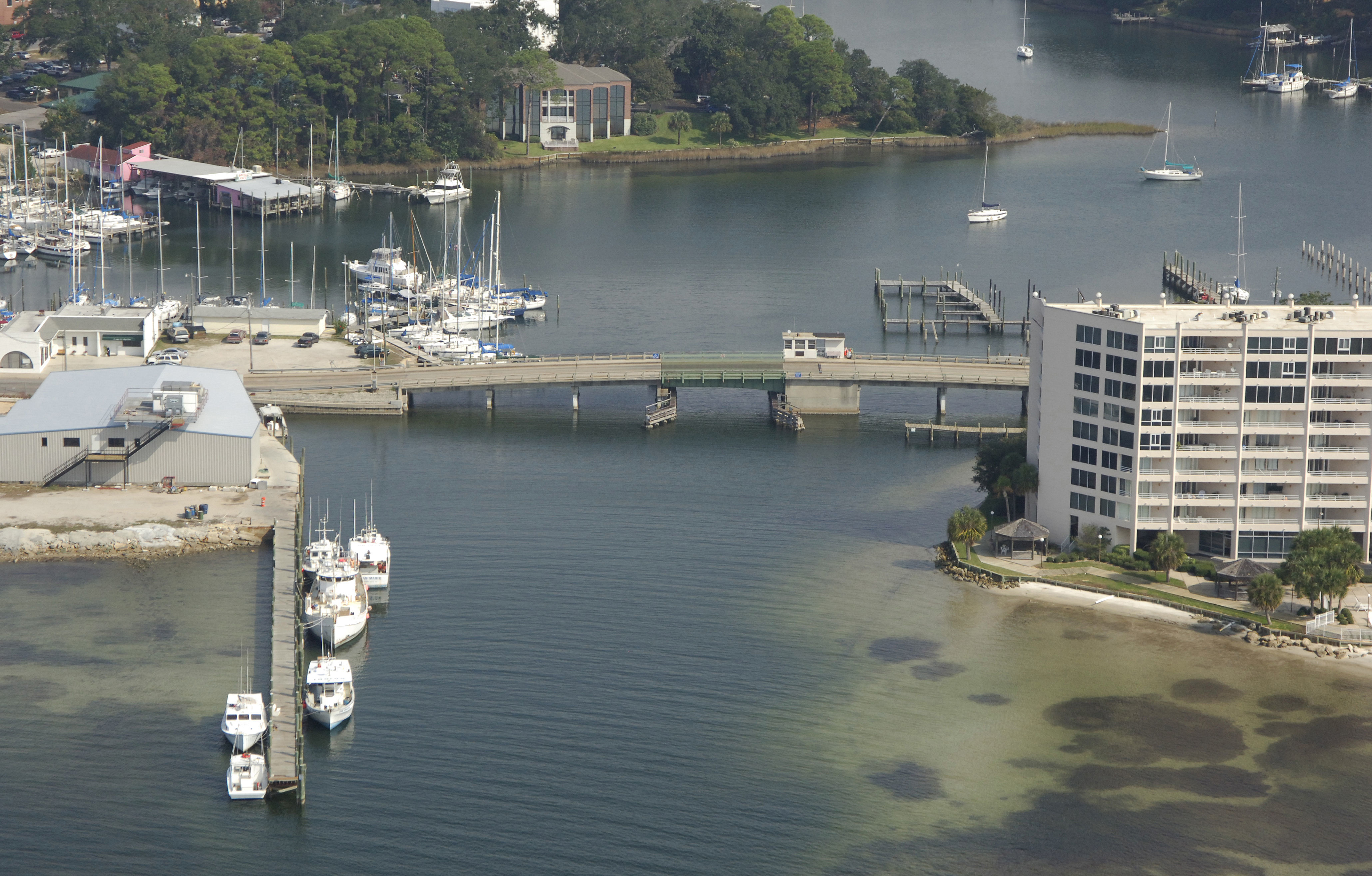
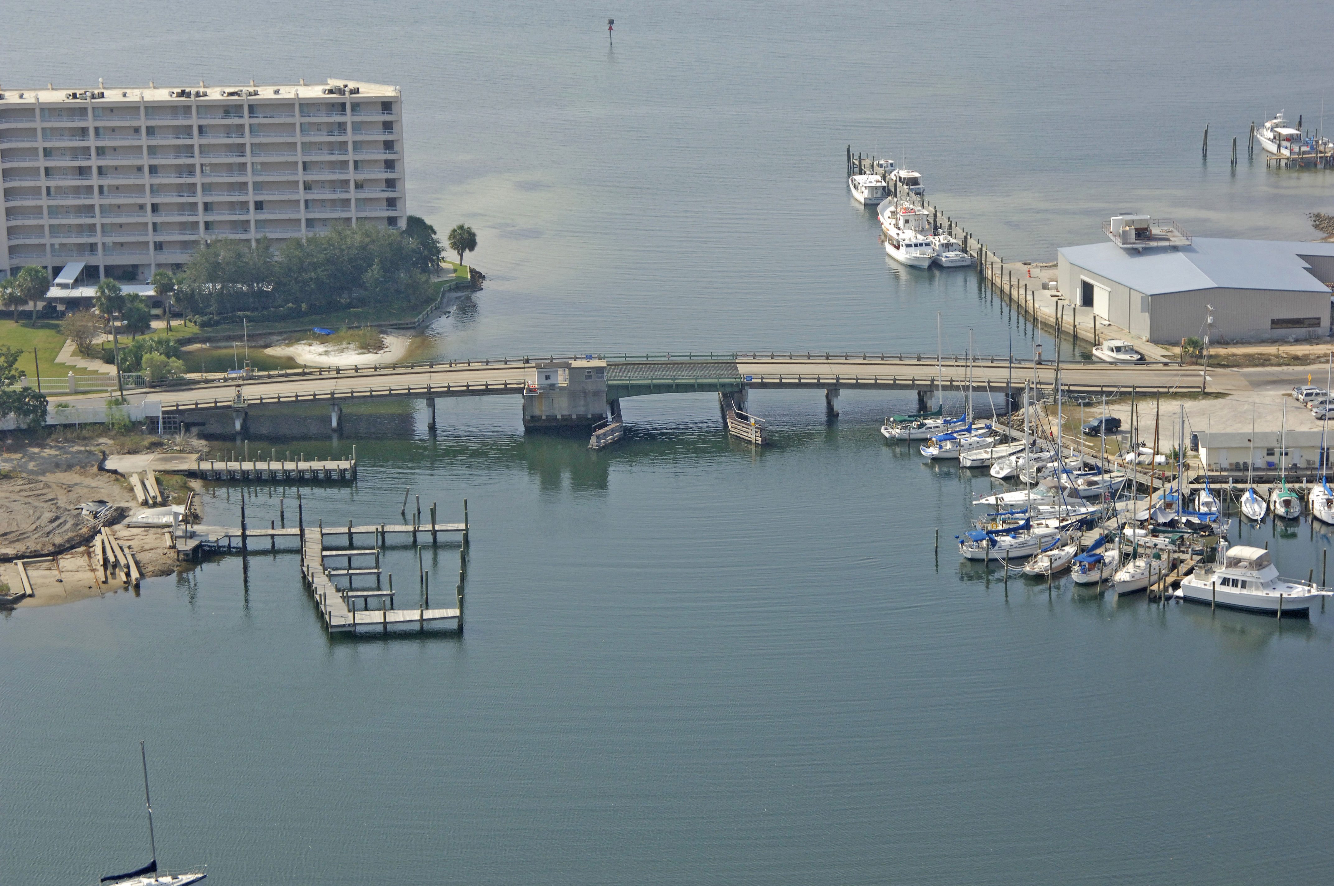
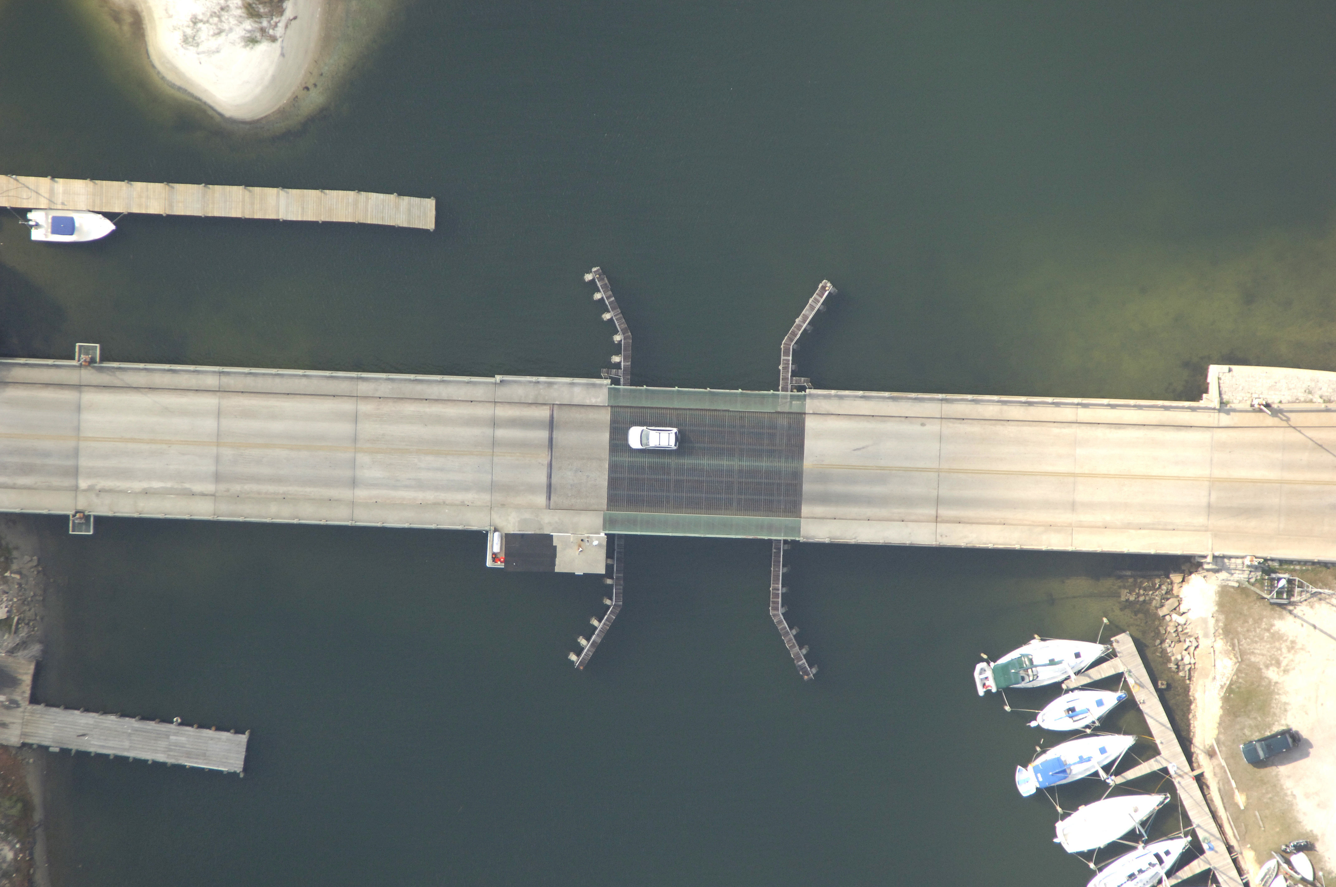
Beach Drive Bascule Bridge
| Florida United States | |
| 30° 9' 2.16'', -85° 39' 33.84'' | |
| Panama City Harbor |
You might also consider...

20 Reviews
Open to the public on a first-come first-serve basis, Bristol Harbor Marina i... Read More

15 Reviews
Treasure Island Marina is Northwest Florida’s premier on-the-water storage fa... Read More
1 Review
Point South Marina is more than a marina; it’s a community of sportsmen drawn... Read More
Details
| Closed vertical clearance | 7 |
About
Introduction:
The Beach Drive bascule Bridge straddles the opening of Massalina Bayou near GIWW Mile 290 and about four statute miles northeast of the Saint Andrews Bay Inlet.
Navigating the Bridge:
Use NOAA Chart 11390.
Massalina Bayou is protected by a wood jetty and pier located on the west side of the bayou entrance. Keep a close watch for arriving and departing vessels making their maneuvers here.
Depths at mid-channel in the entrance are reported to be eight feet or more, but with most gulf locations, a tight watch on the depth sounder and slower speeds are recommended. The bridge has a closed vertical clearance of seven feet with 40 feet of vertical clearance in the center span.
Bridge Schedule:
Local Notices to Mariners are available online from the U.S. Coast Guard.
Reviews
No reviews yet! Be the first to write a review of Beach Drive Bascule Bridge.