Corey Causeway Bascule Bridge
| Saint Petersburg, Florida United States | |
| 27° 44' 48.12'', -82° 44' 47.04'' | |
| St. Pete Beach |


You might also consider...


Details
| Bridge type | Bascule |
| Closed vertical clearance | 23' |
| Vhf | 9 |
| Schedule | Weekdays 8 AM-7 PM and weekends 10 AM-7 PM, opens on the hour then every 20 minutes. |
About
Introduction:
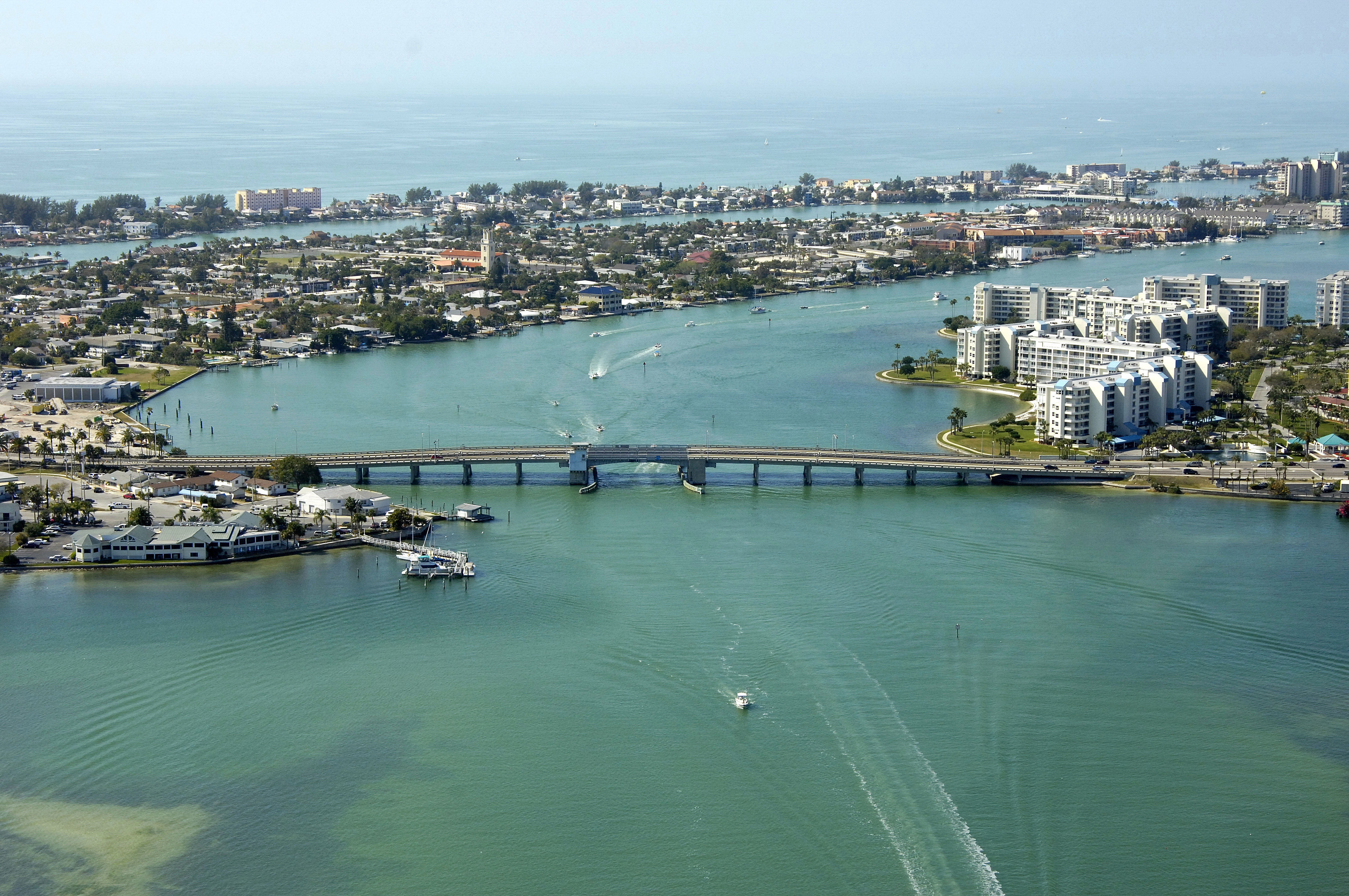
Situated in the heart of Saint Petersburg at GIWW Mile Marker 117.3, the Corey Causeway Bascule Bridge carries vehicular traffic from Saint Petersburg to Saint Pete Beach and back on state Route 19A.
Navigating the Bridge:
Use NOAA Chart 11411.
The bridge has a closed vertical clearance of 23 feet with 90 feet of horizontal clearance in the center span. The channel is well marked and of good depth, however currents are strong and boating traffic can be heavy here; especially on weekends.
Bridge Schedule:
The bridge operates on a restricted opening schedule. Year-round, Monday through Friday, from 8 a.m. to 7 p.m., the bridge opens on the hour and every 20 minutes after. On weekends and holidays, from 10 p.m. to 7 p.m., the bridge also opens on the our and every 20 minutes thereafter.
Depending on schedule, the bridge can be opened by horn signal (one long, one short) or by hailing the bridge tender on VHF Channel 09. (All bridges in the state of Florida must be hailed on VHF Channel 09.)
Local Notices to Mariners:
Local Notices to Mariners are available online from the U.S. Coast Guard.