Fort Clinch Landmark
| Fernandina, Florida United States | |
| 30° 42' 15.17'', -81° 27' 11.97'' | |
| Fernandina Beach |


You might also consider...

About
Introduction:
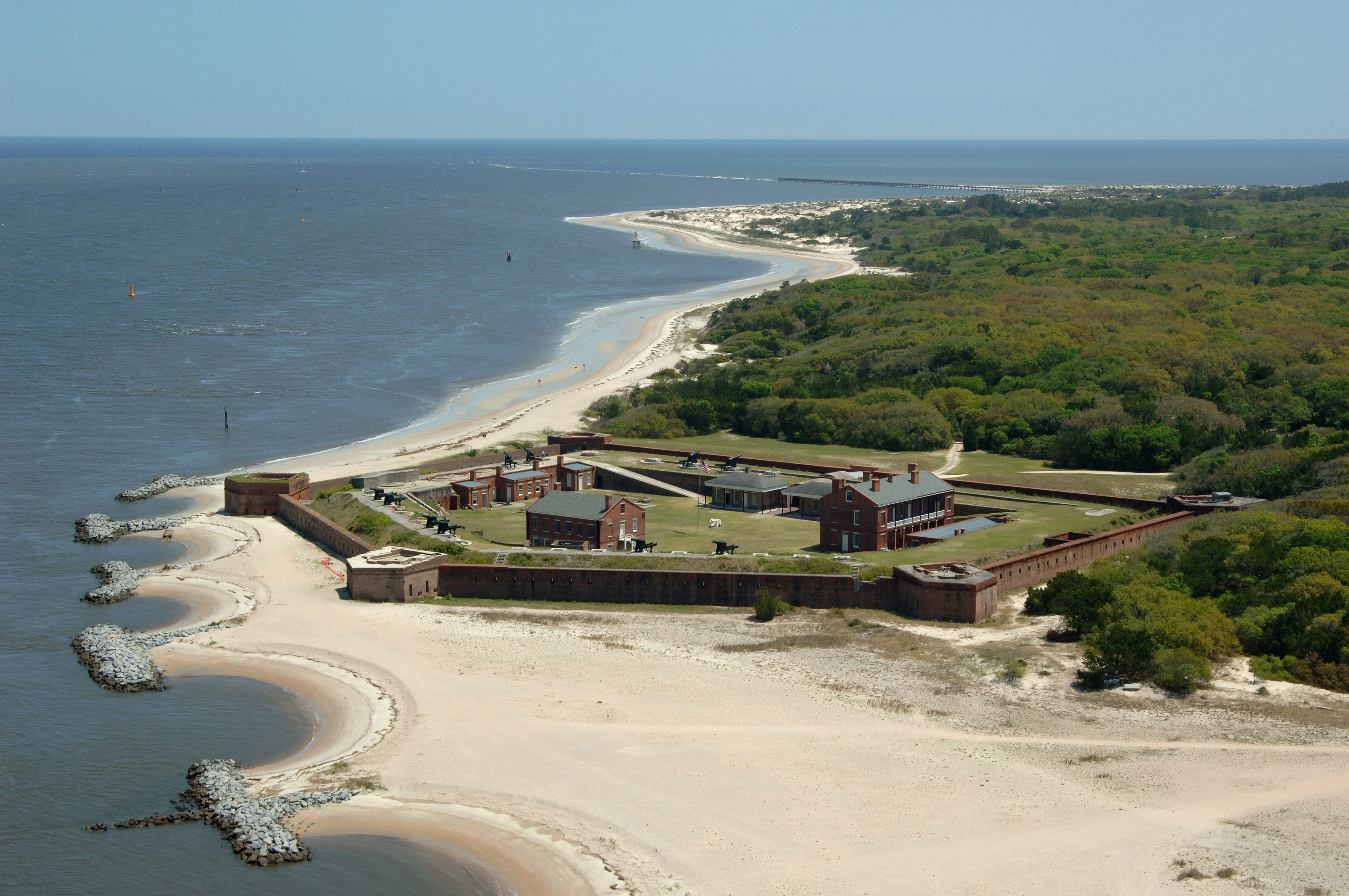
The site on Amelia Island at the entrance to the St. Marys River and the Cumberland Sound has been occupied by various military troops Since 1736. Construction of a fort, later named Fort Clinch, was begun in 1847. A pentagonal brick fort with both inner and outer walls, Fort Clinch was a safe haven for blockade runners during the Civil War. Briefly occupied by Confederate forces, its recapture by Federal troops in early 1862 gave the Union control of the adjacent Georgia and Florida coasts. The fort was used in 1898 during the Spanish-American War, but was abandoned until the Civil Conservation Corps (CCC) restored it in the 1930s. A Florida State Park, Fort Clinch is interpreted as the base of Union operations in the area throughout the Civil War.
Fort Clinch is on A1A at the north end of Amelia Island, three miles north of Fernandina Beach. Open daily from 8:00 am. - dusk. Fort open daily 9:00 a.m. - 5:00 p.m. Admission. (904) 277-7274.