


Huntington Harbor
California United States
Marinas near Huntington Harbor
| Name | Reviews | Max LOA | VHF | Dock Depth | Gas / Diesel | Lift / Crane | Wifi | Amps |
|---|---|---|---|---|---|---|---|---|
| Peter's Landing Marina | - | 0.0' | 68 | Low 0.0'High 0.0' | - | - | - | - |
| Sunset Aquatic Marina | - | - | - | GYesDYes | LNearby | 30-50 | ||
| Mariners Point Fuel Dock | - | - | - | - | - | - | - | - |
| Sunset Aquatic Shipyard | - | - | - | - | - | - | - | - |
| SeaGate Yacht Club | - | - | - | - | - | - | - | - |
| Davenport Marina | - | 0.0' | - | Low 0.0 mHigh 0.0' | - | - | - | - |
| Huntington Harbour Yacht Club | - | 0.0 m | - | Low 0.0 mHigh 0.0' | - | - | - | - |
| Huntington Harbour Marina | - | - | - | - | - | - | - | - |
| Navy Yacht Club Long Beach | - | - | - | - | - | - | - | |
| Seal Beach Yacht Club | - | 0.0' | - | Low 0.0 mHigh 0.0' | - | - | - | - |
| Alamitos Bay-Long Beach Marina | 150.0' | - | Low 0.0'High 0.0' | G$7.00/galD$7.25/gal | CYes | 30 and 50 | ||
| Alamitos Bay Yacht Club | - | 0.0' | - | Low 0.0 mHigh 0.0' | - | - | - | - |
| Long Beach Yacht Club | - | 9 | - | - | - | - | - | |
| Marina Shipyard | - | - | - | - | - | - | - | - |
| Marina Pacifica Boat Slips | - | - | - | - | - | - | - | - |
Introduction:
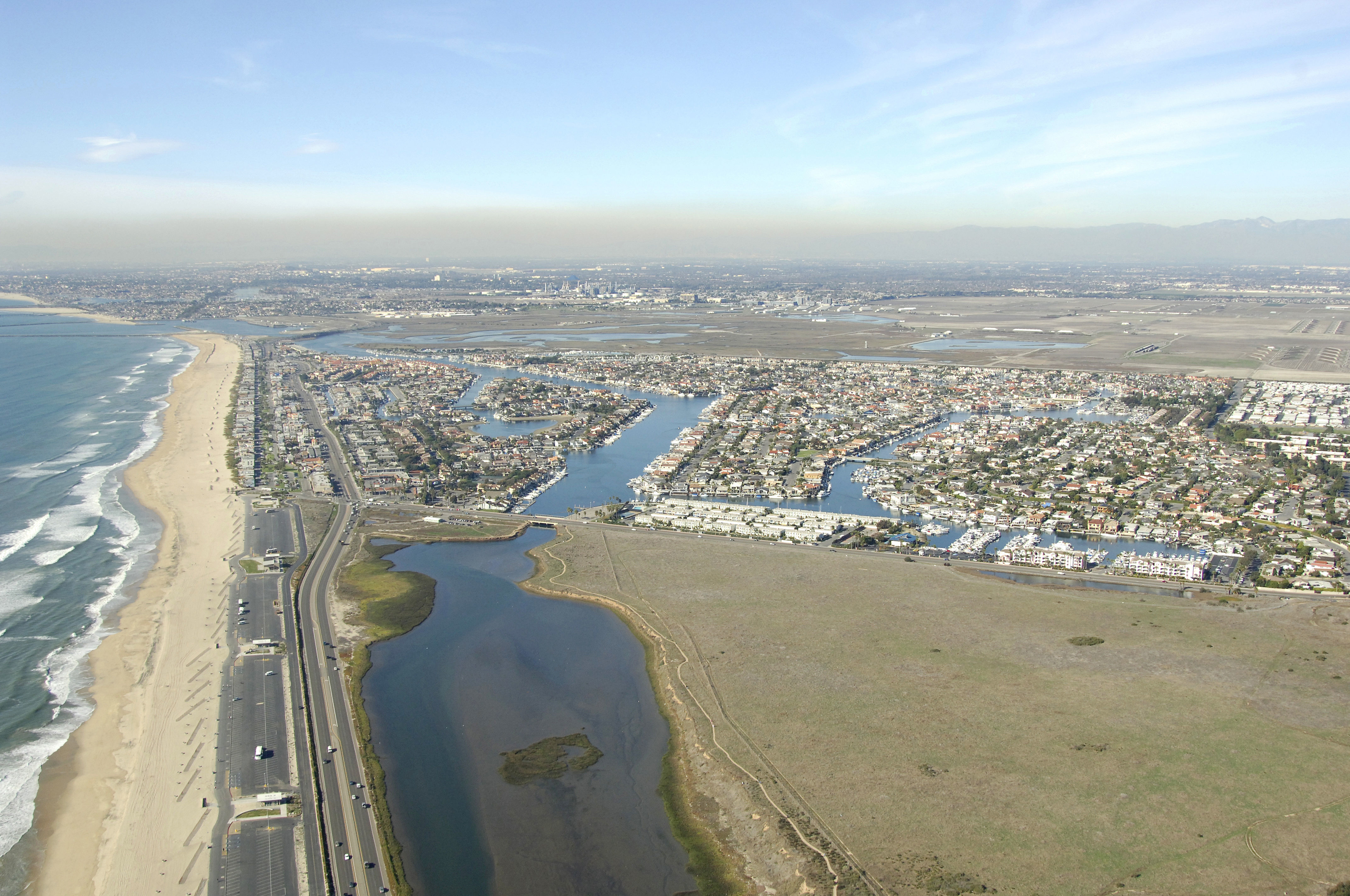
Just a stones throw from Alamitos Bay and Anaheim Bay Huntington Harbour is a popular recreational area with marinas, excellent beaches and water activities. Surf City is close by and a popular area with visitors to soak up the rays.
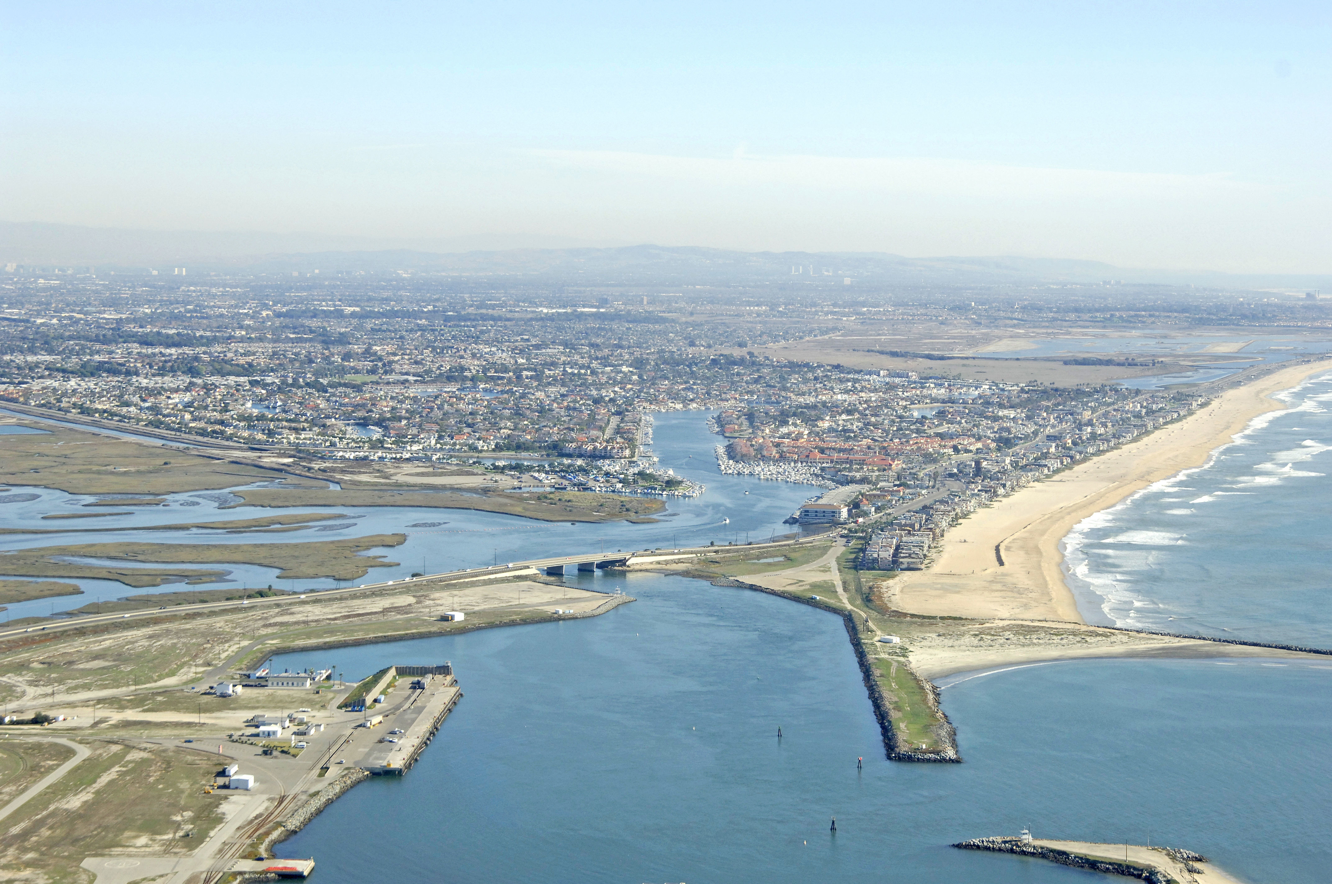
Anaheim Bay, which is the entrance to Huntington Harbour, is home to the Seal Beach Naval Weapons Station and all sorts of naval craft including nuclear sub, Aegis-Class destroyers and all variety of military sea vessels. Keep in mind that a fixed bridge (23-foot vertical clearance) that few sailboats can clear limits passage to Huntington Harbour.
Navigating the Water:
Use NOAA Chart 18749.
Approach from the south. Flashing green bell buoy 1 and flashing red whistle buoy 2 mark the initial passage to Anaheim Bay, while flashing green 5 and flashing red 6 mark the west and east jetties of the inlet, respectively.
As the Naval Weapons Station at Seal Beach is located near here, there are usually many special restrictions in place, depending on what craft are in port, and what weapons are being loaded or unloaded. Keep your VHF radio tuned to channel 16 and follow any instructions given by security patrol craft.
A 23-foot fixed vertical clearance bridge limits further passage to Huntington Harbour. Huntington Harbour itself holds eight- to 11-foot depths among the islands.
Local Notices to Mariners:
Local Notices to Mariners are available online from the U.S. Coast Guard.
Things To Do/Local Events:
See the Helpful Links section at the bottom of this page for more detailed information.