


Dana Point Harbor
Dana Point, California United States
Marinas near Dana Point Harbor
| Name | Reviews | Max LOA | VHF | Dock Depth | Gas / Diesel | Lift / Crane | Wifi | Amps |
|---|---|---|---|---|---|---|---|---|
| Embarcadero Marina at Dana Point | - | 0.0' | - | Low 0.0 mHigh 0.0' | - | - | - | - |
| Dana Point Shipyard | - | 0.0' | - | Low 0.0 mHigh 0.0' | - | - | - | - |
| The Marina at Dana Point | 65.0' | - | - | GYesDYes | - | - | 30/50 | |
| Dana West Yacht Club | - | 0.0 m | - | Low 0.0 mHigh 0.0' | - | - | - | - |
| Dana Point Yacht Club | - | - | - | - | - | - | - | - |
| Newport Harbor Patrol Guest Dock | 0.0 m | - | Low 0.0 mHigh 0.0' | - | - | - | - | |
| Balboa Yacht Club | - | 0.0' | - | Low 0.0 mHigh 0.0' | - | - | - | - |
| Bahia Corinthian Yacht Club | - | 0.0' | - | Low 0.0 mHigh 0.0' | - | - | - | - |
| Bayside Marina | - | - | - | - | - | - | - | |
| California Recreation Company | - | - | - | - | - | - | - | - |
| Newport Beach Yacht Club | 0.0 m | - | Low 0.0 mHigh 0.0' | - | - | - | - | |
| Villa Cove Marina | - | - | - | - | - | - | - | - |
| Island Marine Fuel | - | - | - | - | - | - | - | - |
| Newport Landing Fuel Dock | - | 0.0' | - | Low 0.0 mHigh 0.0' | - | - | - | - |
| Balboa Yacht Basin | - | 0.0 m | - | Low 0.0 mHigh 0.0' | - | - | - | - |
Introduction:
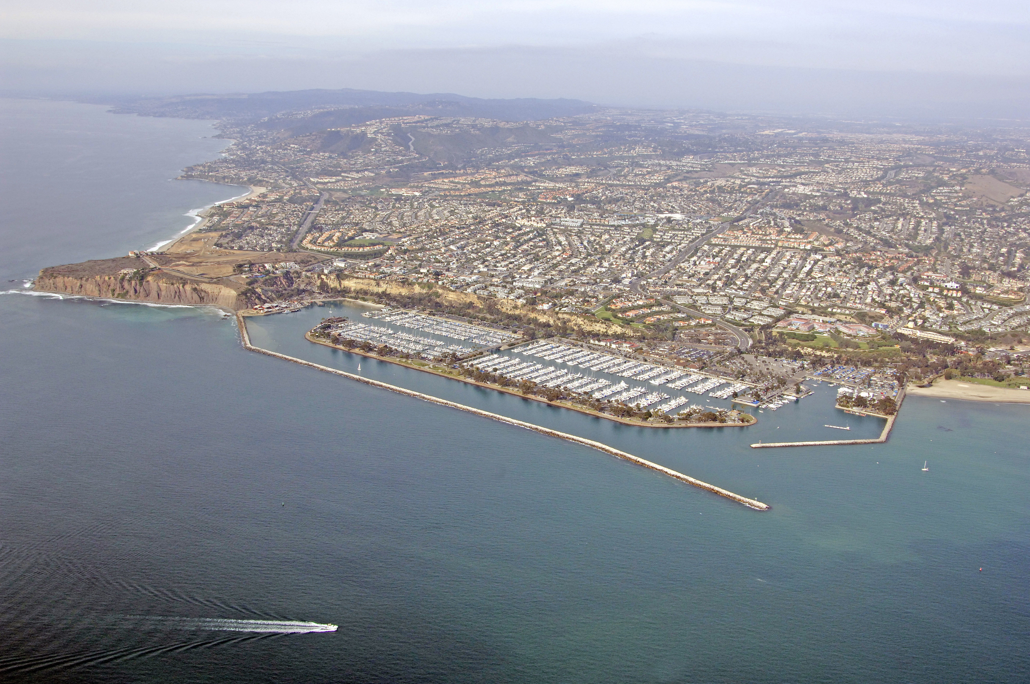
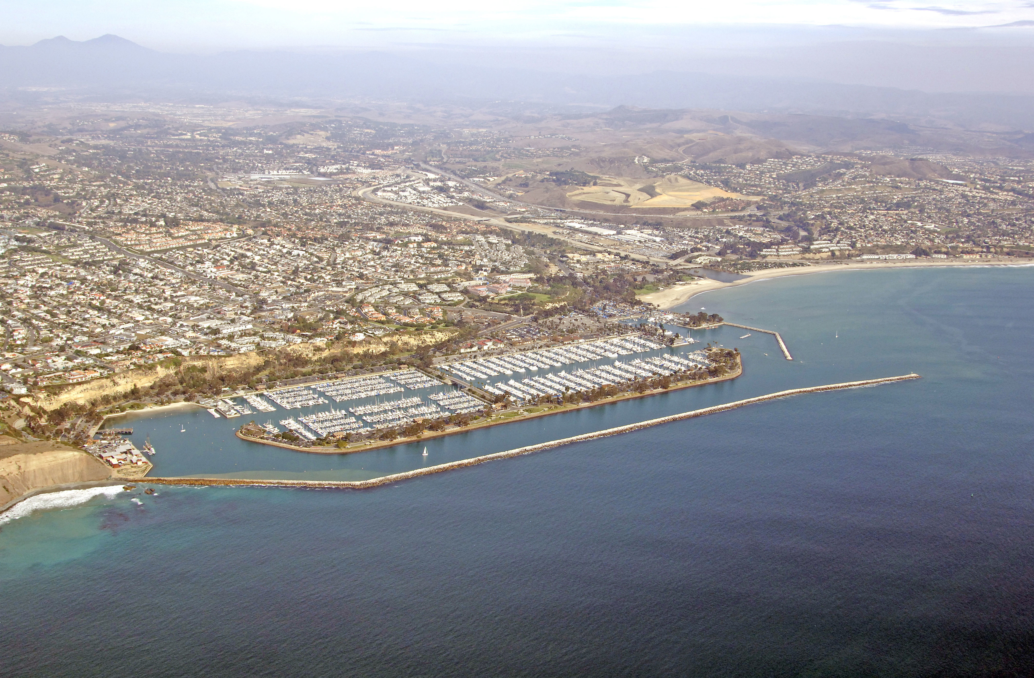
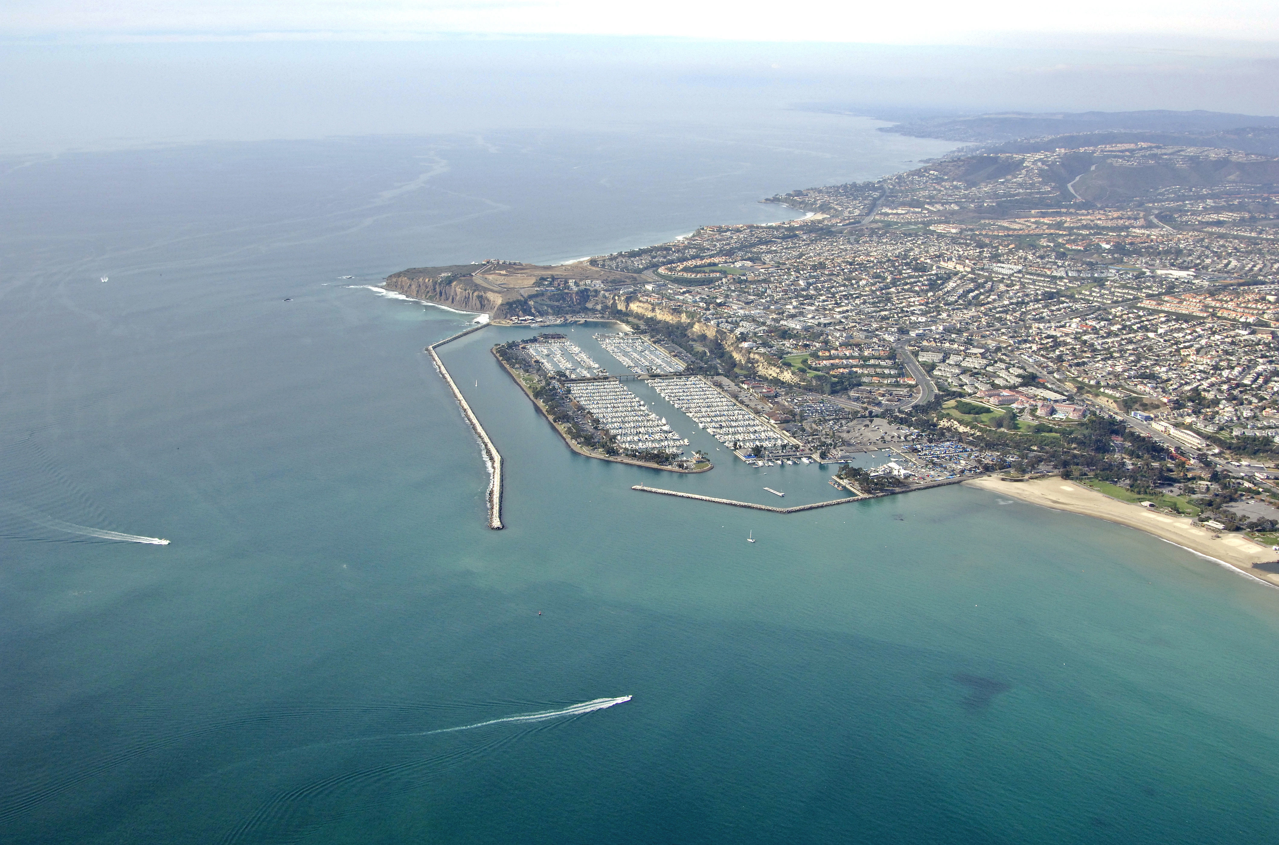
Dana Point juts out into the Pacific Ocean about eight miles from Newport Beach to the north, and has a well protected harbor area that is extremely popular with visiting boaters. Dana Point itself sits west of the main harbor area and is immediately noticeable by its bold, cliff-like appearance, which is in contrast to the smooth sandy beaches so typical of this area.
Dana Point Harbor has a plethora of marinas and marine-repair/service facilities if you are in need of service for your boat. The surrounding town has many places to take in a tasty meal and absorb the Southern California atmosphere of the area.
Navigating the Water:
Use NOAA Chart 18746.
Keep in mind that this chart shows soundings in fathoms, not feet. One fathom equals six feet of depth.
Enter from the south. Flashing green buoy 1 marks the start of the approach to the harbor opening at the west end of Dana Point. Once you have cleared flashing green buoy 1, you can either set a course for flashing red buoy 2 two at the mouth to the harbor, or flashing green 3, which marks the southernmost of the two breakwalls bordering the harbor entrance. Depths inside the harbor range from nine to 15 feet.
Local Notices to Mariners:
Local Notices to Mariners are available online from the U.S. Coast Guard.