


Half Moon Bay
California United States
Marinas near Half Moon Bay
| Name | Reviews | Max LOA | VHF | Dock Depth | Gas / Diesel | Lift / Crane | Wifi | Amps |
|---|---|---|---|---|---|---|---|---|
| Half Moon Bay Yacht Club | - | - | - | - | - | - | - | - |
| Pillar Point Harbor | - | - | - | - | - | - | - | - |
| Coyote Point Yacht Club | - | 0.0 m | - | Low 0.0'High 0.0 m | - | - | - | - |
| Coyote Point Marina | 75.0' | 16 | Low 6.0' | G$6.75/galD$7.50/gal | - | - | ||
| Coyote Point Fuel Dock | - | 0.0 m | - | Low 0.0'High 0.0 m | - | - | - | - |
| Oyster Cove Marina | - | 0.0' | - | Low 0.0'High 0.0' | - | - | - | - |
| Oyster Point Fuel Dock | - | 0.0' | - | Low 0.0'High 0.0' | GYesDYes | - | - | - |
| Oyster Point Marina | - | 0.0' | - | Low 0.0'High 0.0' | GYesDYes | - | - | - |
| Sierra Point Yacht Club | - | - | - | - | - | - | - | - |
| Brisbane Marina | 0.0' | - | Low 0.0'High 0.0' | - | - | - | - | |
| Docktown Marina | - | 0.0 m | - | Low 0.0'High 0.0' | - | - | - | - |
| Blu Harbor by Windsor | - | - | - | - | - | - | - | |
| Peninsula Yacht Club | - | 0.0 m | - | Low 0.0'High 0.0' | - | - | - | - |
| Bair Island Marina | 75.0' | - | Low 0.0'High 0.0' | - | - | - | 30, 50 | |
| Redwood Landing Marina | - | - | - | - | - | - | - | - |
Introduction:
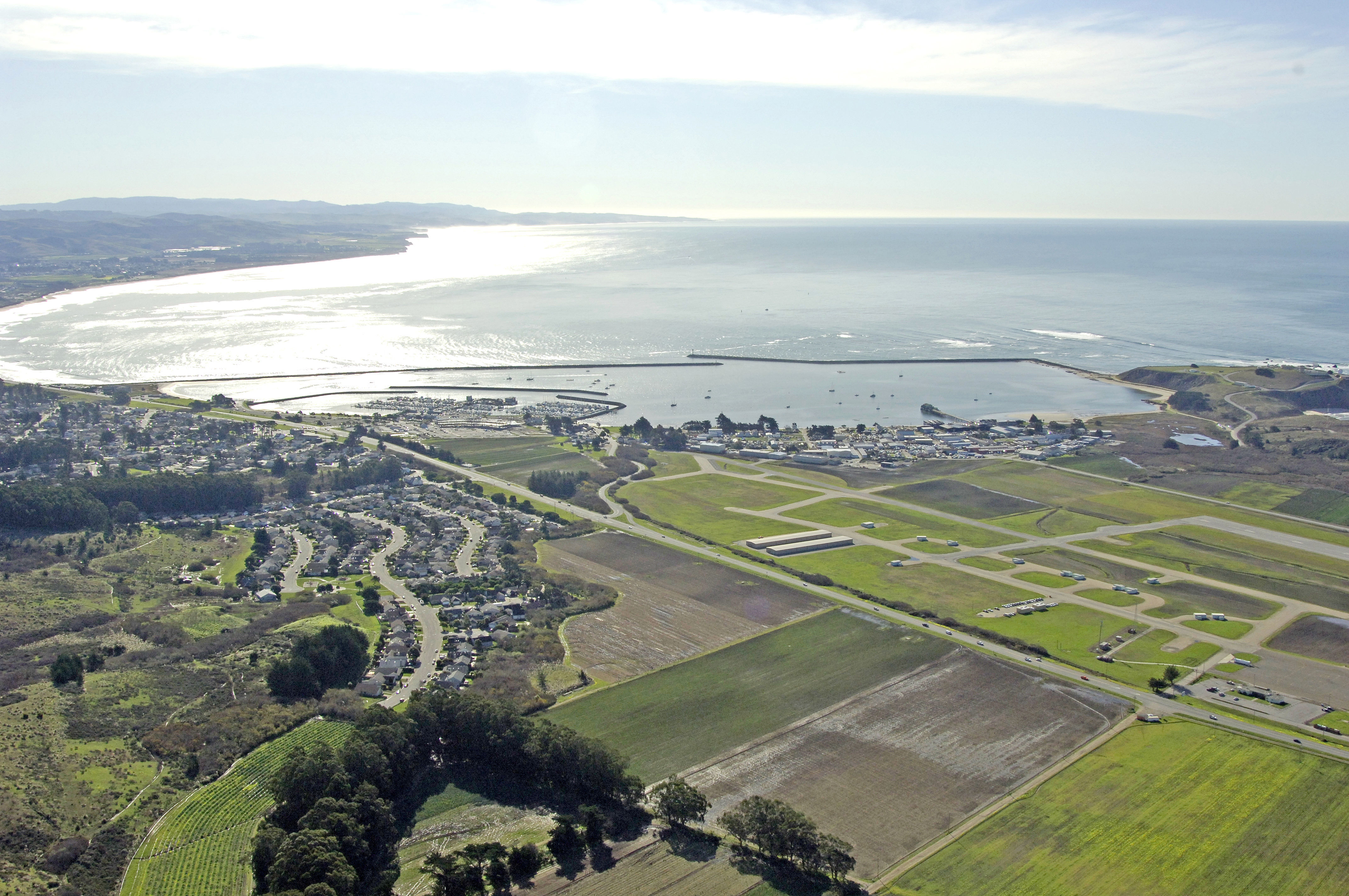
A glimpse at the image above gives all the evidence needed behind the town of Half Moon Bays name. Located 25 miles south of San Francisco, the small surfing town of Half Moon Bay is conveniently located within driving distance of Californias second largest city, and has a well protected and maintained harbor with ample facilities.
Once a vacation and beach destination, Half Moon Bay is considered a commuter town by many, as most of the population work in San Francisco, which is a short 30-mile drive away.
Navigating the Water:
Use NOAA Chart 18645.
Keep in mind that this chart shows sounding in fathoms, not feet. One fathom is equal to six feet.
Half Moon Bay has several reefs and areas of breaking water to the south of the harbor, all of which are well-marked. The best approach is to pick up red and white Morse (A) buoy PP, and then aim for flashing green bell buoy 8 to the east, leaving it to port on entry. Flashing red 6 and a flashing white light mark the opening in the breakwaters to the town harbor. Depths inside are about six to eight feet.
Local Notices to Mariners:
Local Notices to Mariners are available online from the U.S. Coast Guard.
Things To Do/Local Events:
See the Helpful Links section at the bottom of this page for more detailed information.