


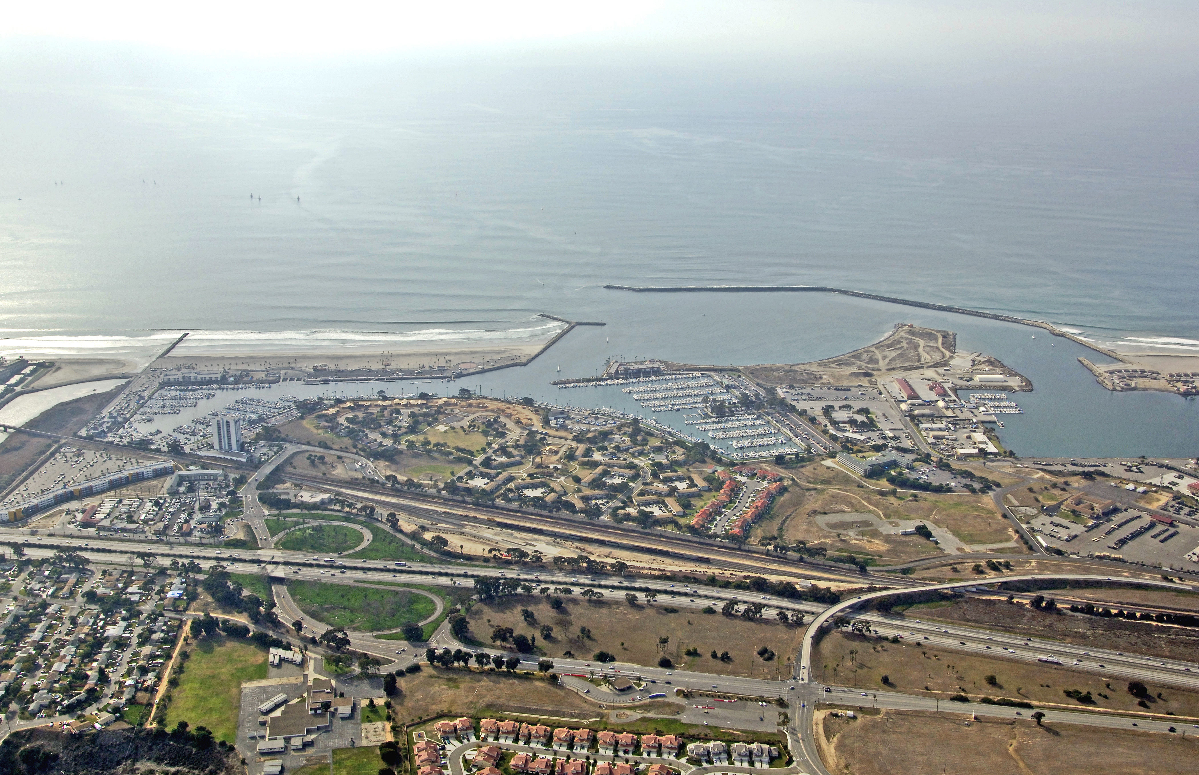
Oceanside Harbor
Oceanside, California United States
Marinas near Oceanside Harbor
| Name | Reviews | Max LOA | VHF | Dock Depth | Gas / Diesel | Lift / Crane | Wifi | Amps |
|---|---|---|---|---|---|---|---|---|
| Oceanside Yacht Club | - | 0.0 m | - | Low 0.0 mHigh 0.0' | - | - | - | - |
| Oceanside Fuel Dock | - | 0.0' | - | Low 0.0 mHigh 0.0' | - | - | - | - |
| Del Mar Marina | - | - | - | - | - | - | - | - |
| Oceanside Harbor Marina | 0.0' | - | Low 0.0 mHigh 0.0' | - | - | - | - | |
| Snug Harbor Marina | - | - | - | - | - | - | - | - |
| Dana Point Shipyard | - | 0.0' | - | Low 0.0 mHigh 0.0' | - | - | - | - |
| Embarcadero Marina at Dana Point | - | 0.0' | - | Low 0.0 mHigh 0.0' | - | - | - | - |
| The Marina at Dana Point | 65.0' | - | - | GYesDYes | - | - | 30/50 | |
| Dana West Yacht Club | - | 0.0 m | - | Low 0.0 mHigh 0.0' | - | - | - | - |
| Dana Point Yacht Club | - | - | - | - | - | - | - | - |
| Campland on the Bay Marina | 0.0' | - | Low 0.0 mHigh 0.0' | - | - | - | - | |
| Mission Bay Yacht Club | 0.0' | - | Low 0.0 mHigh 0.0' | - | - | - | - | |
| Bahia Resort Hotel Marina | - | 0.0 m | - | Low 0.0 mHigh 0.0' | - | - | - | - |
| San Diego Mission Bay Resort | - | - | - | - | - | - | - | - |
| Lake Elsinore West Marina | - | - | - | - | - | - | - | - |
Introduction:
Oceanside is an idyllic south coast California town, and is conveniently located 35 miles north of downtown San Diego and is also the home to the Marine Corps Base Camp Pendleton.
Oceansides main attraction, though, is surfing. Surf shops line the beautiful beaches and dozens of black-suited surfers can usually be seen plying the waves for a good, long ride. If grabbing a board and hitting the water isnt your thing, shuttles to Sand Diego are available; or for more freedom, rent a car for t he day to check out the scenes south of here.
Navigating the Water:
Use NOAA Chart 18874.
Soundings on this chart are given in fathoms. One fathom equals six feet. Keep this in mind when using your chart.
Approach from the west. Red and white Morse (A) buoy OC starts the approach to Oceanside Harbor. Once you have cleared Red and white Morse (A) buoy OC, flashing green 1 and flashing red 2 (with horn) mark the west and east breakwaters, respectively. Depths in side the entrance channel are charted at 18 feet, with project depths of 15 feet in Oceanside Harbor, though shallower depths do exist; keep a close eye on your depth sounder at all times.
Local Notices to Mariners:
Local Notices to Mariners are available online from the U.S. Coast Guard.