


Puerto Arecibo Harbor
Puerto Arecibo, Puerto Rico
Marinas near Puerto Arecibo Harbor
| Name | Reviews | Max LOA | VHF | Dock Depth | Gas / Diesel | Lift / Crane | Wifi | Amps |
|---|---|---|---|---|---|---|---|---|
| Club Nautico Arecibo | - | - | - | - | - | - | - | - |
| Puerto Arecibo Wharf | - | - | - | - | - | - | - | - |
| Aguadilla Town Docks | - | - | - | - | - | - | - | |
| Villa Pesquera Restaurant & Marina | - | - | - | - | - | - | - | - |
| Caribbean Images Marina | - | 0.0' | - | Low 10.0 mHigh 11.0' | - | - | - | |
| Ponce Yacht and Fishing Club | 200.0' | - | Low 15.0'High 0.0' | GYesDYes | LYes | 30, 50, 100 | ||
| Safe Harbor San Juan | - | - | - | - | - | - | - | - |
| Club Nautico Rincon | 0.0 m | - | Low 0.0 mHigh 0.0 m | - | - | - | - | |
| Cana Gorda State Park | - | - | - | - | - | - | - | - |
| Club Nautico de San Juan Marina | 250.0' | 16 | - | - | - | - | 30, 50, 100 | |
| San Juan Bay Marina | 250.0' | 16 | - | G$5.01/galD$5.26/gal | - | - | ||
| La Bahia Marina | - | - | - | - | - | - | - | - |
| Club Deportivo | - | 0.0 m | - | Low 0.0 mHigh 0.0' | - | - | - | - |
| Marina 9 Barrios | - | - | - | - | - | - | - | - |
| Marina Puerto Real | 120.0' | 16 | Low 9.0' | G$4.747/galD$4.357/gal | - | 30, 50, 100 |
Introduction:
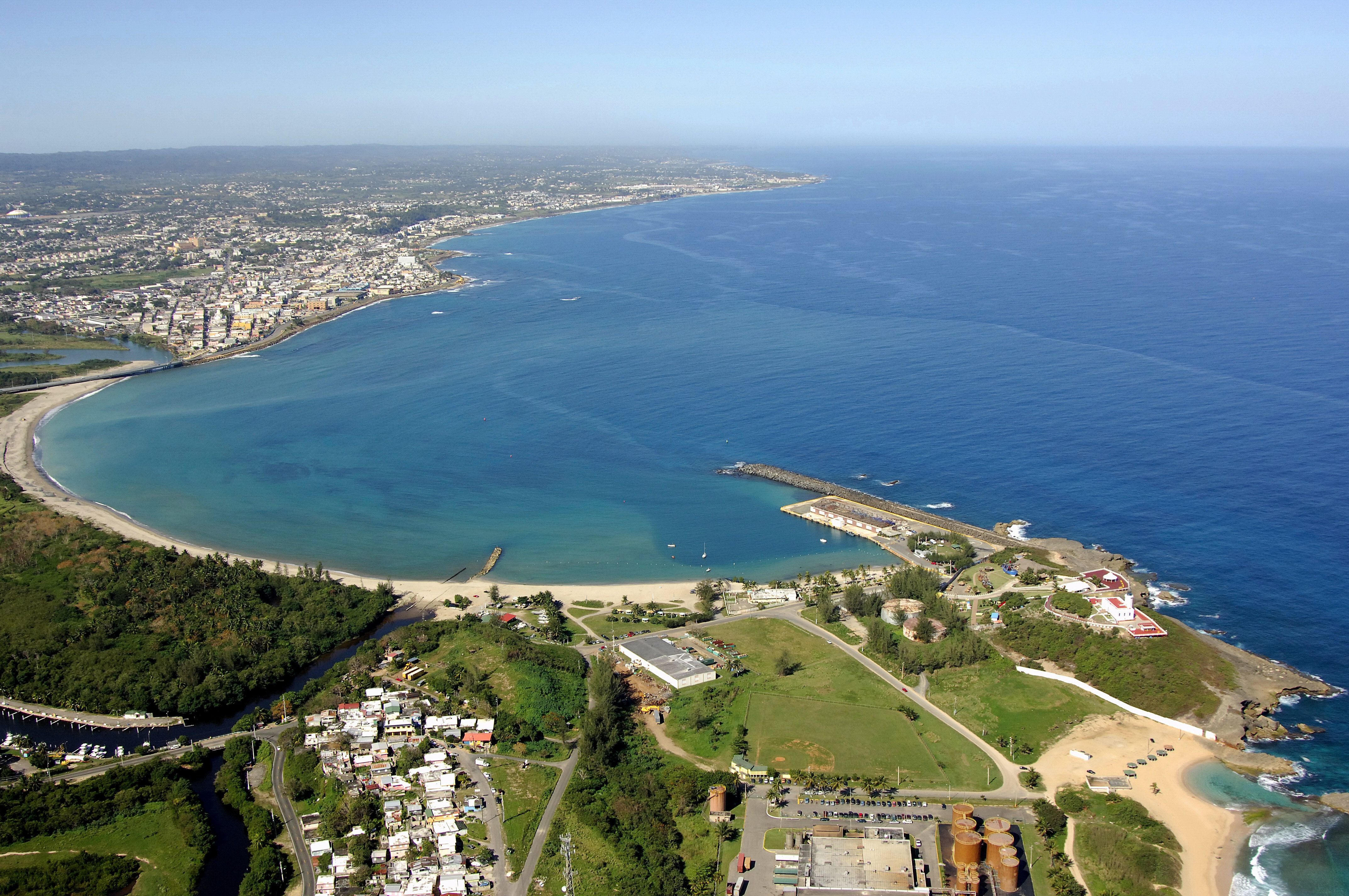
The town of Arecibo lies on the northern coast of Puerto Rico about 40 miles west of San Juan, 27 miles east of Isabela and 36 miles north of Ponce. Lush and green, the surrounding landscape contrasts the more arid landscape of locales found on Puerto Ricos southern coast.
One of Arecibos claims to fame is the Arecibo Observatory, which is home to one of the worlds largest and most powerful radio telescopes. The dish of the telescope is actually a tiles surface built into the bowl of a mountain.
History:
Arecibo was settled in 1556 and was the third Spanish settlement on the island. It wouldnt be until sixty years later in 1616 when the town would officially adopt its name, which is from an old Indian leader that ruled the area.
Navigating the Water:
The half-moon-shaped harbor here is not very well protected, save for a breakwatered area on the west end of the harbor, which is where the town anchorage is located. A flashing white light form the lighthouse atop Punta Morrillos will help guide you in from the Atlantic.
Local Notices to Mariners:
See our Local Notices to Mariners blog for updates on the latest conditions and advisories for this area.