


Ponce Bay
Ponce, Puerto Rico
Marinas near Ponce Bay
| Name | Reviews | Max LOA | VHF | Dock Depth | Gas / Diesel | Lift / Crane | Wifi | Amps |
|---|---|---|---|---|---|---|---|---|
| Caribbean Images Marina | - | 0.0' | - | Low 10.0 mHigh 11.0' | - | - | - | |
| Ponce Yacht and Fishing Club | 200.0' | - | Low 15.0'High 0.0' | GYesDYes | LYes | 30, 50, 100 | ||
| Villa Pesquera Restaurant & Marina | - | - | - | - | - | - | - | - |
| La Bahia Marina | - | - | - | - | - | - | - | - |
| Cana Gorda State Park | - | - | - | - | - | - | - | - |
| Marina de Salinas | 65.0' | 72 | Low 10.0' | G$1.29/galD$1.45/gal | - | 30/50 | ||
| Playita Salinas | - | - | - | - | - | - | - | - |
| Club Nauticos De Guayama | - | - | - | - | - | - | - | - |
| Jobos Yacht Club | - | - | - | - | - | - | - | - |
| Jobos Bay Marine & Fishing Club | - | - | - | - | - | - | - | |
| Club Nautico Arecibo | - | - | - | - | - | - | - | - |
| Puerto Arecibo Wharf | - | - | - | - | - | - | - | - |
| Boqueron Yacht Club | 0.0 m | - | Low 0.0 mHigh 0.0' | - | - | - | - | |
| Boqueron Bay Marina | - | 0.0 m | - | Low 0.0 mHigh 0.0 m | - | - | - | - |
| Salinas Bay Dock | - | - | - | - | - | - | - | - |
Introduction:
The city of Ponce, located on Puerto Ricos southern coast, is the third largest city in Puerto Rico. Once the capital of the southern region under Spanish rule, the area fell to the U.S. in 1898.
Navigating the Water:
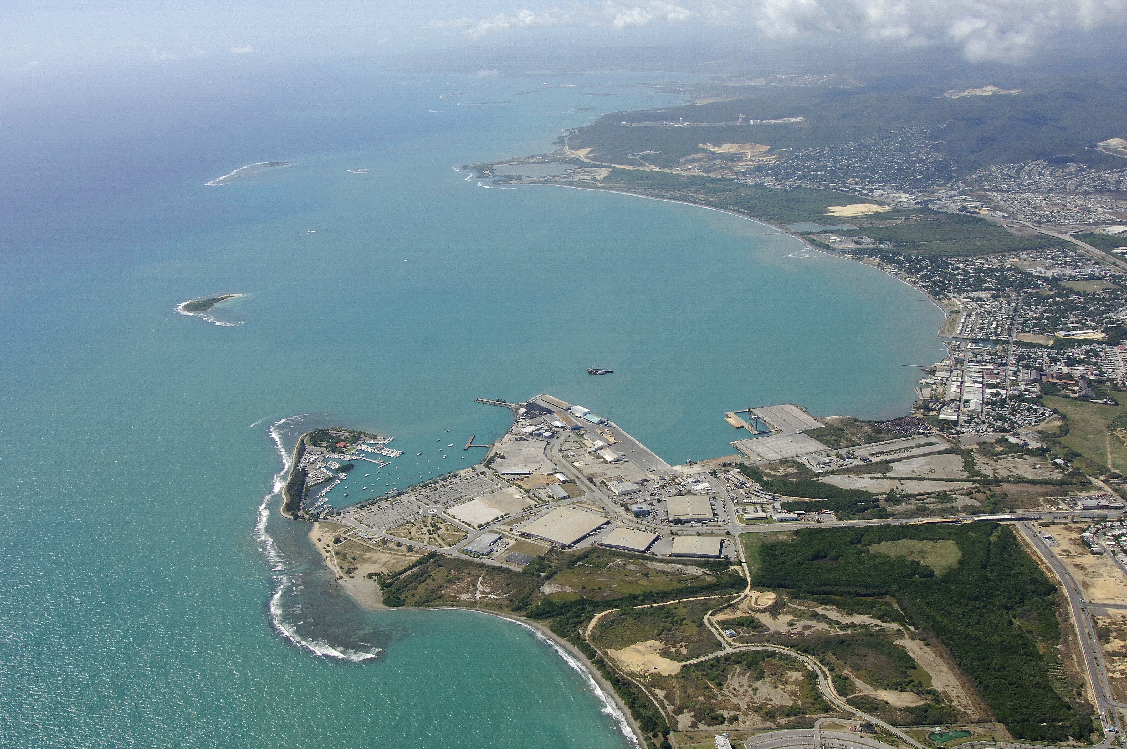
The city marina, located in the lower left hand corner of the image above, is a popular stop with cruising boaters and has a wide variety of services, including transient slips for overnight tie ups and a fuel dock with gas and diesel fuel.
There is an anchorage that is located about three miles southwest of the aforementioned marina, with depths of about 39 feet. From here, you can access a dinghy dock near the Ponce Yacht Club.
Local Notices to Mariners:
See our Local Notices to Mariners blog for updates on the latest conditions and advisories for this area.
Transportation:
The Mercedita Airport is located five miles to the northeast of the waterfront and features connecting domestic flights to San Juan and other domestic Puerto Rico airports. Your best bet for getting to the airport is one of the local taxi cab companies that run throughout the city.