


Moraine Cay Harbor
Abacos Bahamas
Marinas near Moraine Cay Harbor
| Name | Reviews | Max LOA | VHF | Dock Depth | Gas / Diesel | Lift / Crane | Wifi | Amps |
|---|---|---|---|---|---|---|---|---|
| Spanish Cay Marina | - | - | - | - | GYesDYes | - | - | - |
| Murray's Service Station (Esso) | - | - | - | - | - | - | - | - |
| Fiddler’s Green Cottages and Marina | - | - | - | Low 0.0'High 0.0' | - | - | - | |
| Green Turtle Club & Marina | 0.0' | - | Low 0.0'High 0.0' | GYesDYes | - | - | ||
| Bluff House Yacht Club & Marina | - | 0.0 m | - | Low 0.0 mHigh 0.0' | GYesDYes | - | - | - |
| Dolphin Marine | - | 0.0 m | - | Low 0.0 mHigh 0.0 m | - | - | - | - |
| Abaco Yacht Services | - | 0.0 m | - | Low 0.0 mHigh 0.0' | - | - | - | - |
| The Other Shore Club | 0.0 m | - | Low 0.0 mHigh 0.0 m | - | - | - | - | |
| New Plymouth Government Dock | - | 0.0 m | - | Low 0.0 mHigh 0.0 m | - | - | - | - |
| New Plymouth Public Dock | - | 0.0 m | - | Low 0.0 mHigh 0.0 m | - | - | - | - |
| Beach Weekend Bahamas | - | 16 | - | - | - | 30, 50, 100 | ||
| Black Sound Marina | 0.0 m | - | Low 0.0 mHigh 0.0 m | - | - | - | - | |
| Roberts Marine | - | - | - | - | - | - | - | - |
| Roberts Dock and Cottages | - | - | - | - | - | - | - | - |
| Pineapple Point Resort | - | - | - | - | - | - | - | - |
Introduction:
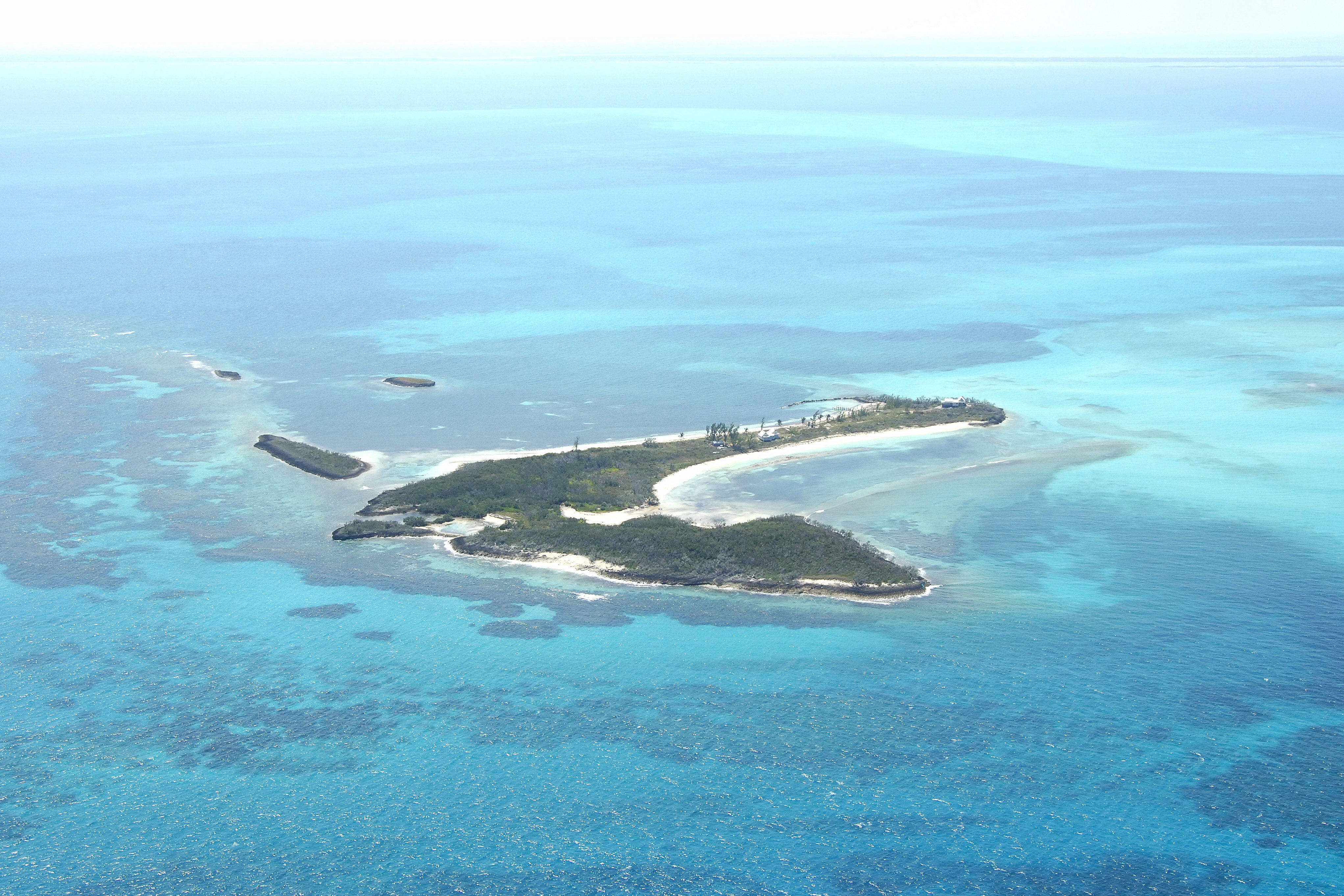
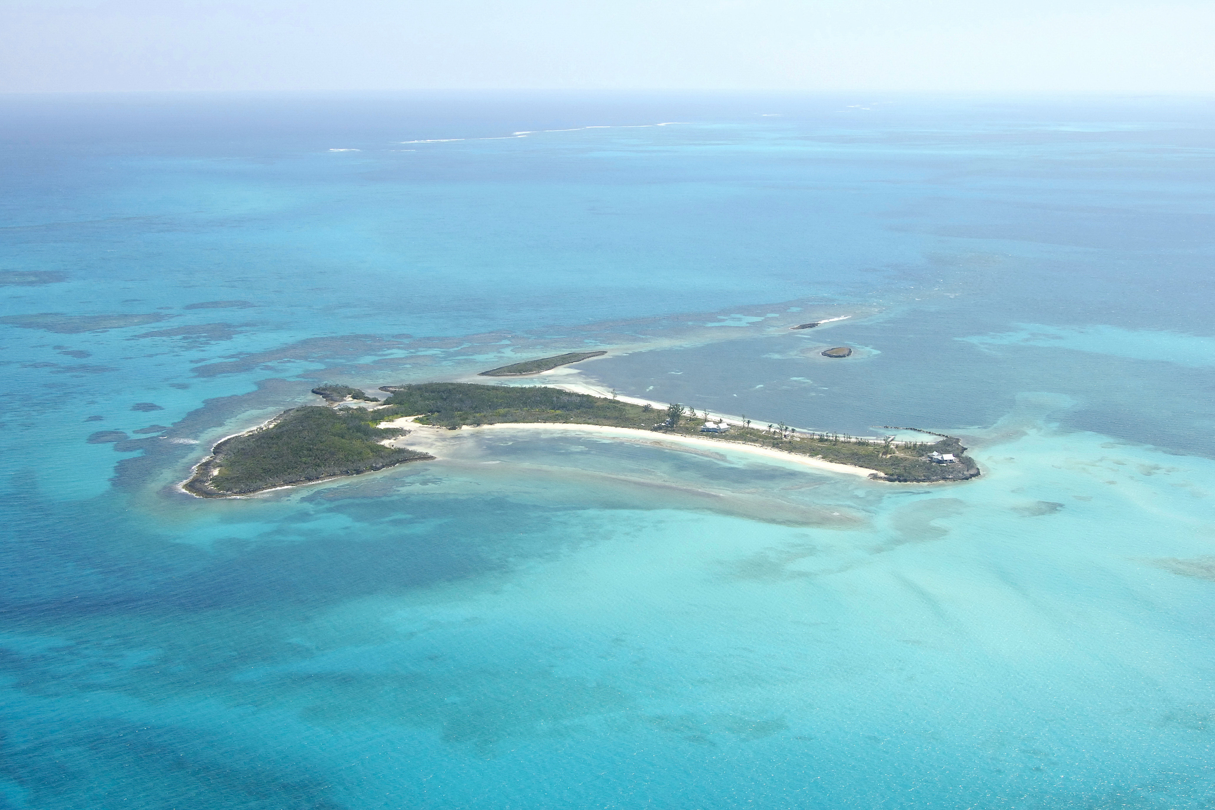
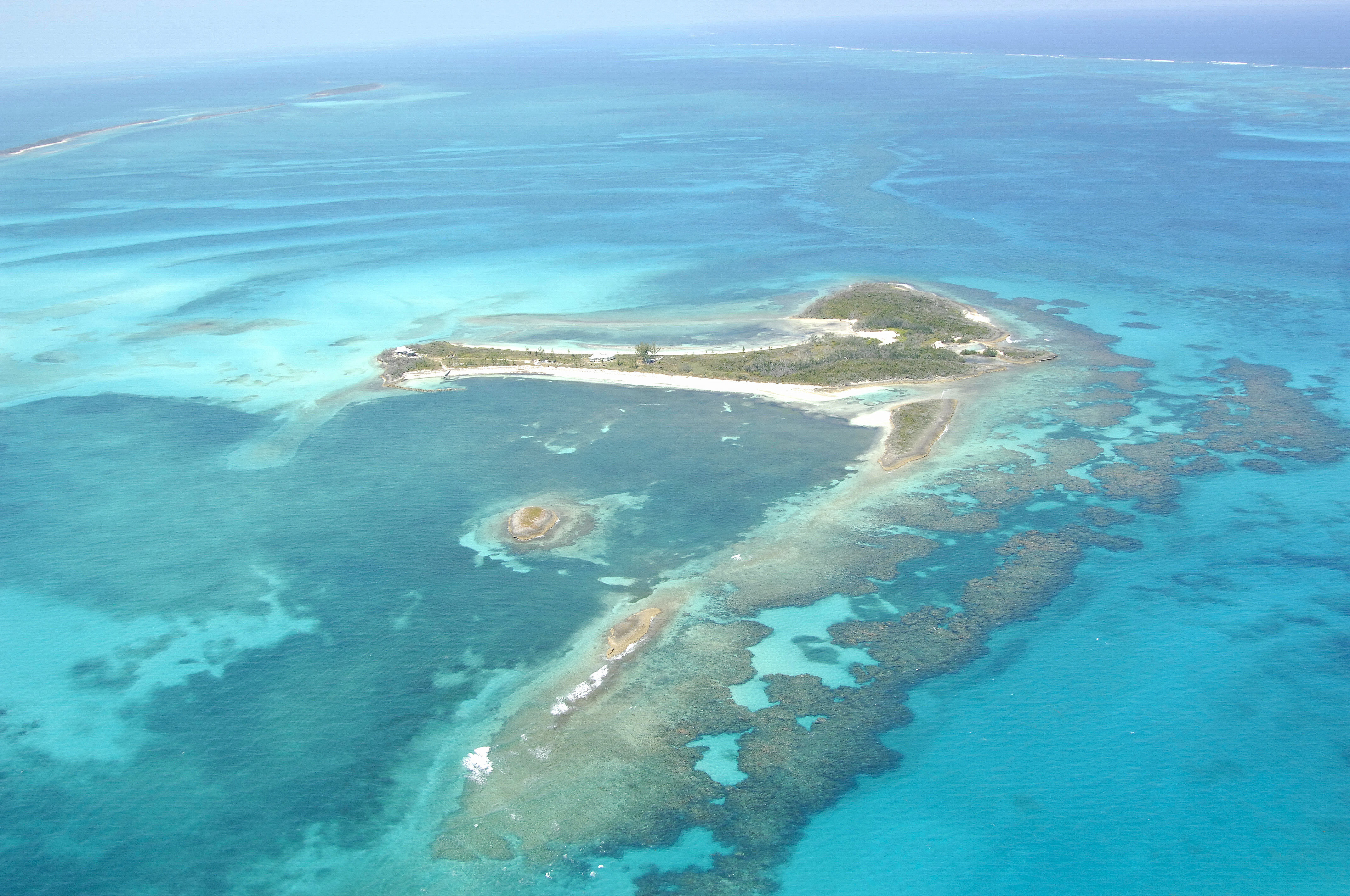
Remote and isolated Moraine Cay is a wonderful place to stop for the night, or to just drop the hook for an afternoon and snorkel around the beautiful reefs hereabouts. Unfortunately, the island itself is private, and exploration ashore is not permitted.
Navigating the Water:
The anchorage for Moraine Cay is not where you would expect it to be in the image above. Although the left (west) side of the island appears to be better protected (and it is), it is very shallow with depths less than 2 feet in places. The primary anchorage is on the east side of the island with depths of 7 to 8 feet. The anchorage is protected from all directions except the south. Mind the 4-foot-deep shoal to the south of the island on approach.
Local Notices to Mariners:
See our Local Notices to Mariners blog for updates on the latest conditions and advisories for this area.
Things To Do/Local Events:
Aside from snorkeling, beach combing, sailing, and other water activities, there is an active and vibrant calendar of other scheduled events in the Abacos. See our Helpful Links section below for a detailed calendar of events.
Transportation:
There is no airstrip on Moraine Cay, so arriving here by boat is your only option. The two nearest airports are Grand Bahama Airport on Grand Bahamas Island 65 miles to the west or Treasure Cay Airport about 30 miles to the southeast.