


Block Island Harbor
Block Island, Rhode Island United States
Marinas near Block Island Harbor
| Name | Reviews | Max LOA | VHF | Dock Depth | Gas / Diesel | Lift / Crane | Wifi | Amps |
|---|---|---|---|---|---|---|---|---|
| Town of New Shoreham | - | 12 | High 22.0' | - | - | - | - | |
| Champlin's Marina and Resort | - | 11 | Low 20.0' | G$5.73/galD$6.99/gal | - | 30/50 | ||
| New Harbor Boat Basin | 110.0' | 9 | Low 10.0'High 0.0' | - | - | - | 30, 50 | |
| Payne's Dock and Mahogany Shoals | 300.0' | - | Low 0.0 mHigh 0.0' | GYesDYes | - | - | - | |
| Smuggler's Cove Marina | - | 0.0 m | - | Low 0.0 mHigh 0.0 m | - | - | - | - |
| Twin Maples Bait & Tackle | - | 0.0 m | - | Low 0.0 mHigh 0.0' | - | - | - | - |
| Old Harbor Dock Town of New Shoreham | - | 0.0' | 12 | Low 0.0 mHigh 0.0' | - | - | - | |
| Ballard's Marina | 120.0' | 10 | Low 10.0' | - | - | - | - | |
| Shelter Cove Marina | - | - | - | - | - | - | - | - |
| Ninigret Landing Marina | - | - | - | - | - | - | - | - |
| Skip's Dock | - | 0.0 m | - | Low 0.0 mHigh 0.0' | - | - | - | - |
| Charlestown Harbormaster | - | - | - | - | - | - | - | - |
| Jim's Dock, Inc | - | 0.0 m | - | Low 0.0 mHigh 0.0' | - | - | - | - |
| State Pier | - | - | - | - | - | - | - | - |
| Point Judith Fisherman's Club | - | - | - | - | - | - | - | - |
Introduction:
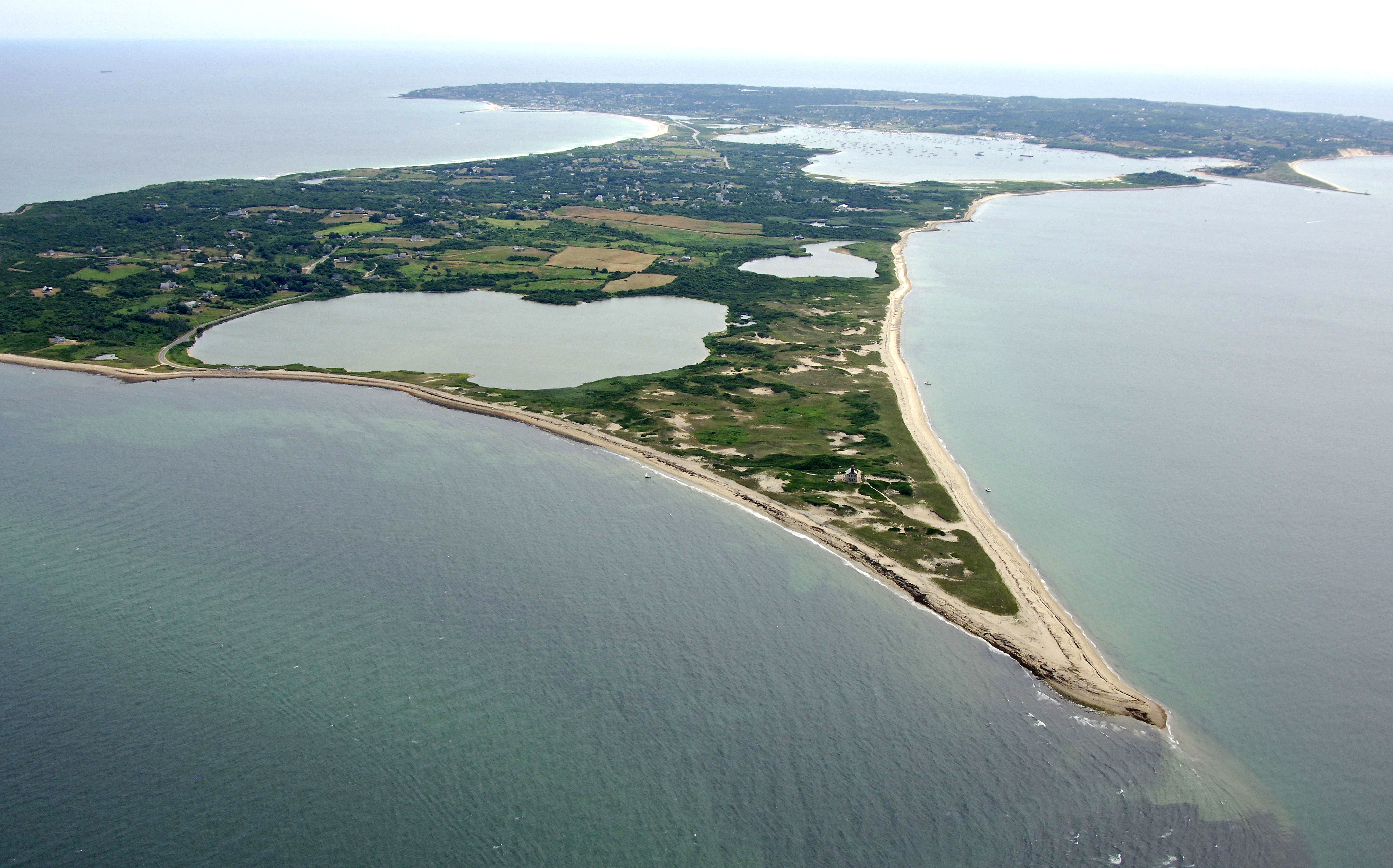
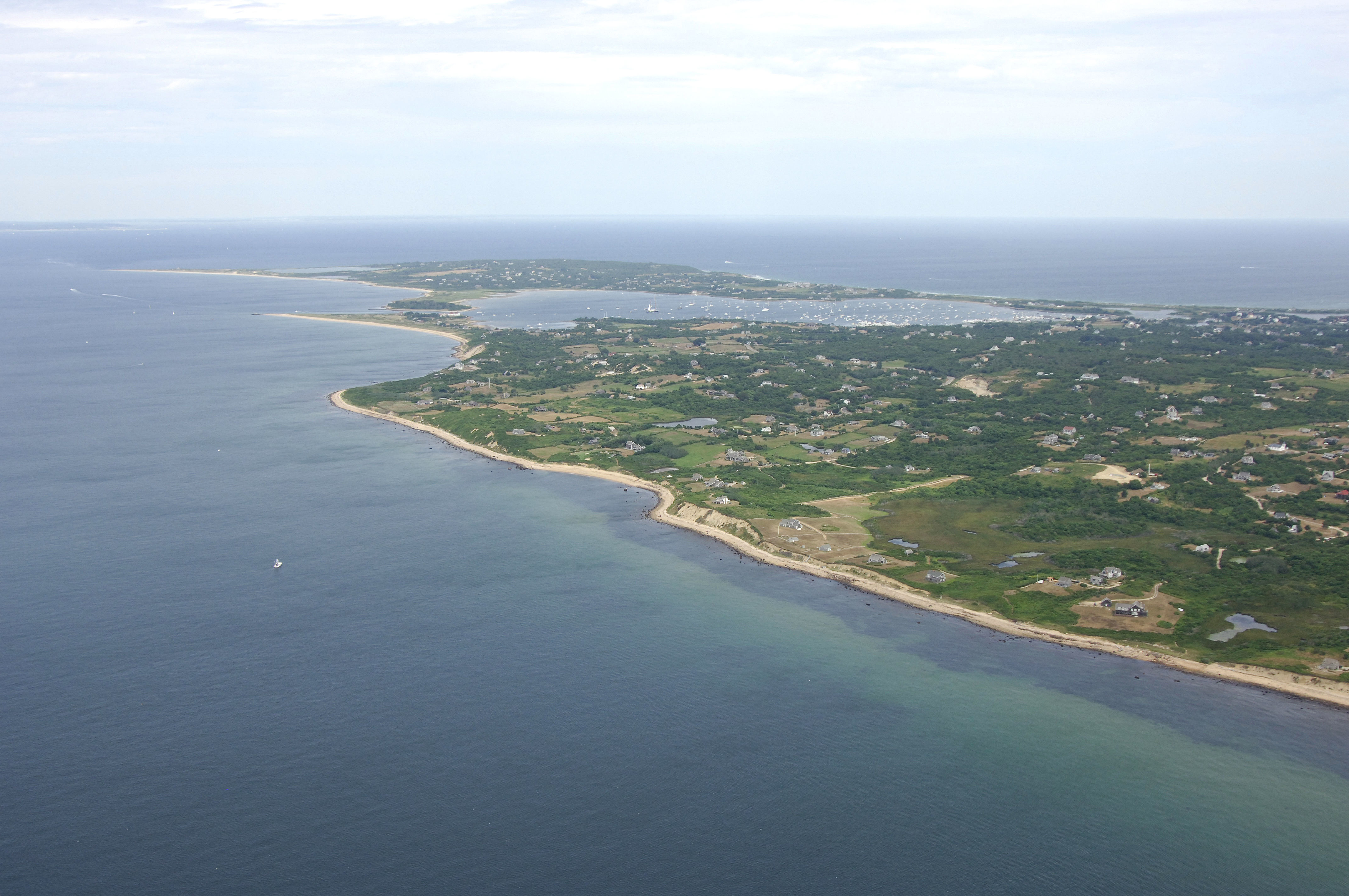
Located on Block Island Sound about 25 miles southwest of Newport and 18 miles northeast of Point Montauk you will find Block Island, Great Salt Pond and Old Harbor. Great Salt Pond, the main yachting center on the island, was not always open to the ocean. It was not until the year 1895 that a final attempt to dredge an access channel from the pond to the ocean succeeded. Today, Great Salt Pond plays host to thousands of boating visitors a year, mainly due to the protected nature of the water and the relative coolness of the climate compared to mainland locales.
Inside the harbor is a huge mooring field and several marinas, most of which cater to transients. Ashore in Block Island there are dozens of activities. Many people enjoy just lying on the beach, while others explore the historic and museum choices in town. Additionally, Block Island has many great dining establishments to choose from.
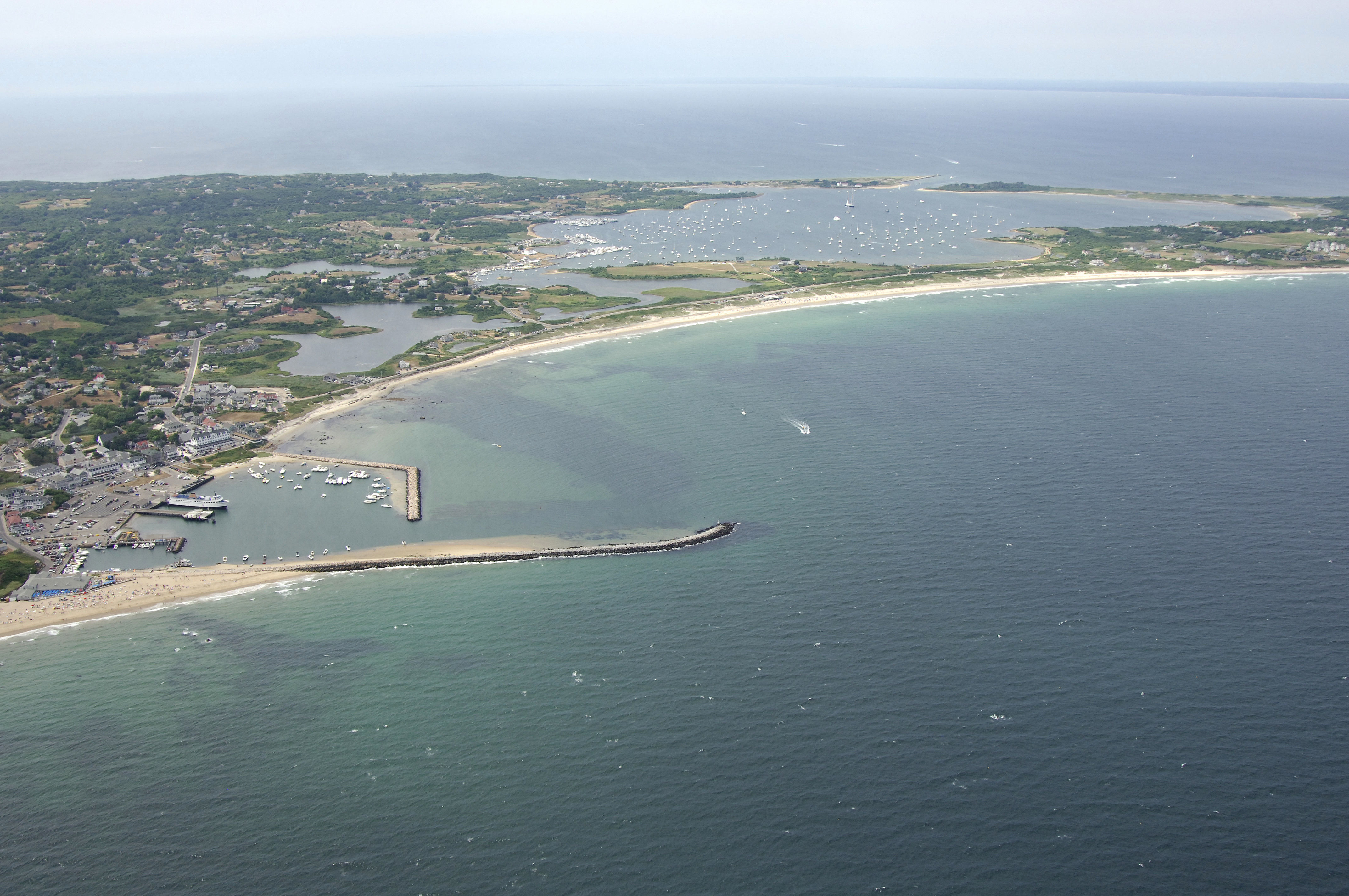
Old Harbor is a man-made yacht basin located on the east side of Block Island, almost geographically opposite from Great Salt Pond, which is on the west side of the island. Old Harbor is the main landing point for the mainland ferries that run on regular schedule to the island, but there is a marina with space here and limited mooring facilities, too. Anchoring is prohibited due to the ferry traffic that comes and goes at all hours.
Inside of the Old Harbor breakwaters is a singe marina on the far side of the small harbor that has facilities and slips available to transient guests. Moorings are available to starboard on entry, and there are several points for landing your dinghy around the harbors edge (be sure to lock and chain your dinghy here).
Navigating the Water:
Great Salt Pond:
Use NOAA Charts 13205 and 13215.
Great Salt Pond is located on the west side of Block Island south of Sandy Point. From Block Island Sound on the west side of Block Island, chart a course for flashing red 4 on the south breakwall of the inlet to Great Salt Pond (unlighted red bell buoy 2 appears before flashing red 4, but the lighted aid makes a better navigation target). Once you have lined up for the inlet, follow in green can 5, green can 7, red nun 8, and then red nun 10 into the the harbor. Depths in the inlet are reported to be at least 11 feet for a width of 100 feet.
Inside the harbor you are first greeted by an expansive mooring field followed farther south by a line of seven marinas, five of which offer services for transients. The moorings are administered by Block Island Town Moorings, which provides water taxi service to and from your spot in the harbor.
Old Harbor:
Use NOAA Chart 13215.
From the east side of Block Island, set a course for flashing green 3 at the east breakwater to Old Harbor. Once you have sighted this light, you will see green can 5, and then red nun 6 before flashing red light 8 marks the west breakwater to the harbor (shorter than the east breakwater).
The harbor inlet and the harbor itself have depths of 10 to 15 feet, and once you have negotiated the breakwalls, you will see the Old Harbor Marina to port and a small mooring field to starboard. Many people simply beach their dinghies on the sandy beach areas to go ashore.
Local Notices to Mariners:
Local Notices to Mariners are available online from the U.S. Coast Guard.
History:
Block Island was first inhabited thousands of years ago by the Niantic Indians who called it Manisses or Little Island. It wasnt until 1614 when the Dutch explorer Adriaen Block first sailed to Block Island.
During the Revolutionary War the island was used as a lookout and fires were lit to signify enemies were coming. Block Island was mostly used for fishing and farming until the late 1800s when steamships became more commonplace. Once it was easier for travelers to visit Block Island via steamship tourism grew significantly. Many hotels were built including The Spring House (1852) which is still standing today. None of Block Islands harbors are natural. Breakwaters were created for Old Harbor and a channel was built to connect Great Salt Pond to the ocean.
In 1950 Block Islands airport was built and today it is easy to travel to and from the island. The island is a very popular vacation destination in New England and offers great beaches, restaurants, and shopping. Much of the island is protected by the Block Island Conservancy leaving much open land for tourists to enjoy.
Transportation:
The only way to get to and from Block Island Harbor efficiently is by plane or boat. Daily ferries run from Point Judith, Newport and New London, CT, to Old Harbor throughout the season. Ashore in Providence, RI, is the T.F. Green International airport, which offers daily commercial air service. See the Helpful Links section below for more detailed transportation schedules.
Helpful Links:
Block Island Chamber of Commerce
Block Island Calendar of Events
Places to Visit:
Aside from sailing, fishing, boating and beach going, there are plenty of activities shoreside near Block Island Harbor. There are plenty of Victorian bed and breakfasts, and the waterfront is lined with excellent dining establishments. Much of the island is a nature preserve, and bird watchers from around the world come here to catch a “life bird” among the many species that live on the beach and in the meadows ashore.
Here are a few of our favorites nearby Block Island Harbor:
Mohegan Bluffs - Mohegan Trail
Southeast Lighthouse - 122 Mohegan Trail
Mansion Beach - Mansion Beach Road
Great Salt Pond - 647 Corn Neck Road
Clay Head Preserve Trail - Corn Neck Road
Block Island Historical Society - Old Town Road
Where to Eat, Drink, and Shop in Block Island:
Block Island is one of New England’s best summer destinations for tourists with many historic and fun attractions. Downtown is just steps away from Block Island Harbor.
Here are some of the best places to eat, drink, and shop nearby Block Island Harbor:
Water Street/Downtown (Shopping) - Water Street
Spring House Hotel (Food & Drinks) - 52 Spring Street
Eli’s (Fine Dining) - 456 Chapel Street
Ballard’s Inn (Drinks) - 42 Water Street
Aldo’s Bakery (Bakery & Cafe) - 130 Weldons Way
The Ice Cream Place (Ice Cream) - 232 Water Street