


Cuttyhunk Harbor
Cuttyhunk, Massachusetts United States
Marinas near Cuttyhunk Harbor
| Name | Reviews | Max LOA | VHF | Dock Depth | Gas / Diesel | Lift / Crane | Wifi | Amps |
|---|---|---|---|---|---|---|---|---|
| Frog Pond Marine Moorings | - | 0.0 m | - | Low 0.0 mHigh 0.0 m | - | - | - | - |
| Cuttyhunk Outer Moorings | 68.0' | - | - | GYesDYes | - | - | ||
| Narrows Town Wharf | - | - | - | - | - | - | - | - |
| Gosnold Fueling Service | - | - | - | - | - | - | - | - |
| Cuttyhunk Marina | 110.0' | 9 | - | G$7.40/galD$7.70/gal | - | 30, 50 | ||
| Cuttyhunk Fish Dock | 0.0' | - | Low 0.0 mHigh 0.0' | - | - | - | - | |
| Menemsha Texaco Service | - | 0.0' | 9 | Low 0.0 mHigh 0.0' | G$1.00/galD$1.00/gal | - | - | |
| Dutcher's Dock Menemsha Basin | 0.0' | - | Low 0.0 mHigh 0.0' | - | - | - | - | |
| Chilmark Harbormaster (Menemsha Harbor) | - | 9 | Low 8.0' | G$5.99/galD$6.49/gal | - | - | 30/50 | |
| Club 380 | - | 0.0 m | - | Low 0.0 mHigh 0.0 m | - | - | - | - |
| The Back Eddy Restaurant | - | - | - | - | - | - | - | - |
| Shamrock Marine | - | - | - | - | - | - | - | - |
| Westport Town Dock | - | - | - | - | - | - | - | - |
| Leach & Son | - | 0.0 m | - | Low 0.0 mHigh 0.0 m | - | - | - | - |
| Westport Yacht Club | 0.0' | 9 | Low 0.0 mHigh 0.0' | - | - | - | - |
Helpful Links:
T.F. Green International Airport
Introduction:
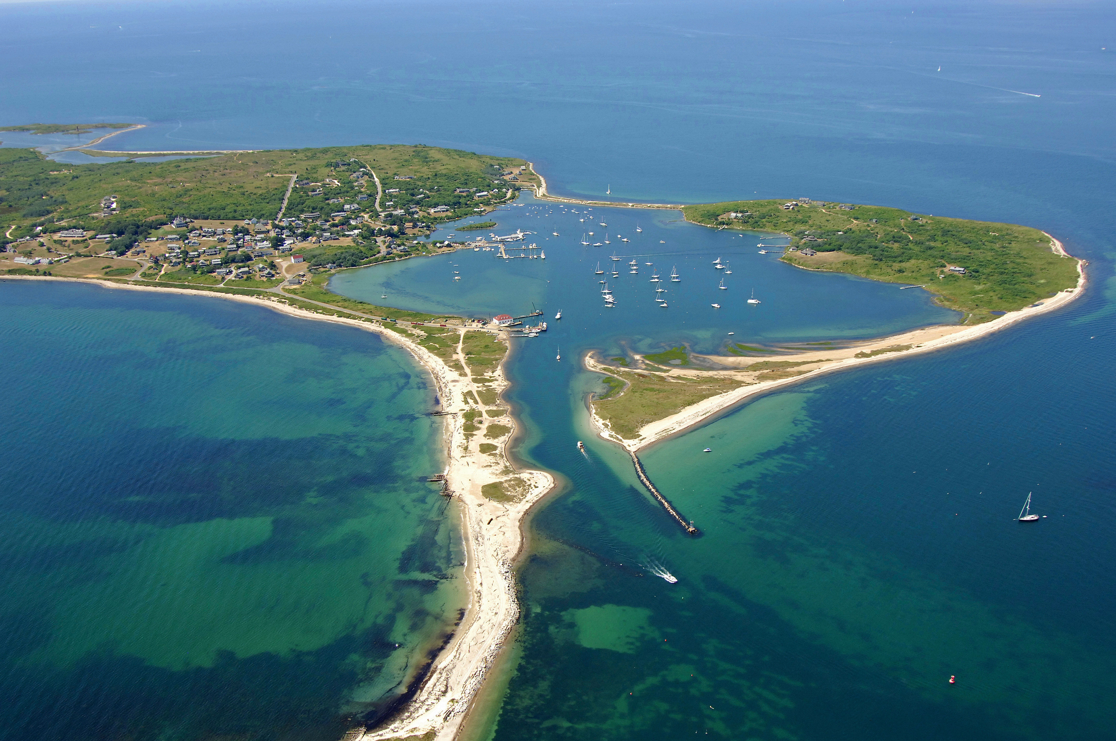
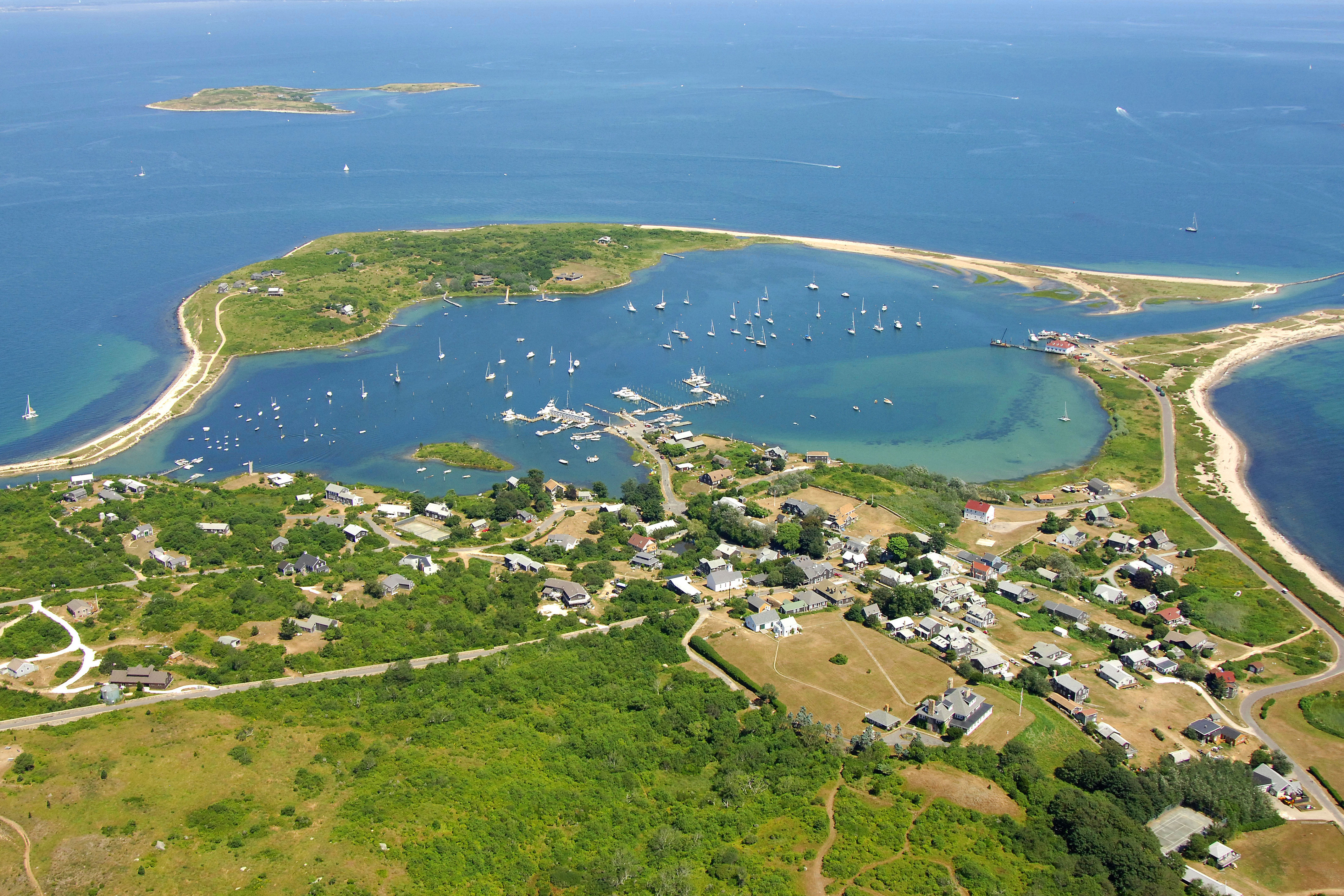
Cuttyhunk Island rests 12 miles south of New Bedford, MA and 8 miles west of Gay Head, Martha's Vineyard. The island is part of the Town of Gosnold, in the Commonwealth of Massachusetts. Cuttyhunk Island has a small beach, a great harbor, excellent fishing and some beautiful hiking trails.
History:
The name Cuttyhunk is derived from the Native American name Poocutohhunkunnoh. Bartholomew Gosnold, who also was the first recorded visitor to close-by Westport, MA, landed on Cuttyhunk in 1602, though it wasnt until 1688 when Ralph Earle, Jr. made permanent residence on the island. Since then, it has become a boating and fishing center, and relies heavily on tourism for its survival.
Navigating the Water:
Use NOAA Charts 13229, 13230 and 13218.
Cuttyhunk Harbor is six miles across Buzzards Bay from New Bedford and seven miles from Menemsha Bight on Martha's Vineyard. It is best to approach Cuttyhunk from the east. Steer toward the Morse (A) buoy southeast of Penikese Island, and then cut the two prominent nun buoys into the well-protected harbor. From the east or south via Vineyard Sound, head into Buzzards Bay via Quicks Hole between Nashawena and Pasque Islands.
It is not advisable to use Canapitsit Channel, which separates Cuttyhunk from Nashawena Island, without local knowledge.
Local Notices to Mariners:
Local Notices to Mariners are available online from the U.S. Coast Guard.
Things To Do/Local Events:
See the Helpful Links section at the bottom of this page for detailed information
Transportation:
Ferry service to the island is provided by a number of charter vessels. See the Helpful Links section at the bottom of this page for schedules and fees.
As with many of the smaller and isolated island in the Cape Cod region, foot and bike travel are the most efficient means of getting around once you have arrived on the island.
For air travel, the New Bedford Regional Airport is the closest airport with charter service to Cuttyhunk Island, and the T.F. Green International Airport in Providience, RI has daily commercial service from major carriers some 40 miles to the northwest of the island.