Wiggins Pass Inlet
| Naples, Florida United States | |
| 26° 17' 20.04'', -81° 49' 56.99'' | |
| Naples Harbor |


You might also consider...


About
Introduction:
Wiggins Pass is located on the West Coast of Florida about 20 miles south of the town of Cape Coral and 40 miles northwest of Everglades City. Mainly a passage for vessels drawing less than four feet, Wiggins Pass allows access from the Gulf of Mexico to the Cocohatchess River where the Pelican Isle Yacht Club, Wiggins Pass Marina, and Cocohatchee River Marina are located. At least two of the marinas typically have transient space available.
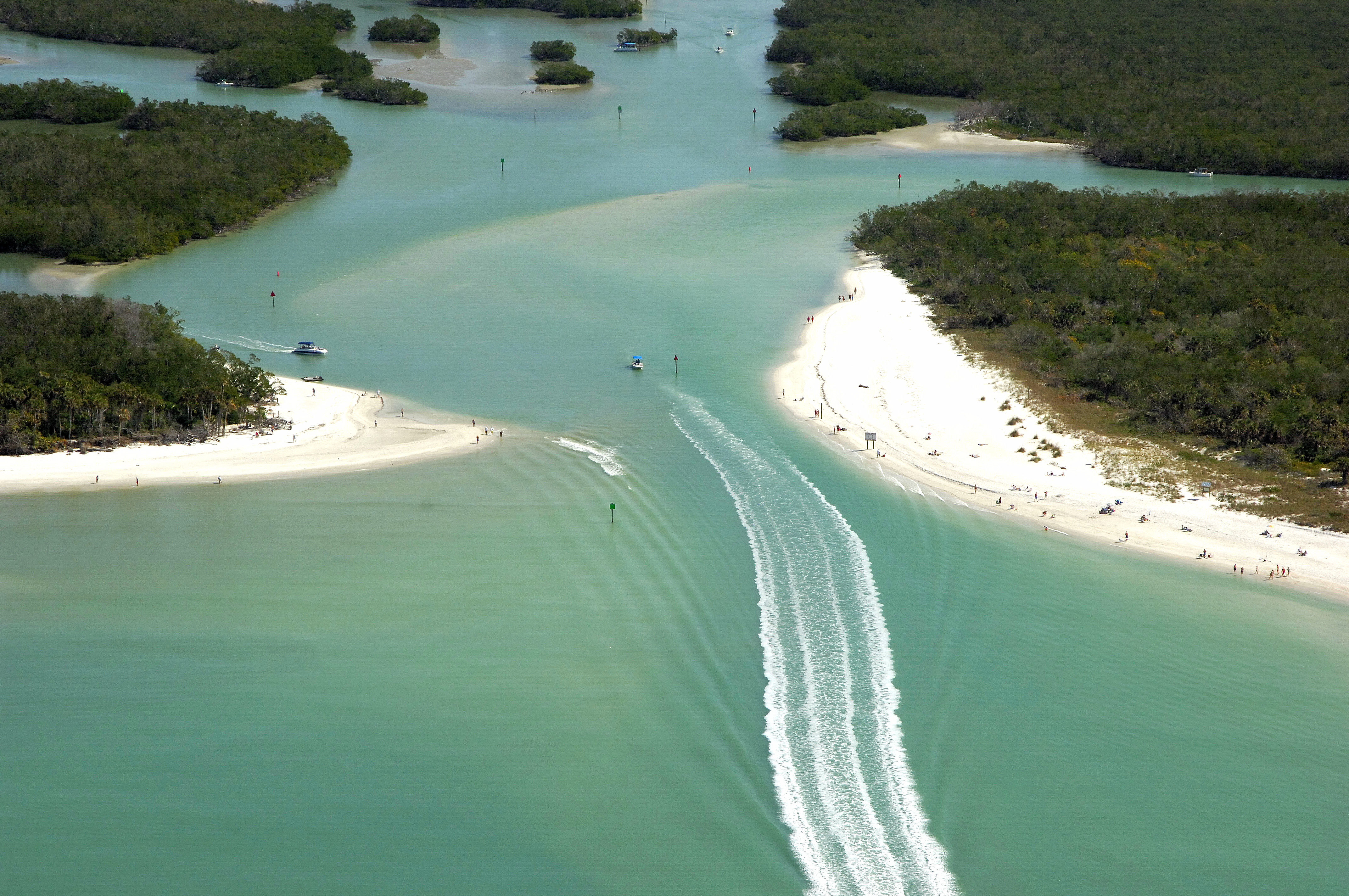
The Cocohatchee River is located in the town of Bonita Springs and there are a few close by opportunities for provisioning. The image above is a view from the west looking east over Wiggins Pass where it enters the Cocohatchee River. Take note of the winding channel. The deepest part of the pass is located to starboard on entry, and then turns sharply to port and into the river.
Navigating the Water:
Use NOAA Chart 11430.
From the Gulf of Mexico, set a course to intercept flashing white WP at the mouth of the inlet. Once you have picked up the flashing light, head toward green daybeacon 1 and red daybeacon 2 (visible in the image above - they are offset from one another), and then follow the privately maintained marker straight back up the Cocohatchee River. Do not make the turn to starboard just past the inlet, this will take you into a private community area.
Local Notices to Mariners:
Local Notices to Mariners are available online from the U.S. Coast Guard.