


Bradenton Beach Harbor
Bradenton Beach, Florida United States
Marinas near Bradenton Beach Harbor
| Name | Reviews | Max LOA | VHF | Dock Depth | Gas / Diesel | Lift / Crane | Wifi | Amps |
|---|---|---|---|---|---|---|---|---|
| Parrot Cove Marina | 65.0' | - | Low 5.0'High 8.0' | - | - | - | ||
| N.E. Taylor Boatworks | - | - | - | - | - | - | - | - |
| Cortez Kitchen | - | - | - | - | - | - | - | - |
| Cortez Cove Marina | - | 0.0' | - | Low 0.0 mHigh 0.0' | - | - | - | - |
| Cortez Village Marina | - | 0.0 m | - | Low 0.0 mHigh 0.0' | GYesDYes | - | - | - |
| Star Fish Company | - | - | - | - | - | - | - | - |
| HH Marina | - | 0.0 m | - | Low 0.0 mHigh 0.0 m | - | - | - | - |
| Cortez Deep Sea Fishing Center | - | 0.0 m | - | Low 0.0 mHigh 0.0 m | - | - | - | - |
| Cortez Kat Charters | - | 0.0' | - | Low 0.0 mHigh 0.0' | - | - | - | - |
| Seafood Shack Marina | 120.0' | 16 | Low 10.0' | GNearbyDNearby | - | - | 30, 50 | |
| Cove Sound Moorings | - | 0.0' | - | Low 0.0 mHigh 0.0' | - | - | - | - |
| Bradenton Beach Marina | 70.0' | 16 | Low 0.0 mHigh 0.0' | G$5.75D$4.95 | LYes | 30, 50 | ||
| Shore Restaurant | - | - | - | - | - | - | - | - |
| Safe Harbor Pier 77 | 45.0' | 16 | Low 7.0' | G$5.949D$4.48 | - | 30-50 AMP | ||
| Cannons Marina New & Used Boat Sales | - | - | - | - | - | - | - | - |
Introduction:
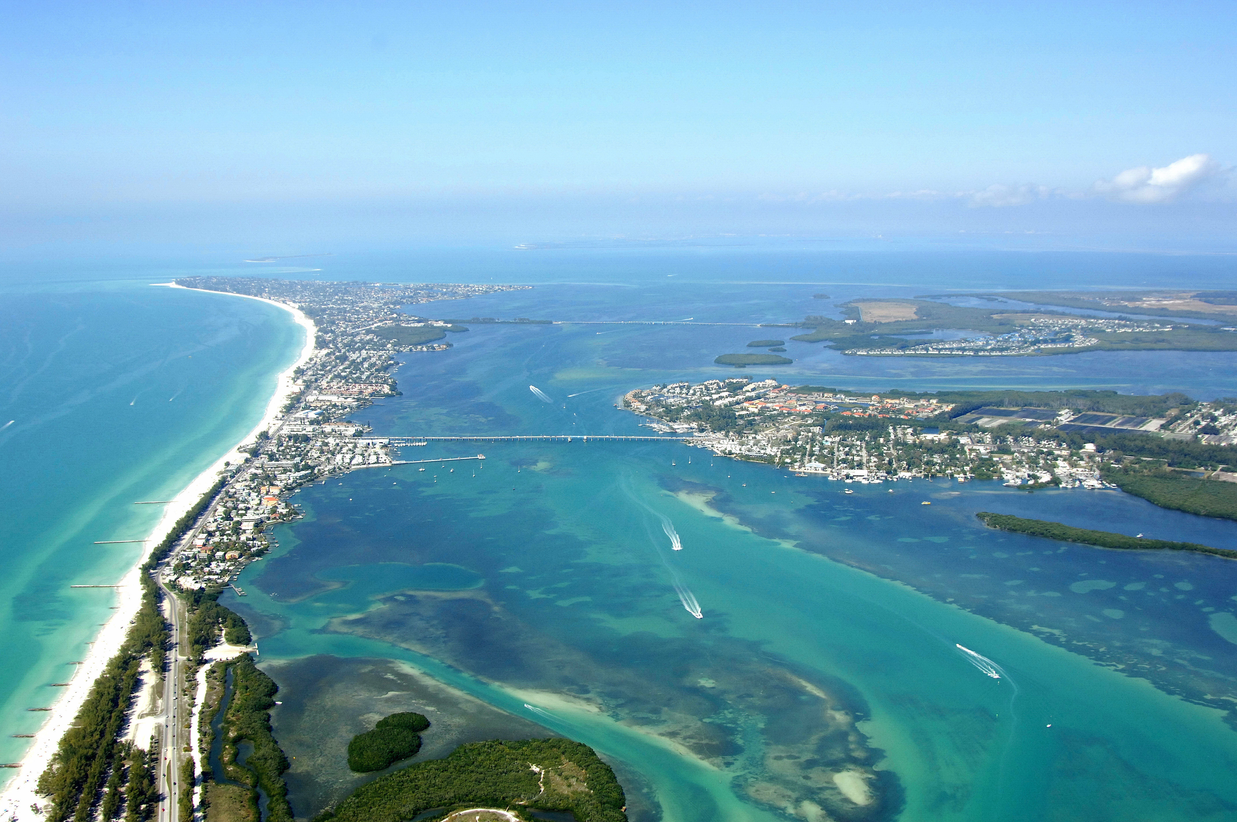
Bradenton Beach is a charming and vibrant community of 1,500 located at the southern end of Anna Maria Island. The Island is located at the southern entrance to Tampa Bay on the Gulf of Mexico. Bradenton Beach shares the island with its sister cities of Holmes Beach and Anna Maria City. Specifically, Bradenton Beach is located off The Gulf Intracoastal Waterway ay GIWW Mile 87 north of Longboat Pass about 20 miles south of Saint Petersburg and 12 miles northwest of Sarasota.
Bradenton Beach merchants offer a full slate of goods and services including accommodation of every kind, restaurants, bars, retail outlets, real estate and other professional services. The unique shops of Bridge Street in the city's central Historic Old Town district are very popular with visitors.
For those with a penchant for the piscatory, you can fish from the popular City Pier, which features a full service Café. Inshore and offshore fishing tours are also readily available from local guides. There are a number of Parks within city limits, including beach front with picnic facilities and public restrooms. There are numerous public accesses to the beach. There are also public boat ramps at the county managed Bay Side Park at the southern tip of the city.
[i]Portions Courtesy City of Bradenton Beach[/i]
Navigating the Water:
Use NOAA Chart 11425.
The Gulf Intracoastal Waterway (GIWW) past Bradenton Beach from GIWW Mile 80 to 90 is well-marked, but tends to be shallow toward the south of Longboat Pass. Project depths for the GIWW are reported to be nine feet, but you may encounter some five- to six-foot deep spots from White Key to Longbeach.
Be prepared for some interesting currents as you cruise in the vicinity of Longboat Pass. The inlet tends to influence current flow in and around the GIWW channel, so keep a sharp eye on your position to make sure you are not being set off course.
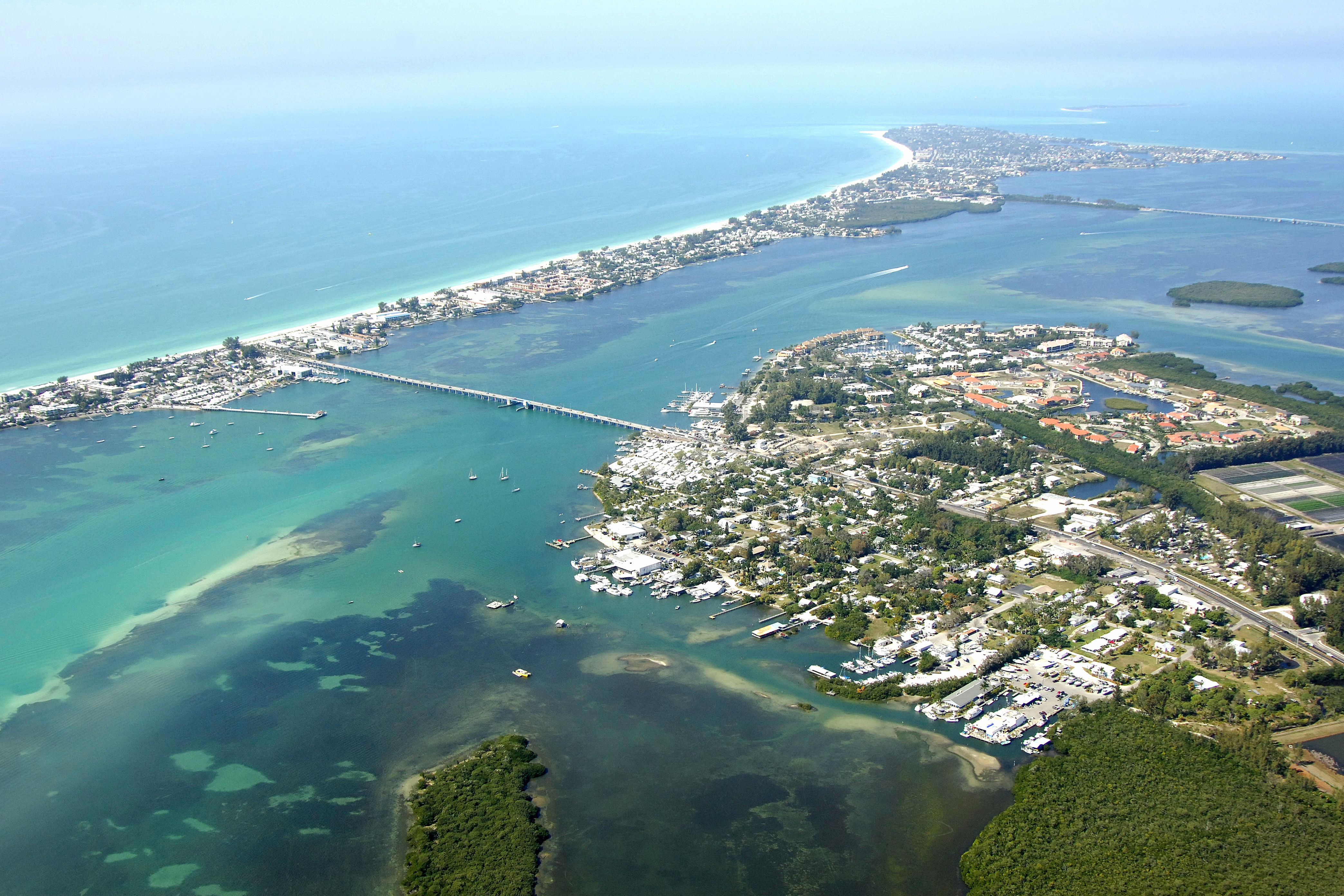
Once you have cleared Longboat Pass heading north, the Waterway narrows as you approach Bradenton Beach and Cortez Island at the Cortez Island Bascule Bridge (22-foot closed vertical clearance; restricted opening schedule). This is the area where you will find the majority of the marinas (additional facilities are available farther on at Anna Maria Key). To the west on Bradenton Beach, there are two marinas, and one of them (visible in the image above to the left at the bridge) offers full services including all fuels, 77-ton lift, transient slips, pump out and a ships store.
To the east on Cortez Island are three additional facilities, two of which have transient facilities available. The other is a fishing center that offers tie-ups for customers purchasing bait, tackle or ice.
Local Notices to Mariners:
Local Notices to Mariners are available online from the U.S. Coast Guard.