Middle River Rallroad Bascule Bridge
| California United States | |
| 37° 56' 21.13'', -121° 32' 2.39'' | |
| Korths Harbor |


Details
| Closed vertical clearance | 11 |
About
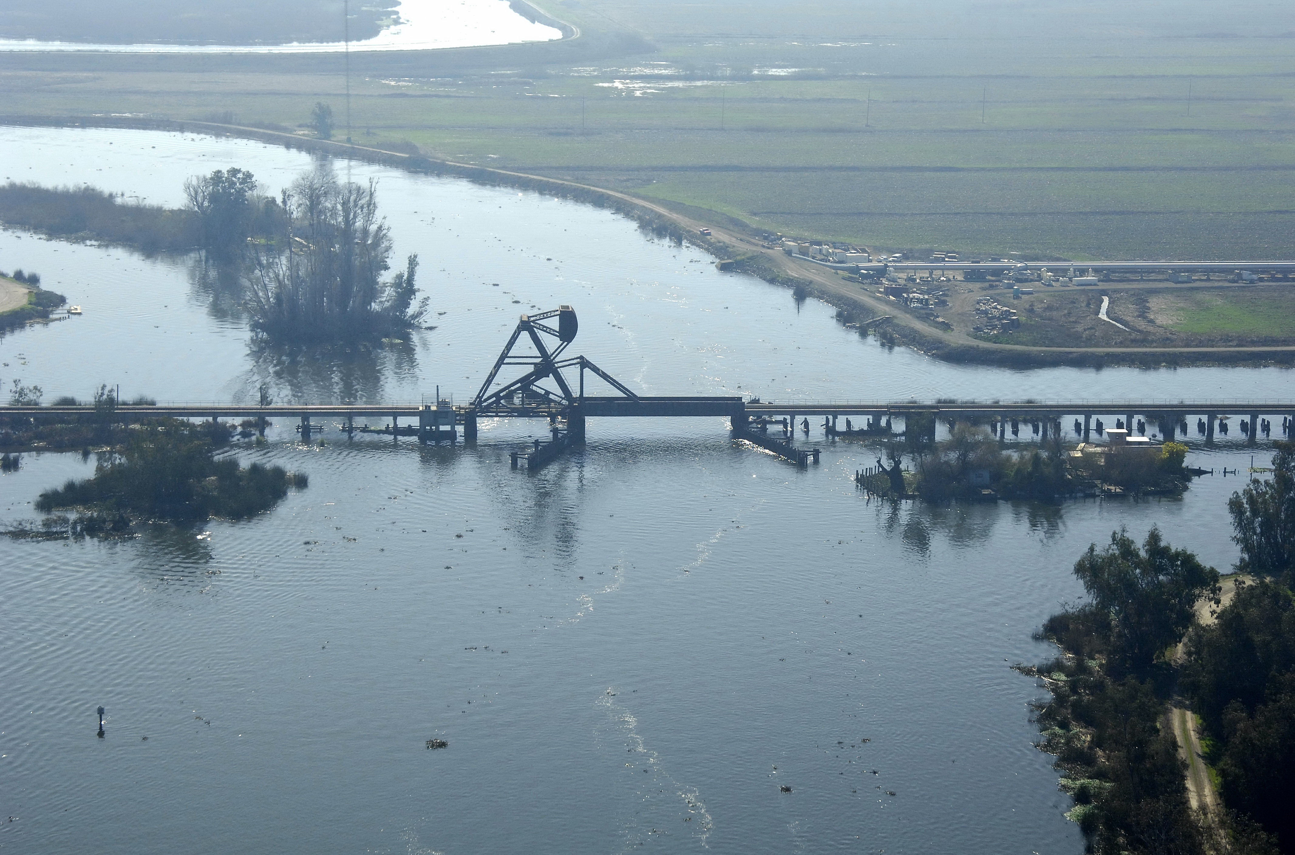
Introduction:
The Middle River Railroad Bascule Bridge carries rail traffic to and from Stockton across the Middle River at its junction with the Orwood levee.
Navigating the Bridge:
Use NOAA Chart 18661.
Characteristics: The bridge has a closed vertical clearance of 11 feet with 79 feet of vertical clearance at the center span when open. Located in a particularly trick stretch of water (currents influenced by Old River, Middle River and Woodward Canal), a careful watch on your speed and drift are warranted here during periods of high water.
Bridge Schedule:
This bridge operate son a restricted opening schedule. Call t he District 11 USCG offices for more details: 510-437-3073.
Local Notices to Mariners:
Local Notices to Mariners are available online from the U.S. Coast Guard.
Reviews
No reviews yet! Be the first to write a review of Middle River Rallroad Bascule Bridge.