Old River Swing Bridge
| California United States | |
| 37° 53' 27.08'', -121° 34' 11.57'' | |
| Korths Harbor |


You might also consider...


Details
| Closed vertical clearance | 12 |
About
Introduction:
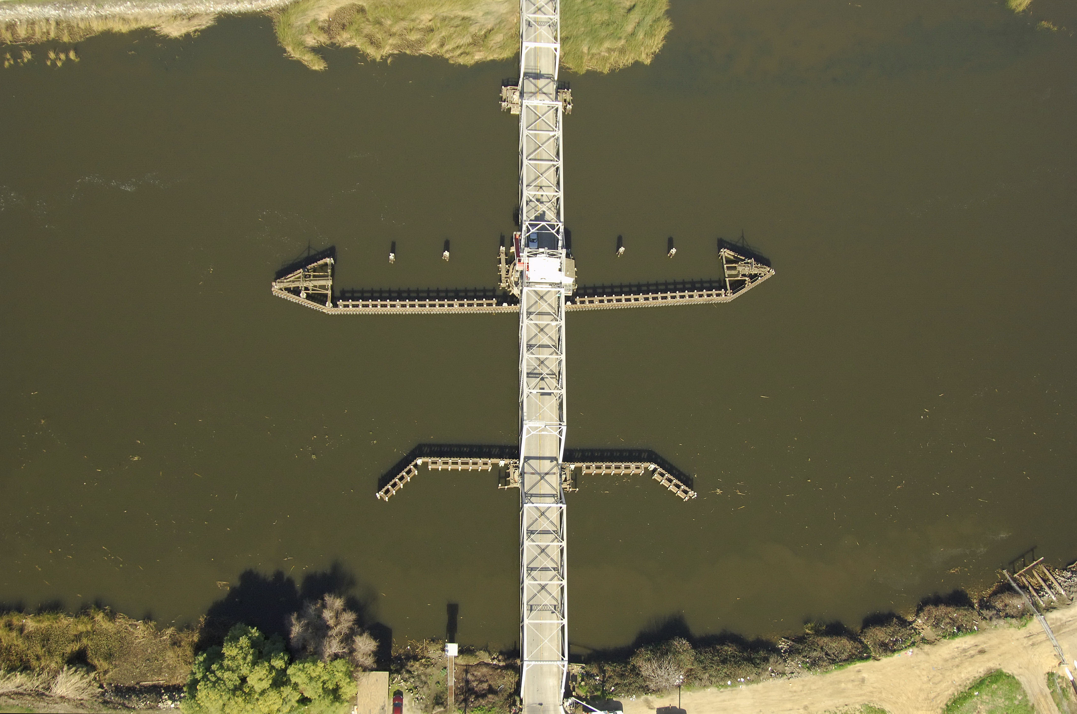
Carrying state Route 4 across Old River south of the North Victoria Canal, the Old River Swing Bridge is one of many crossings the highway makes in its east-west journey across the Sacramento River Delta.
Navigating the Bridge:
Use NOAA Chart 18661.
Characteristics: The bridge has a 12-foot closed vertical clearance with 98 feet of horizontal clearance at the center span. Project depths for Old River in this area are 12 feet, with shoaling prevalent in some areas toward the middle; a close watch on the depth sounder is warranted.
Bridge Schedule:
This bridge operates on a restricted opening schedule.
From May 1 to Oct. 31, the bridge operates from 6 a.m. to 10 p.m. with four hours advance notice.
From Nov. 1 to April 30, the bridge operates from 9 a.m. to 5 p.m. with four hours advance notice.
The bridgetender can be reached on VHF Channel 09, or via phone at 209-465-0935.
Local Notices to Mariners:
Local Notices to Mariners are available online from the U.S. Coast Guard.