Southern Pacific Swing Bridge
| California United States | |
| 37° 29' 51.01'', -122° 6' 32.4'' | |
| Redwood City |


You might also consider...

63 Reviews
Located in the heart of Silicon Valley, Westpoint Harbor is a privately owned... Read More

23 Reviews
Antioch Municipal Marina offers one of the best locations on the California D... Read More

Ayala Cove has the largest public docks and moorings on the bay, and is among... Read More
Details
| Closed vertical clearance | 13 |
About
Introduction:
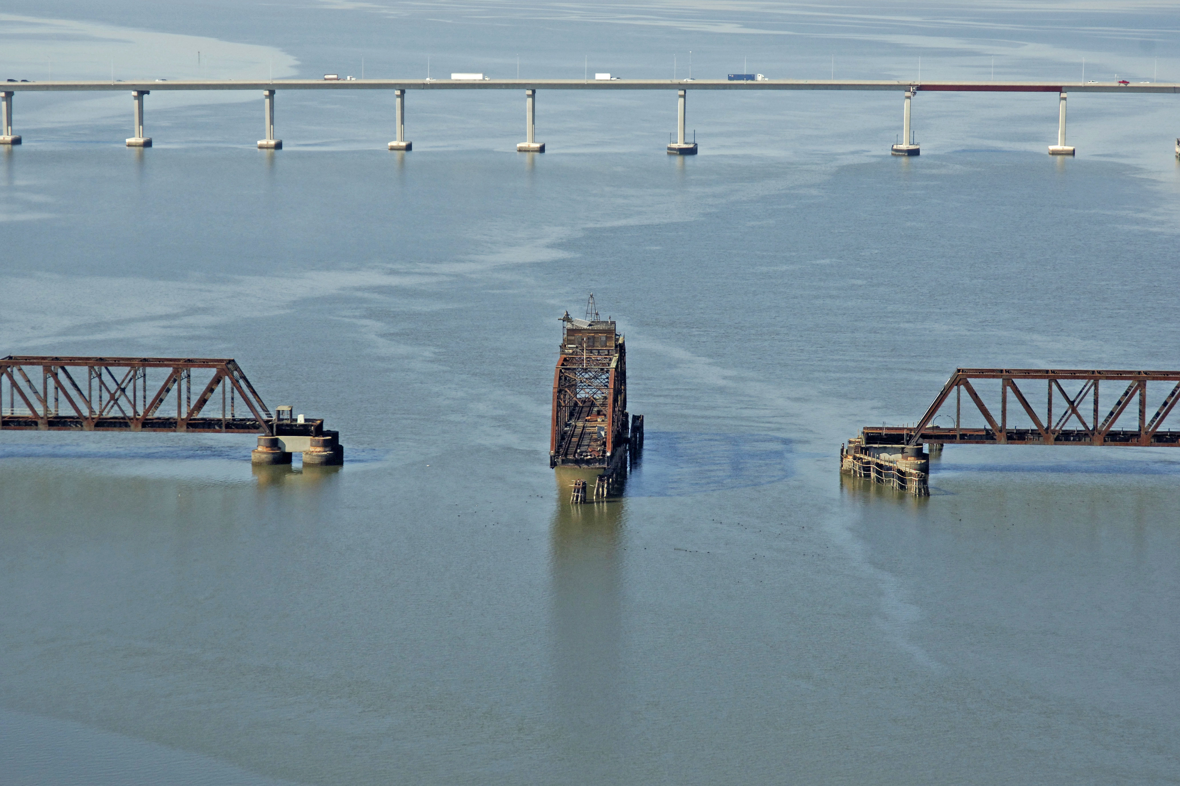
The South Pacific Railroad Swing Bridge is a discontinued swing bridge that used to carry rail traffic across South San Francisco Bay into Palo Alto. It has been abandoned and is permanently in the open position.
Navigating the Bridge:
Use NOAA Chart 18651.
Charatceristics: The bridge has a closed vertical clearance of 13 feet with 125 feet of clearance within the center span. Traveling southward, depths shallow quickly past flashing red 16 at Dumbarton Point.
Bridge Schedule:
This bridge is no longer in use by rail traffic and has been left permanently in the open position
Local Notices to Mariners:
Local Notices to Mariners are available online from the U.S. Coast Guard.
Reviews
No reviews yet! Be the first to write a review of Southern Pacific Swing Bridge.