Turner Cut Bascule Bridge
| California United States | |
| 37° 58' 35.03'', -121° 28' 26.4'' | |
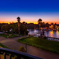
| Korths Harbor |


You might also consider...


Details
| Closed vertical clearance | 16 |
About
Introduction:
The Turner Cut Bridge is unusual in that instead of the bridge leafs opening up toward the sky, or a lift pulling the bridge section upward, the opening portion of this bridge merely slides back, hence its unusually nomenclature as a retractable bridge.
The Turner Cut Retractable Bridge is located 10 miles west of Stockton on Turner Cut, a tributary that breaks off the San Joaquin River between McDonald and Roberts islands. Turner but has two marinas at its lower ends, both located conveniently close to the bridge with a variety of services.
Navigating the Bridge:
Use NOAA Chart 18661.
The Turner Cut Retractable Bridge has a closed vertical clearance of 16 feet and 30 feet of horizontal clearance at the center span. North of the bridge, water depths in the cut range from eight to 17 feet, with the shallower depths occurring close to the marinas. Water depths increase to 11- to 14-foot depths south of the bridge. As with all San Joaquin Delta locations, caution is warranted during periods of high water when the spring melt begins in the mountains.
Bridge Schedule:
The Turner Cut Bridge is manned 24 hours a day and opens on demand. Hail the bridgetender on VHF Channel 09, or via phone at 209-464-1253 to request an opening.
Local Notices to Mariners:
Local Notices to Mariners are available online from the U.S. Coast Guard.