Salinas Harbor Inlet
| Salinas, Puerto Rico | |
| 17° 56' 52.08'', -66° 17' 29.03'' | |
| Salinas Harbor |


You might also consider...


About
Introduction:
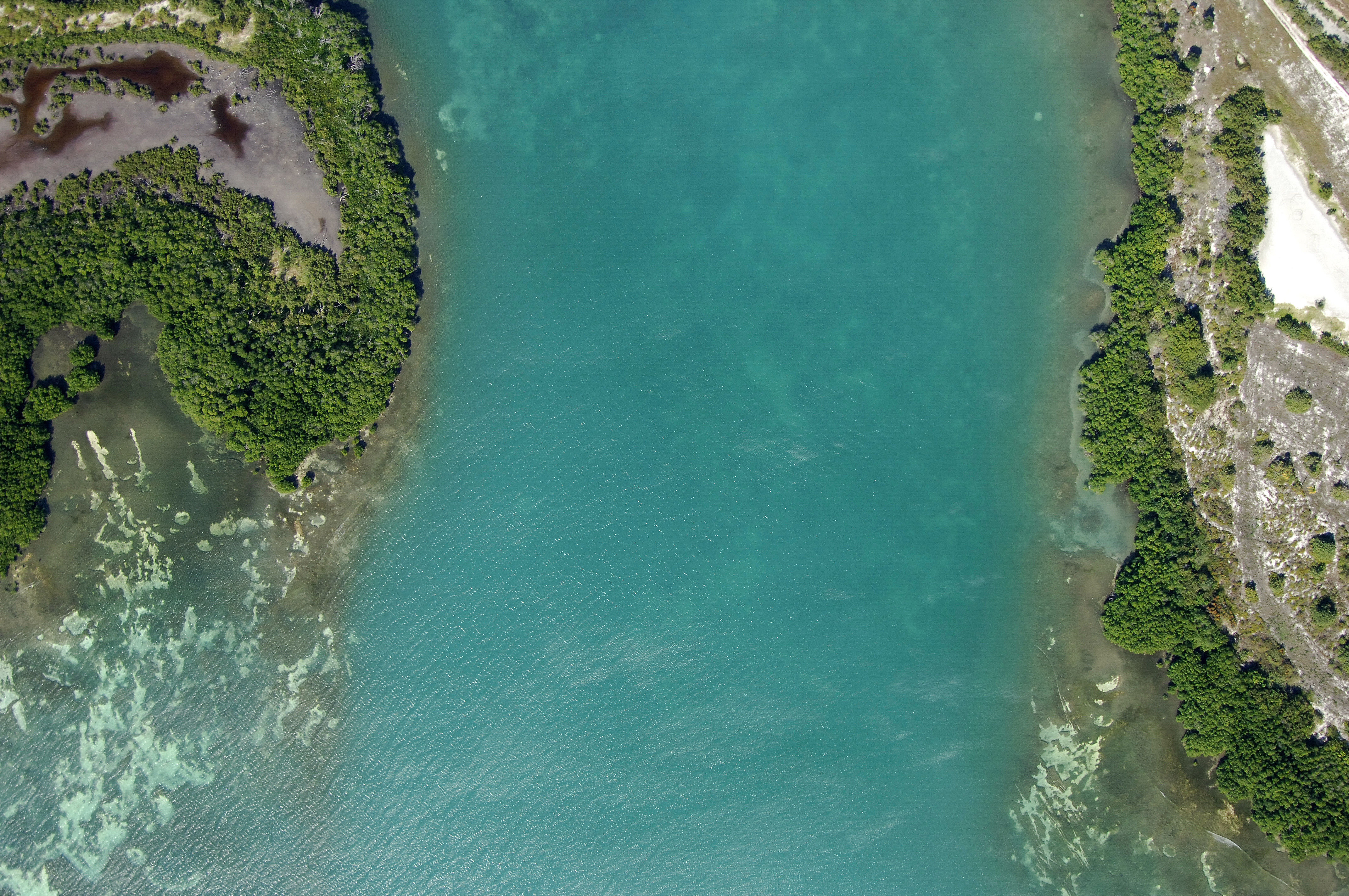
Located off Rincon Bay on the shores of Salinas Beach, Salinas Harbor is probably the best protected and most popular harbor for the boating set in Puerto Rico. Unlike many of the open coves and beach harbors that experience rolling fetches from the sea, Salinas Harbor is well enclosed and protected from swell by Mata Key, the mangrove areatoward the left in the image above.
Navigating the Water:
Once you have successfully navigated your way into Rincon Bay west of the Ratones Keys (Cayos Ratones), you can set a course for the opening of Salinas Bay between Cayos Mata and Punta Arenas. Be advised that the whole Salinas Bay area is a No-Wake Zone, due to manatees (this includes your dinghy).
Once you have dropped the hook in the northern end of the harbor, you can dinghy ashore where you will find shops, restaurants, markets and other stores for provisioning. There is only one marina in town, but there are supplies and fuel available here.
Local Notices to Mariners:
See our Local Notices to Mariners blog for updates on the latest conditions and advisories for this area.