Ponce de Leon Cut South Inlet
| Ponce, Florida United States | |
| 29° 3' 28.08'', -80° 54' 54.0'' | |
| New Smyrna Beach |


You might also consider...

About
Introduction:
Located on Floridas East Coast at Intracoastal Waterway (ICW) Mile Marker 843.5 about 13 miles south of Daytona Beach and 48 miles north-northwest of Cape Canaveral, the Ponce de Leon Cut is a man-made land cut originally dug to avoid the hazardous shoals of the Ponce de Leon Inlet, which lies just to the east.
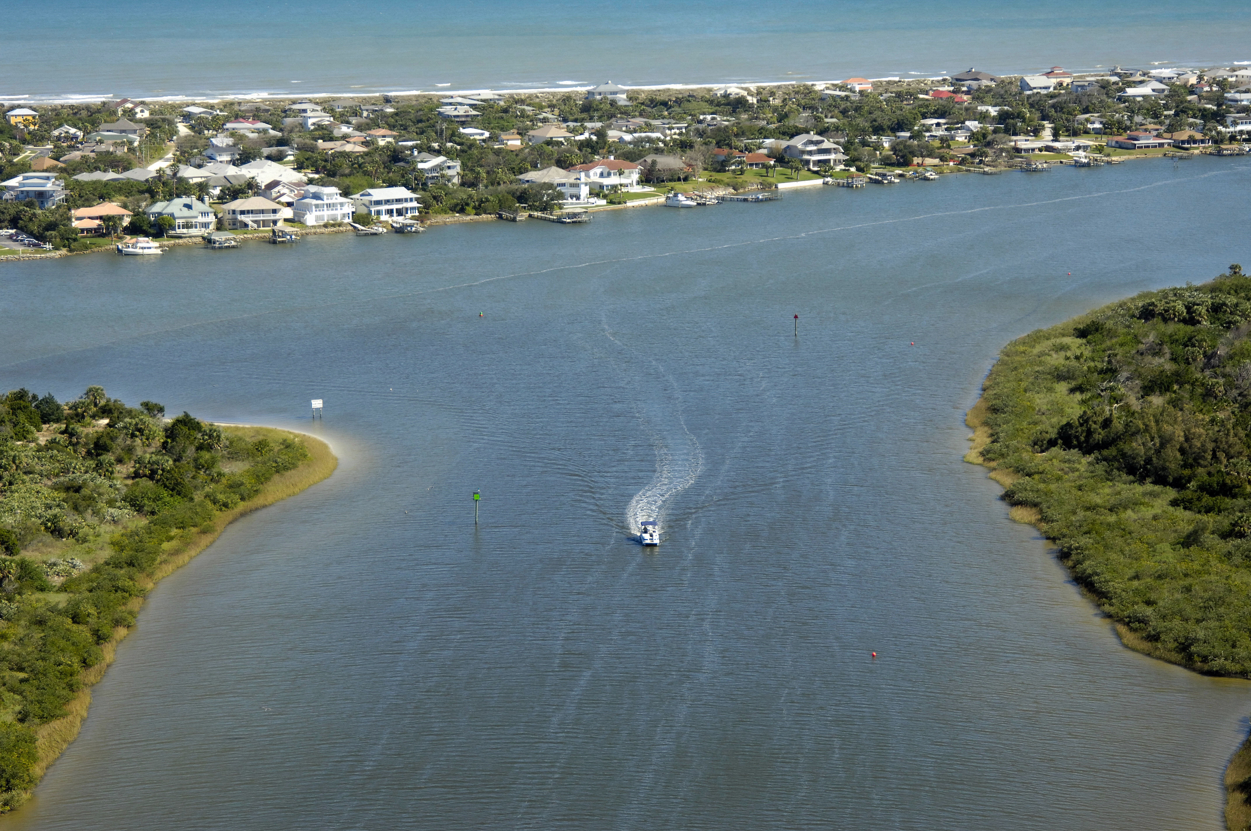
The image above is a view from the south-southeast looking to the north-northeast up south terminus of the Ponce de Leon Cut Inlet where it meets up withe the Matanzas River, which can be seen entering from the east on the lower right-hand side of the image.
Navigating the Water:
Use NOAA Chart 11485.
From the Intracoastal Waterway heading north, pick up red daybeacon 18 (visible in the image above). which marks the opening of the Ponce de Leon Cut. Once you have picked up red daybeacon 18, set a course a little farther up to intercept flashing green 17 (also visible in the image above) on the north side of the channel. From here, the channel bends slightly north, passing flashing red 14 and red daybeacon 10, before making a sharp turn north at flashing red 10.
Local Notices to Mariners:
Local Notices to Mariners are available online from the U.S. Coast Guard.