Tarpon Springs Inlet
| Tarpon Springs, Florida United States | |
| 28° 10' 30.0'', -82° 47' 26.89'' | |
| Tarpon Springs Harbor |


You might also consider...


About
Introduction:
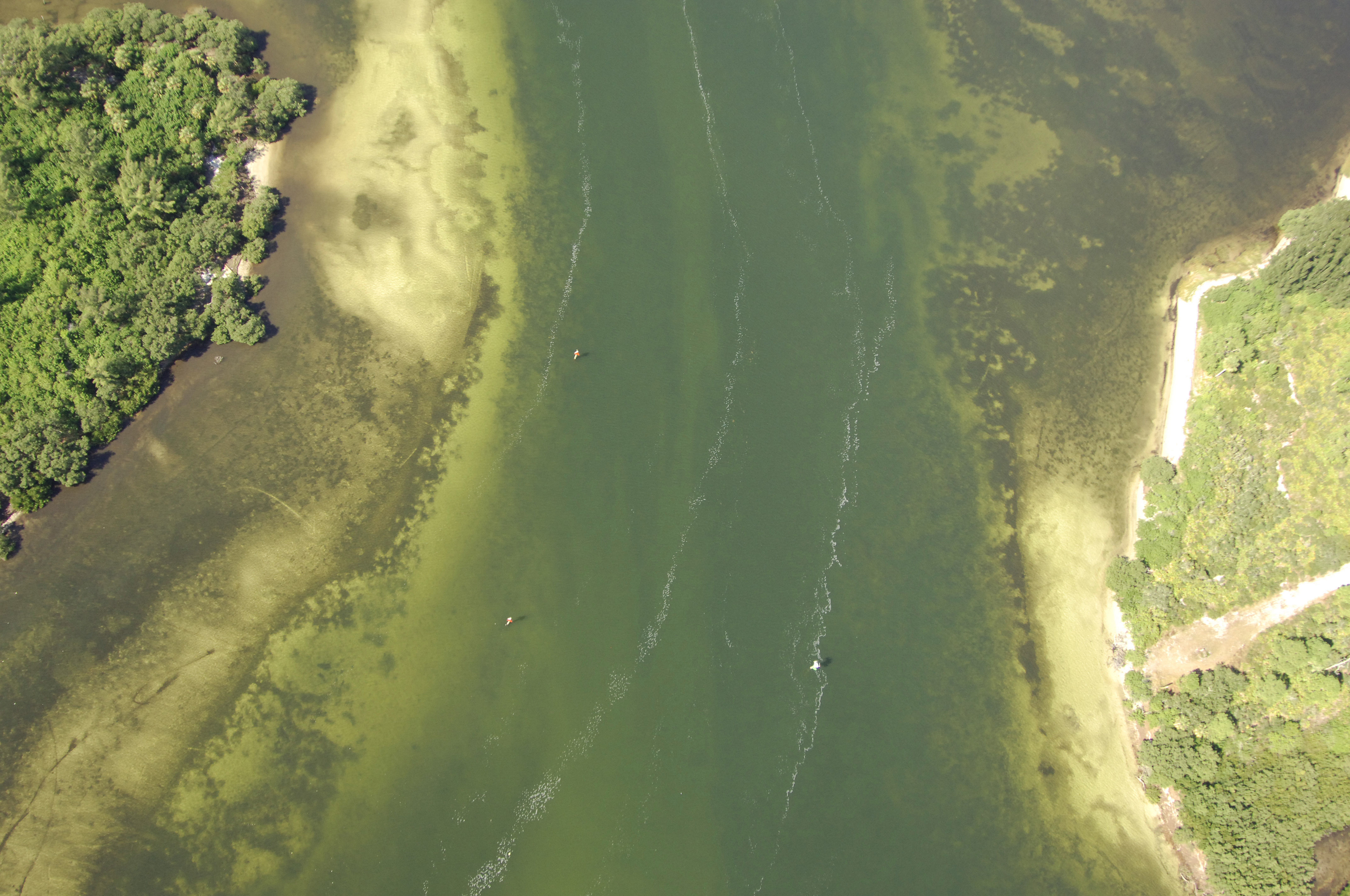
Located on Floridas West Coast, Tarpon Springs is one of the first well-equipped stopovers for northbound cruisers on the GIWW after leaving the Clearwater Florida. Tarpon Springs is 15 miles north of Clearwater and 22 miles southwest of Hernando Beach around Gulf Intracoastal Waterway (GIWW) Mile 150. The image above is a view from the west looking east over the Anclote River near red daybeacon 14, where the channel takes a bend into the Cut C Range and up toward the town of Tarpon Springs.
Navigating the Water:
Use NOAA Chart 11411.
The primary entrance to the Anclote River is via the Gulf Intracoastal Waterway, which makes its way into the area from GIWW Mile 150 south of Anclote Key. The mouth of the Anclote River can also be approached from the north, and this approach has a wider channel with a few marks to announce the shallow spots. Whether you arrive from the north or the south, quick flashing green 1 is the first mark into the Anclote River and marks the beginning of a long dredged channel into the river itself. Controlling depths in the channel up to Tarpon Springs are reported to be at least 6.5 feet.
Once you have picked up quick flashing green 1, a long line of daybeacons guide you in until you reach quick flashing green 9, which marks the first northeast turn in the progression of the river toward Tarpon Springs. The next turn comes at quick flashing green 17, where you can pick up the Cut C Range until green daybeacon 21, where range assistance is terminated. The rest of the trip up the river is fairly uneventful, with several marinas scattered along the passage, a good portion of which accept transient guests.
Local Notices to Mariners:
Local Notices to Mariners are available online from the U.S. Coast Guard.