Halifax Creek South Inlet
| Ormond Beach, Florida United States | |
| 29° 22' 30.0'', -81° 5' 7.07'' | |
| Daytona Beach |


About
Introduction:
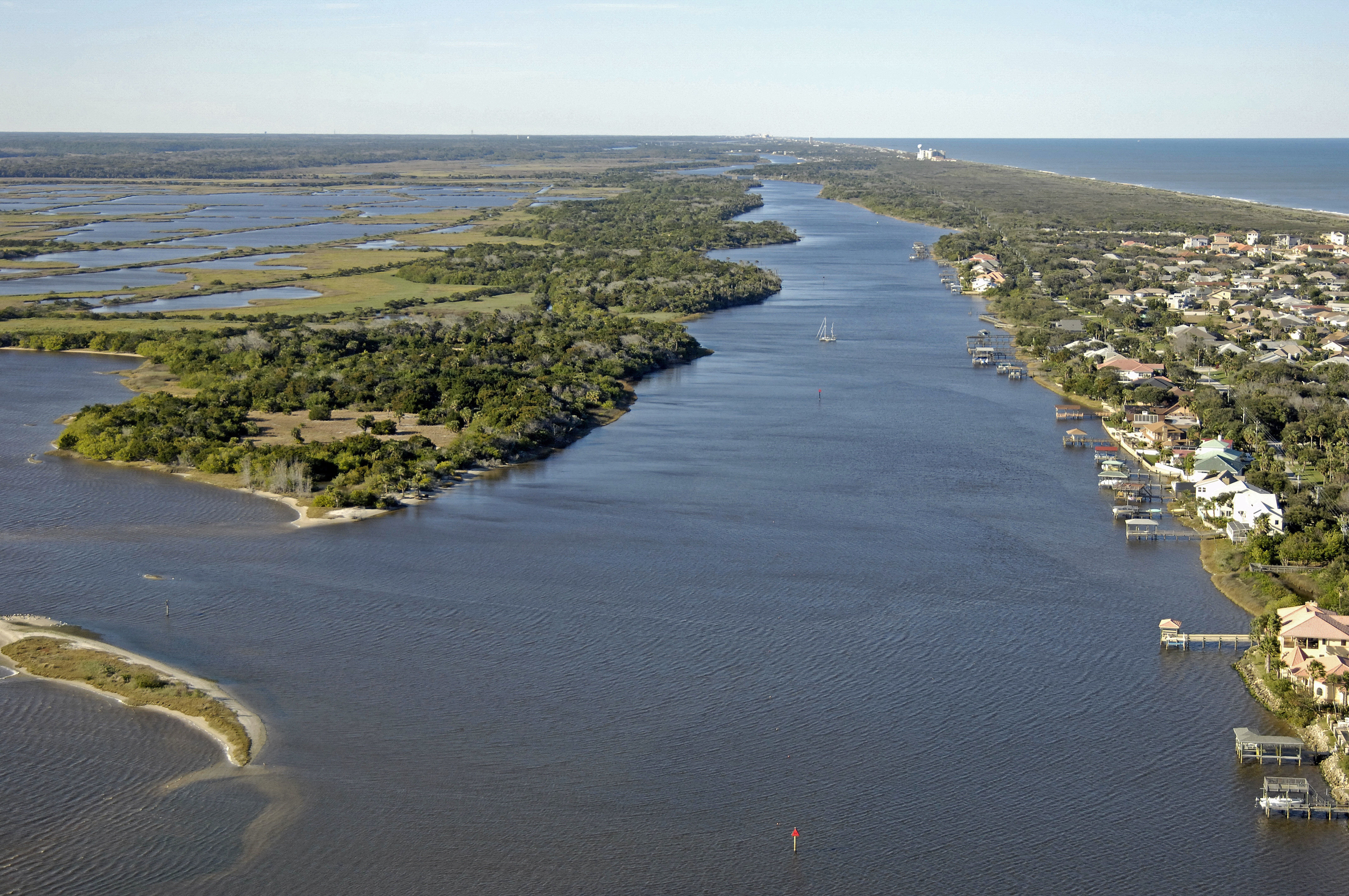
The image above is a view from the north, looking south over the southern terminus of Halifax Creek where it meets the Halifax River. The Intracoastal Waterway Channel runs east (left) past the long island picture above, and then runs straight south for about 15 miles to Daytona Beach.
Use NOAA Chart 11485.
Approaching the southern terminus of Halifax Creek near Intracoastal Mile 818, you will find red daybeacon 30. Once you have picked up red daybeacon 30, continue south to intercept red daybeacon 32 (visible in the image above in the lower portion of the photo), and then continue toward the south to red daybeacon 34, which is visible just off the tip of the large wooded island. Be sure to keep to the east of the island, as the area to the west is is fairly shoal with three- to four-foot depths.
This area is pretty devoid of marinas or marine facilities, but the facilities of Daytona Beach are only 15 miles to the south via the Intracoastal Waterway/Halifax River.
Local Notices to Mariners:
Local Notices to Mariners are available online from the U.S. Coast Guard.