White Sound Inlet (Green Turtle Cay)
| Abacos Bahamas | |
| 26° 46' 17.04'', -77° 19' 58.09'' | |
| Green Turtle Cay |


You might also consider...


About
Introduction:
Green Turtle Cay and the surrounding out islands are likely one of the busiest and most popular destinations in the Abacos, and perhaps the entire Bahamas island chain. Located just west of Treasure Cay, Green Turtle Cay is 25 miles northwest of Marsh Harbour and 35 miles east of Grand Bahama Island.
Ashore on the island are three protected harbors (White Sound to the north and Black Sound and Settlement Harbour to the south), and there are a variety of services in each. We will be discussing White Sound.
Navigating the Water:
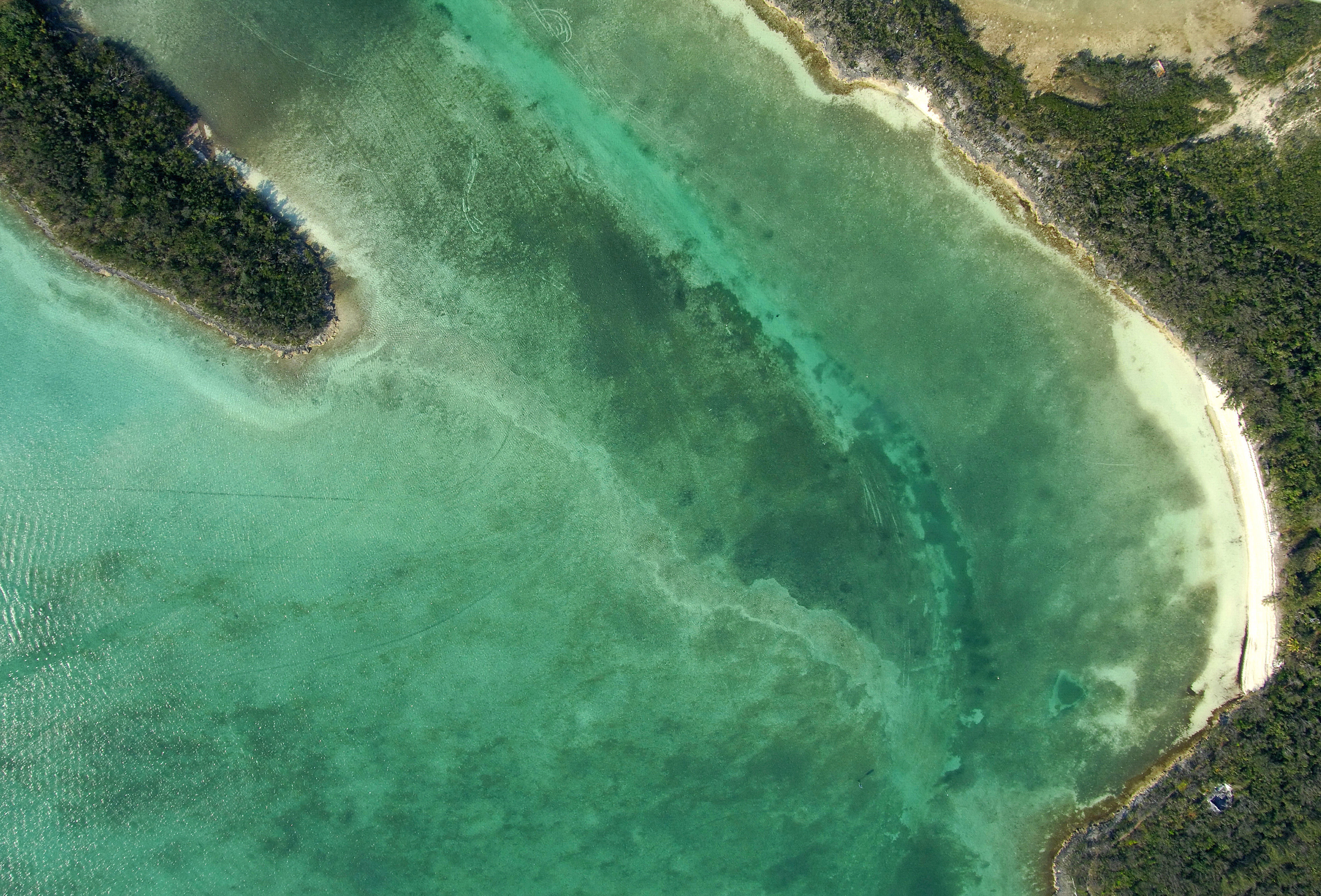
Visible in the image above (zoom in if necessary), there are two signs that mark the entrance to White Sound right around where the sailboat and kayaking expedition are located. These are the marks that you will want to line up with on approach. The channel itself is about 30 feet wide with depths of 4 to 5 feet.
Once you have cleared the entrance, you can head north up into White Sound proper where you will find the Green Turtle Club and Bluff House marinas, both of which have transient slips and fuel.
Local Notices to Mariners:
See our Local Notices to Mariners blog for updates on the latest conditions and advisories for this area.