St. Johns River Inlet
You might also consider...


About
Local Notices to Mariners:
Local Notices to Mariners are available online from the U.S. Coast Guard.
Helpful Links:
Saint Johns Pilot Association History
Introduction:
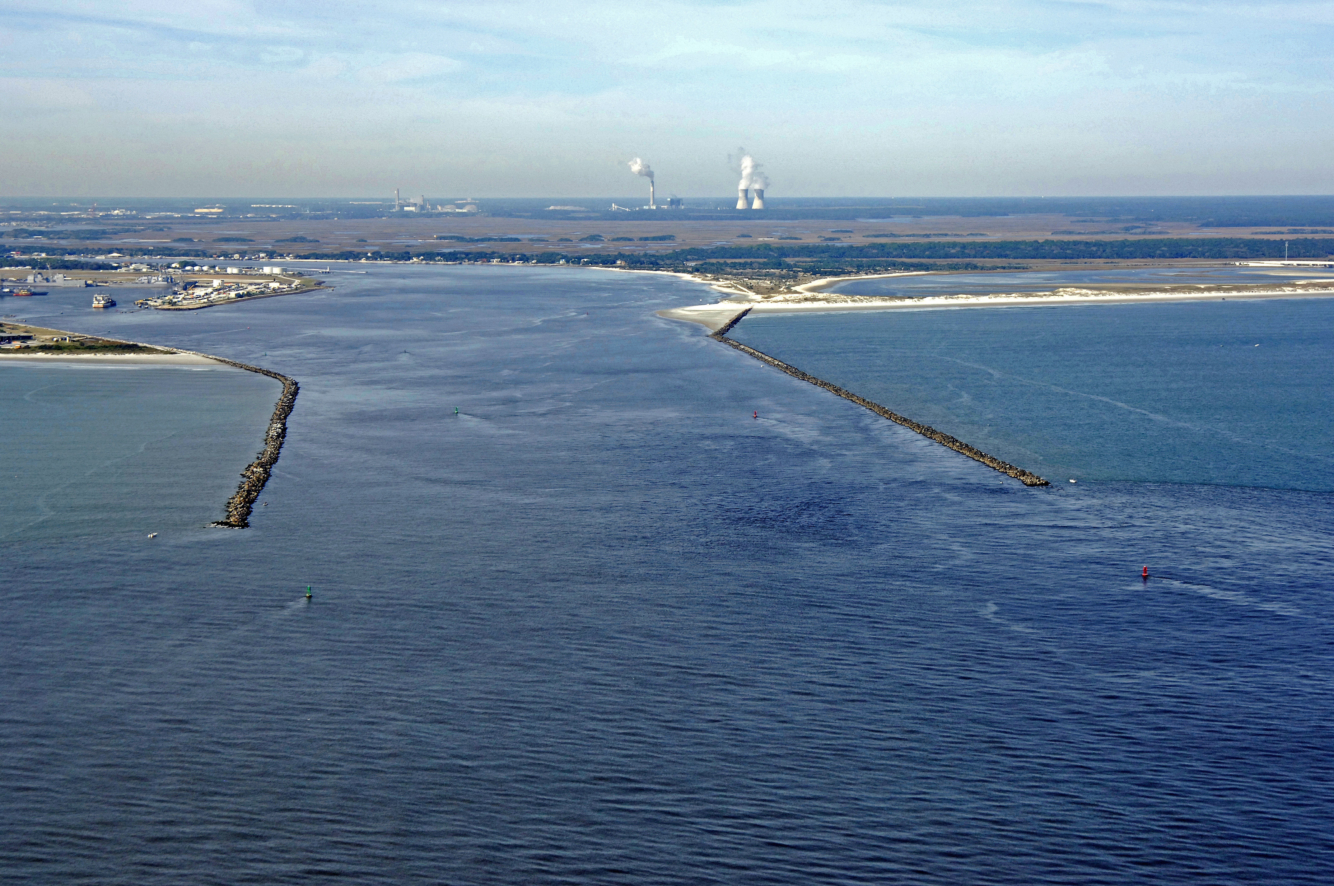
The image above is a view from the east looking west over the jettied entrance to the St. Johns River where it empties into the Atlantic east of Jacksonville. The Mayport Naval Facility if visible to the left of the entrance, while the electric facility near Browns Island can be seen off to the west. The St. Johns River is located 35 miles north of St. Augustine and 20 miles south of the St. Marys River Entrance.
From its confluence the Atlantic Ocean at Mayport, the St. Johns River runs nearly 150 miles south to Harney Lake. Along the way are several towns and interesting places to see. Some cruisers take a month just to explore the whole river. The Intracoastal Waterway runs into the St. Johns River at Sisters Creek, and the picks up again to the southeast at Chicpoit Bay. A quick exploration visit can be had in Jacksonville, which has a lot for the visiting tourist to do, and plenty of marinas with good facilities.
Navigating the Water:
Use NOAA Chart 11490.
The St. Johns River Entrance is approached from the east via the Atlantic Ocean. As a major commercial shipping channel, you must be on the lookout for, and be prepared to give way to, large commercial ships and smaller tugs with long tows. This is especially true at night, when the lights on shore can navigational aids can mask and cloak and approaching ship. Have your VHF handy and if you are equipped with radar, use it religiously. Farther on up the river, the Blount Island facility is also heavy with commercial traffic, as there is a large container unloading facility here.
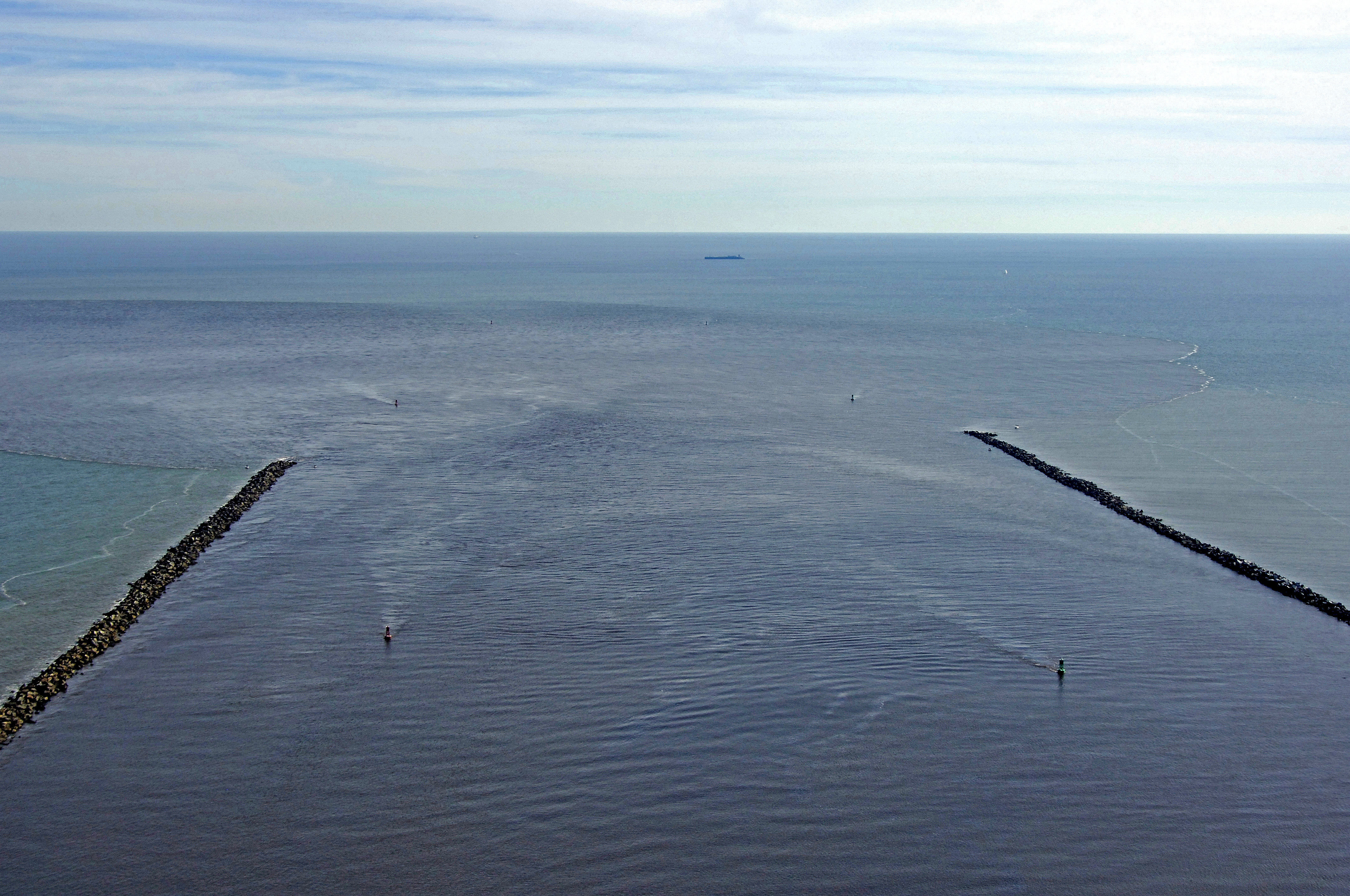
The approach to the St. Johns River starts about 3.3 miles to the east of the jettied entrance at Morse (a) buoy SJ, which is located at an approximate waypoint of N30 23.584 W81 19.134. Once you have picked up Morse (A) buoy SJ, set a course of approximately 282 degrees magnetic for about 2.5 miles to intercept flashing green buoy 3 and flashing red buoy 4 just east of the inlet jetties. The last two buoys before you enter the inlet are flashing green buoy 5 and flashing red buoy 6, which can be seen in the image above. From here, the course is well marked and deep, but not that there is a strong, but not fierce, current running through the entrance.