Sesuit Harbor Inlet
| East Dennis, Massachusetts United States | |
| 41° 45' 29.88'', -70° 9' 15.85'' | |
| Sesuit Harbor |


You might also consider...

About
Introduction:
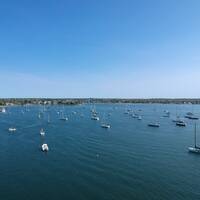
Sesuit Harbor is located on the north shore of Cape Cod about seven miles east of Barnstable Harbor. The harbor is very easy to enter, and the channel to the protected harbor is relatively short. Expect six-foot depths all the way to the end of the harbor.
Sesuit Harbor has excellent facilities (marinas and a yacht club), so this is an excellent point to base your exploration of the surrounding Cape Cod area out of. If you need repairs, there is a full-service repair yard with a lift in the harbor. There are unfortunately no moorings or anchoring in the harbor.
Navigating the Water:
Use NOAA Chart 13246.
From Cape Cod Bay, pick up flashing green buoy "1S," about one mile north of the harbor. From here, set a course for flashing red "2" at the west breakwater of the harbor (green daybeacon "3" marks the east breakwater), and then hed in to the harbor, keeping an eye our for small moored boats at the first turn. The marinas are located at the head of the harbor to the west.
Local Notices to Mariners:
Local Notices to Mariners are available online from the U.S. Coast Guard.