Wychmere Harbor Inlet
| Wychmere, Massachusetts United States | |
| 41° 39' 48.96'', -70° 3' 55.08'' | |
| Wychmere Harbor |


You might also consider...


About
Introduction:
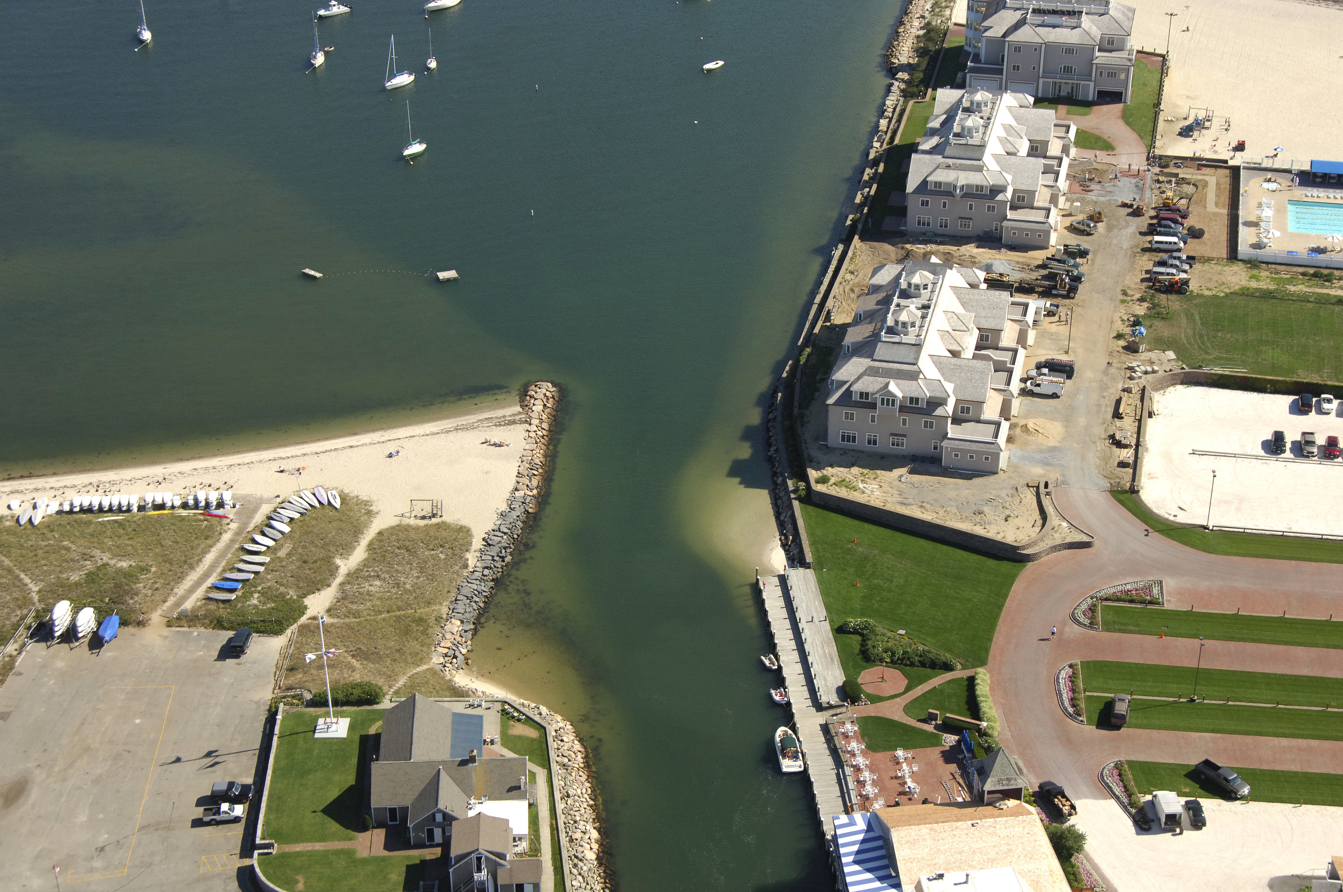
Wychmere Harbor is located on the South Shore of Cape Cod about four miles west of Stage Harbor and seven miles east of South Yartmouth. The image above is a view from the south looking north into the Wychmere Harbor entrance.
Navigating the Water:
Use NOAA Chart 13229.
From Nantucket Sound, first set a course to intercept green can buoy 1, which is about .6 miles south of the Saquatucket Harbor jetties, in the area of waypoint N41 39.398 W70 03.615. Although the outer channel into Saquatucket Harbor is not lighted, you can use flashing green 1 on the Wychmere Harbor jetty to help guide you in toward green nun buoy 1 at night. Wychmere Harbor and its entrance have reported depths of three to seven feet.
Once you have successfully navigated to green can buoy 1, set a course to the north and pick up green can 3 and red nun buoy 2 just a little farther on. From here, red and green nun buoy S will come up on your right, and marks the junction of the Wychmere Harbor and Saquatucket Harbor entrances. From here, bear to port, and then pickup red nun buoy 2 where you will turn north into the harbor.
Local Notices to Mariners:
Local Notices to Mariners are available online from the U.S. Coast Guard.