Southhampton Shoal Lighthouse
| California United States | |
| 38° 2' 9.95'', -121° 29' 42.01'' | |
| Korths Harbor |


About
Introduction:
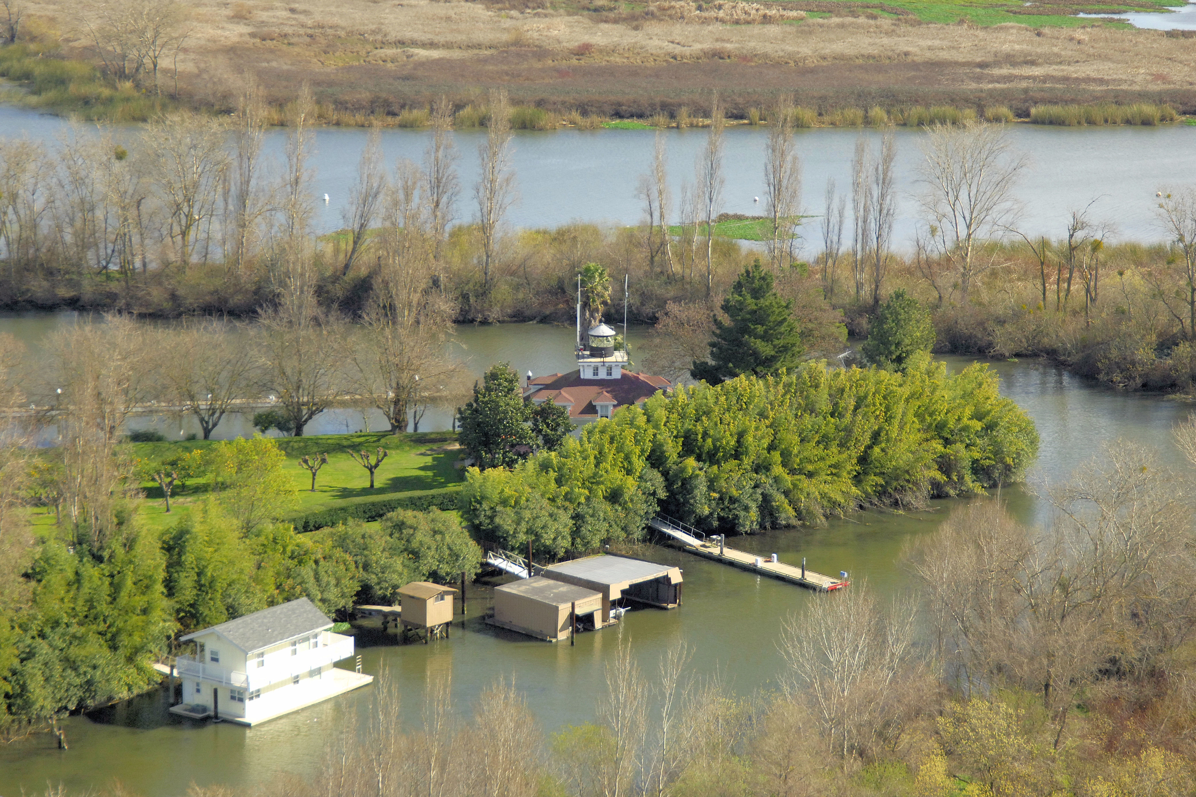
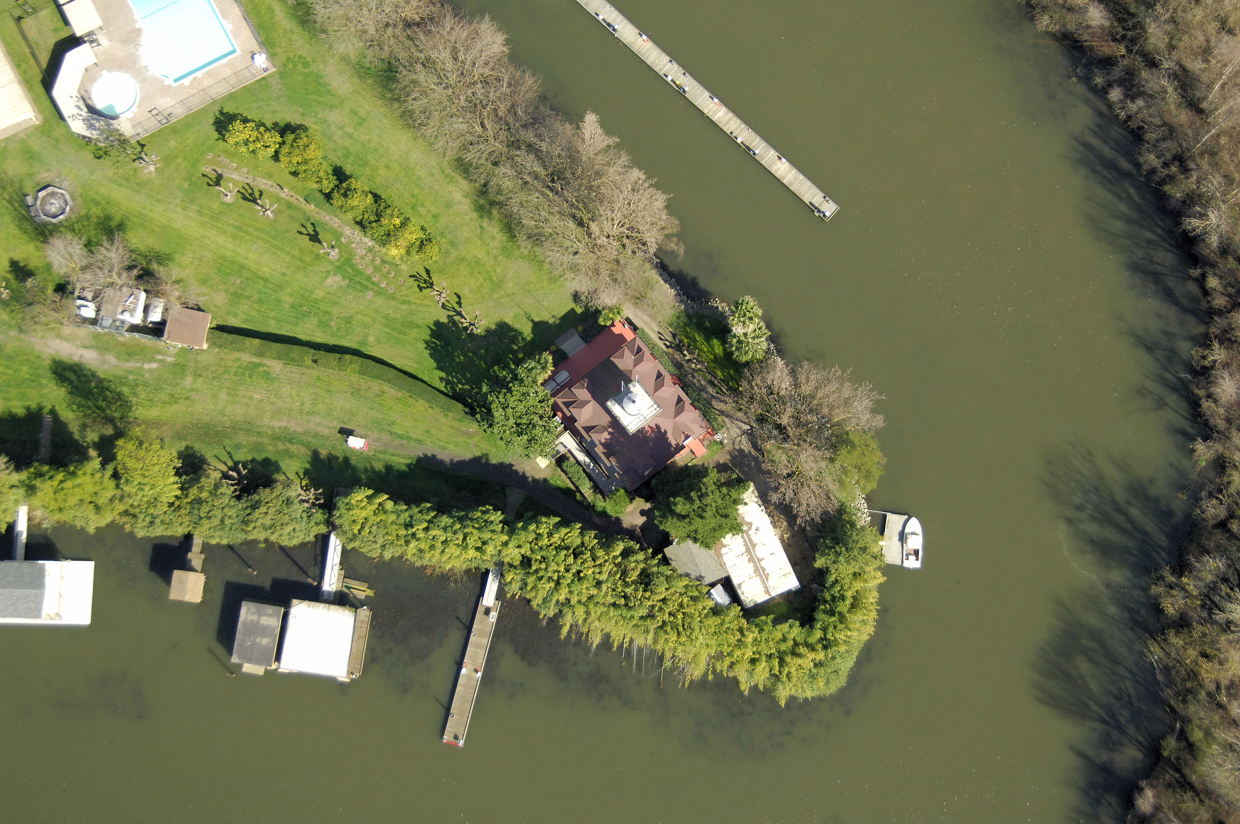
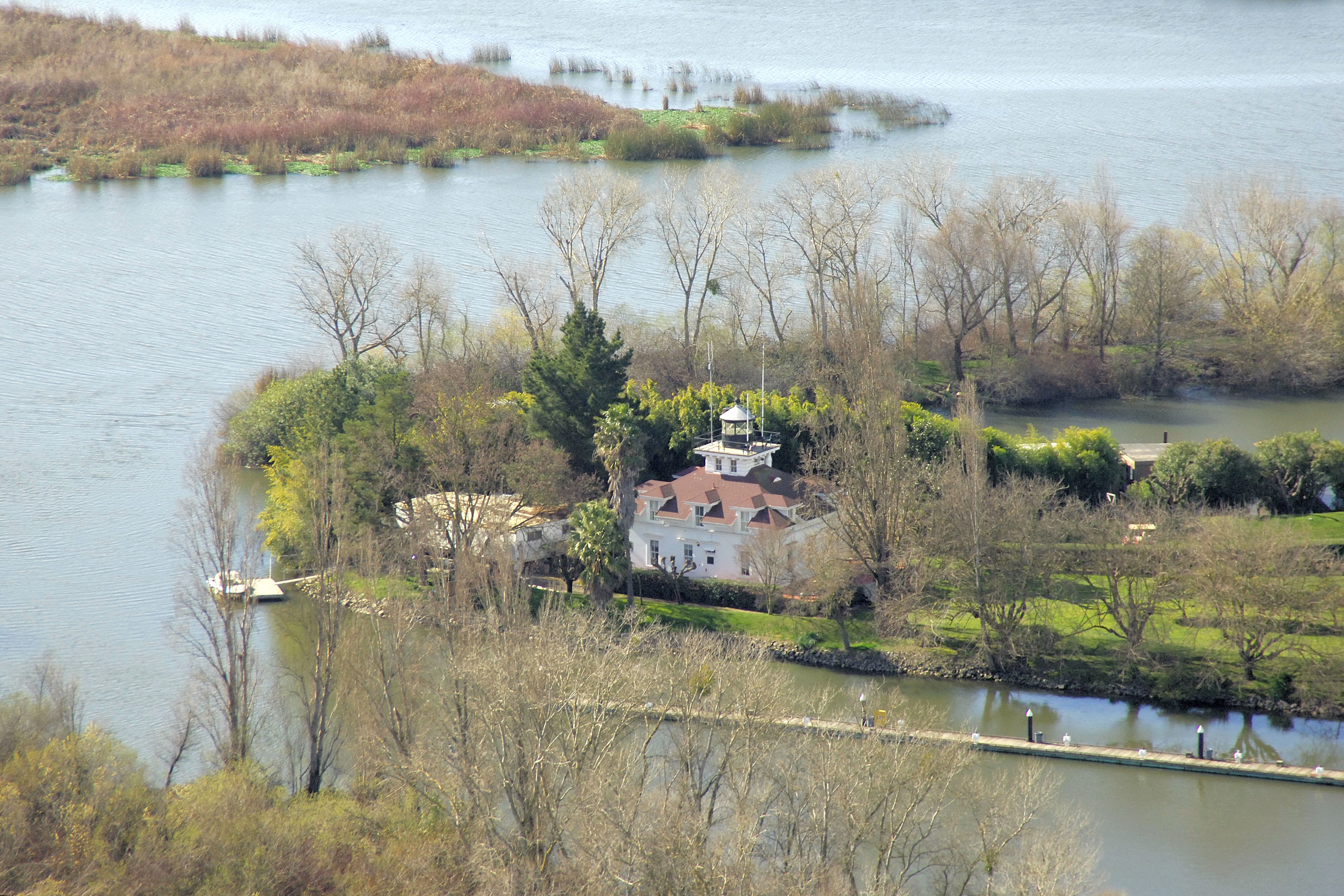
This lighthouse originally stood watch over Southampton Shoal, a two-mile-long hazard along the eastern side of the shipping channel that runs between Berkeley and Angel Island on the west near San Francisco. The lighthouse currently stands on Tinsley Island, far up the San Joaquin River from where it originally stood in San Francisco Bay.
History:
The original lighthouse was installed, as described above, in 1905. Like many other lighthouses, the structure received heavy damage during the 1906 San Francisco Earthquake and required extensive repair. The lighthouse was deemed unnecessary in 1960, and was barged up the San Joaquin River to Tinsley Island, which is owned by the Saint Francis Yacht Club.
Navigating in and Around the Lighthouse:
Use NOAA Chart 18663.
Characteristics: The lighthouse no longer serves any navigational functions.
Local Notices to Mariners:
Local Notices to Mariners are available online from the U.S. Coast Guard.
Tour Schedule:
Tinsley Island is easy to reach by boat, and a dock is available for tie-ups.