Snake Creek Bascule Bridge
| Plantation Key, Florida United States | |
| 24° 57' 9.0'', -80° 35' 15.01'' | |
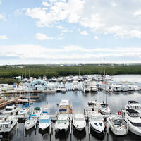
| Islamorada Harbor |


You might also consider...


Details
| Bridge type | Bascule |
| Closed vertical clearance | 27' |
| Schedule | Opens on the hour from 6 AM to 6 PM. Opens on request at all other times. |
About
Introduction:
Located off of the Intracoastal Waterway near Mile Marker 1156, the Snake Creek Bascule Bridge carries state Route 1 (Overseas Highway) traffic over Snake Creek, which allows boating traffic to pass between Plantation and Wind keys.
Navigation:
Use NOAA Chart 11449.
The bridge has a closed vertical clearance of 27 feet with 60 feet of horizontal clearance in the center span.
Snake Creek is one of the more reliable between keys passage along Hawk Channel and the Intracoastal Waterway (ICW). From the ICW, flashing red 12 marks the beginning of the passage to Snake Creek, and from Hawk Channel (Atlantic Ocean side) an unnumbered flashing red light marks the Snake Creek Passage.
Once inside, the creek holds seven- to 11-foot depths, aside from a four-foot-deep shoal near flashing red 12 on the ICW side.
Bridge Schedule:
This bridge opens on a restricted opening schedule. From 8 a.m. to 4 p.m. daily, the bridge opens on the hour and half-hour. The bridge opens on signal at all other times.
Depending on schedule, the bridge can be opened by horn signal (one long, one short) or by hailing the bridge tender on VHF Channel 09. (All bridges in the state of Florida must be hailed on VHF Channel 09.)
Local Notices to Mariners:
Local Notices to Mariners are available online from the U.S. Coast Guard.
Reviews
With a 4.5’ draft and 24’ air draft we squeezed under Snake Creek Bridge at high tide. Tide board showed 24’ but we still had a few feet to spare. All charts show insufficient depth in snake creek, local knowledge said markers were accurate and they were, very well marked, never saw less that 6’ depth at high tide.