Crescent Beach Bascule Bridge
| Crescent Beach, Florida United States | |
| 29° 46' 6.72'', -81° 15' 29.41'' | |
| St. Augustine |


You might also consider...


Details
| Bridge type | Bascule |
| Closed vertical clearance | 25 |
| Vhf | 9 |
| Comments | Opens upon request. |
About
Introduction:
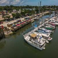
Located at Intracoastal Waterway Mile Marker 788.9, the Crescent Beach Bascule Bridge carries state Route 206 traffic from the mainland at Braddocks Point to the Atlantic Ocean side at Crescent Beach. The bridge is approximately nine miles south of Saint Augustine and six miles north of Matanzas Inlet.
Navigation:
Use NOAA Chart 11485.
The bridge has a closed vertical clearance of 25 feet and 90 feet of horizontal clearance at the center span.
Approaching from the north, flashing green 57 and red daybeacon 8 mark the southward bend in the ICW channel toward the bridge, and from the south, flashing red 64, red daybeacon 62 and red daybeacon 60 line the approach. Depths outside the marked channel are very shallow (one-foot depths), while in-channel depths vary from four to six feet.
Bridge Schedule:
This bridge opens on signal, 24 hours a day, seven days a week.
The bridge can be opened by horn signal (one long, one short) or by hailing the bridge tender on VHF Channel 09. (All bridges in the state of Florida must be hailed on VHF Channel 09.)
Local Notices to Mariners:
Local Notices to Mariners are available online from the U.S. Coast Guard.