Clear Lake Inlet
| Clear Lake, Texas United States | |
| 29° 32' 56.04'', -95° 0' 52.93'' | |
| Clear Lake |


You might also consider...


About
Introduction:
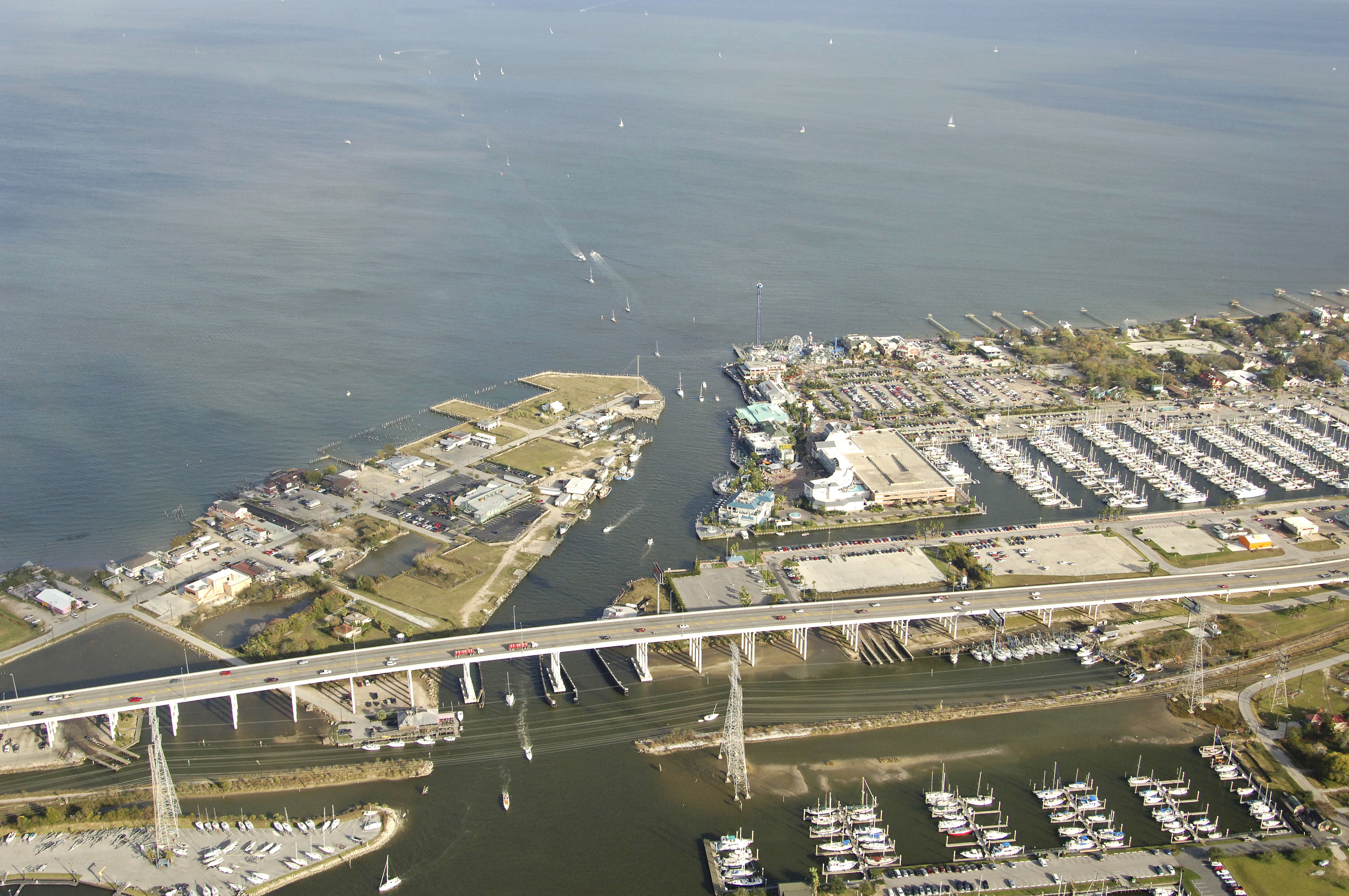
Clear Lake is a large recreational boating area near the Houston City limits that is located on the west side of Galveston Bay about 71 miles west of Sabine Pass and 48 miles northeast of Freeport. Lined with marinas and yachting facilities with plenty to do ashore, Clear Lake has plenty of exploration opportunites for boaters of all interests. The entire length of Clear Lake stretches some six miles from its opening into Galveston Bay southwest all the way to League City.
Technically, Clear Lake is bounded on the north by the town of Seabrook, while Kema lies to the south. The southern shore of Clear Lake has the heaviest collection of marinas and yachting facilities, especially in the Clear Creek area around the high fixed bridge near Clear Lakes entrance. Within a short distance to all the marinas, cruisers can find an assortment of excellent restaurants, grocery stores and markets, drug stores and all other manner of facilities. If you are in need of something specific, check with your marina for details.
Navigating the Water:
The approach to the Clear Lake Inlet is from the east via Galveston Bay. First, set a course to intercept the area near waypoint 29 33.227N 94 58.903W. Once you have arrived near the waypoint, set a course of about 261 degrees magnetic for about a mile to pick up green daybeacon 1 and flashing red 2 at the approach channel to Clear Lake. Once you have picked up green daybeacon 1 and flashing red 2, work your way down the channel past flashing red 4, green daybeacon 5, flashing red 6, green daybeacon 7, and finally quick flashing red 8 at the cut into Clear Lake. Depths along the entrance range from 10 to 12 feet.
Inside, you will first see the Kemah Boardwalk Marina to port, just before a high fixed that bridge crosses Clear Creek with a vertical clearance of 73 feet. After you pass the fixed bridge, you are technically in Clear Creek and the Portofino Marina will appear to port and the large island housing the extensive Seabrook Shipyard shows up to starboard. Several other marinas doth the shoreline of Clear Lake. For details on facilities, amenities, or to make a reservation, see our detailed marina listings for the area.
Local Notices to Mariners:
See our Local Notices to Mariners blog for updates on the latest conditions and advisories for this area.