Longboat Pass Inlet
| Sarasota, Florida United States | |
| 27° 26' 33.0'', -82° 41' 30.13'' | |
| Bradenton Beach |


You might also consider...


About
Introduction:
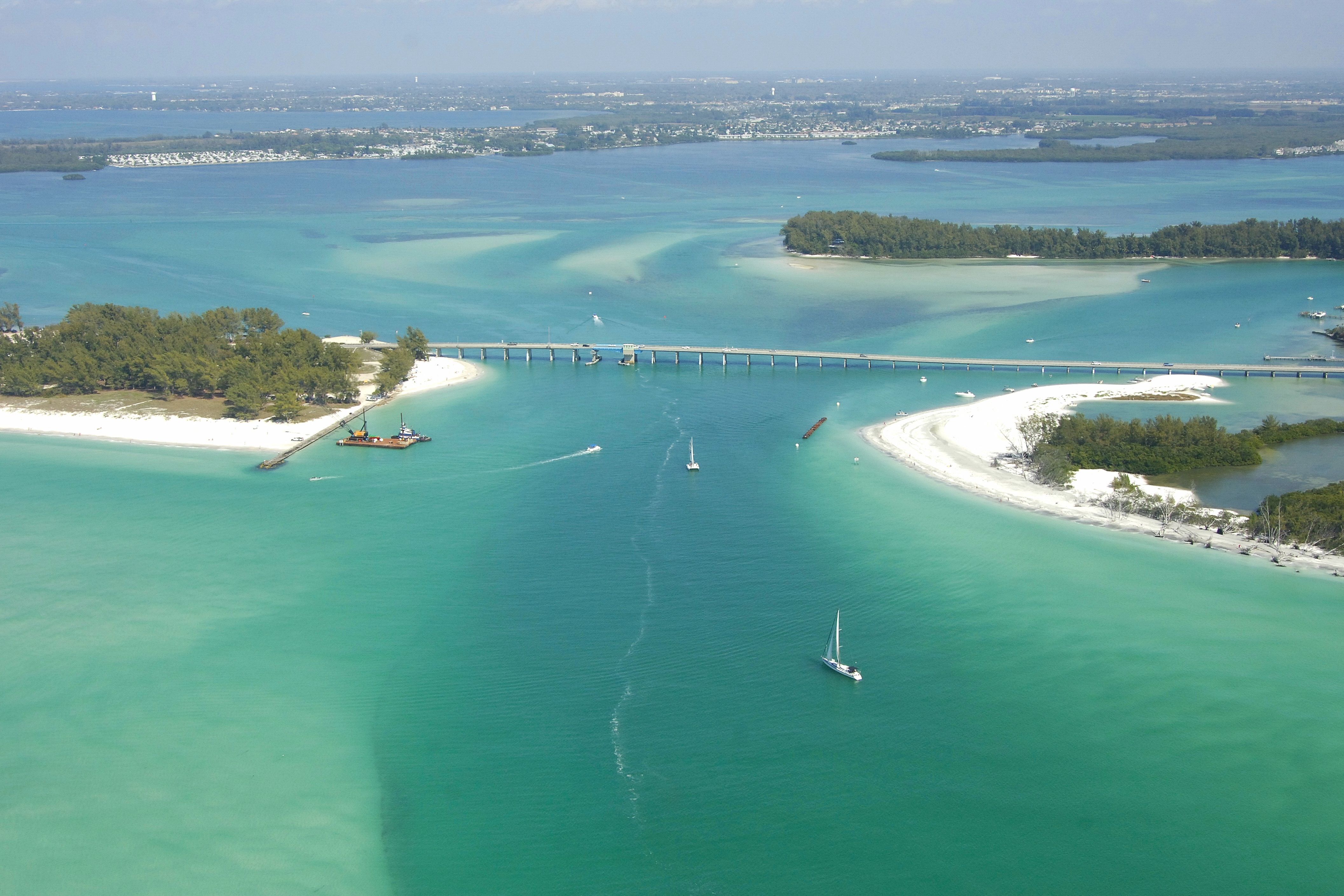
Located about nine miles southwest of Bradenton and 21 miles south of St. Petersburg, Longboat Pass provides a reliable, albeit shallow, entrance to Anna Marina Sound (at Gulf Intracoastal Waterway Mile 85) from the Gulf of Mexico.
The image above is a view from the west looking east over Longboat Pass and the Longboat Pass Bascule Bridge (17-foot closed vertical clearance, restricted opening schedule). Long Beach works in on the right (south) side of the inlet, while Bradenton Beach can be seen on the left (north) side of the inlet. The Gulf Intracoastal Waterway runs behind the spoil island in the upper right-hand portion of the image.
Navigating the Water:
Use NOAA Chart 11425.
The primary obstacle to navigation on Longboat Pass is the Longboat Pass Bascule Bridge, which has a closed vertical clearance of 17 feet. The Federal Register notes new restrictions in place/being studied, so you should call well in advance of arriving in the area in case you have to divert to New Pass (9.5 miles south) or the Tampa Bay Inlet (9.5 miles to the north).
To approach the inlet, first set a course to intercept the area around waypoint N27 25.971 W82 42.010, which is where Morse (A) light LP is located. Once you have picked up the Morse (A) light, set a course of approximately 008 degrees magnetic until you reach green daybeacon 1, which marks a five-foot-deep shoal just west of the inlet. At green daybeacon 1, set another course, this time approximately 041 degrees magnetic for .4 mile, which will bring you to red daybeacon 2 and green daybeacon 3.
From here you can head into Longboat Pass, assuming you have sorted out an opening schedule for the bridge. If you have to wait for an opening, you may want to time your approach to avoid waiting in the channel when the current is running, especially on an incoming tide.
Local Notices to Mariners:
Local Notices to Mariners are available online from the U.S. Coast Guard.