Bowlees Creek Inlet


You might also consider...

About
Introduction:
Bowlees Creek is located on the far northeastern corner of Sarasota Bay about two miles west of Gulf Intracoastal Waterway Mile Marker 80. Only seven miles north of Sarasota-proper, the area makes a peaceful and quiet stopover point for cruisers staging their further passages north across Tampa Bay to St. Pete Beach or across Sarasota Bay to points south. =
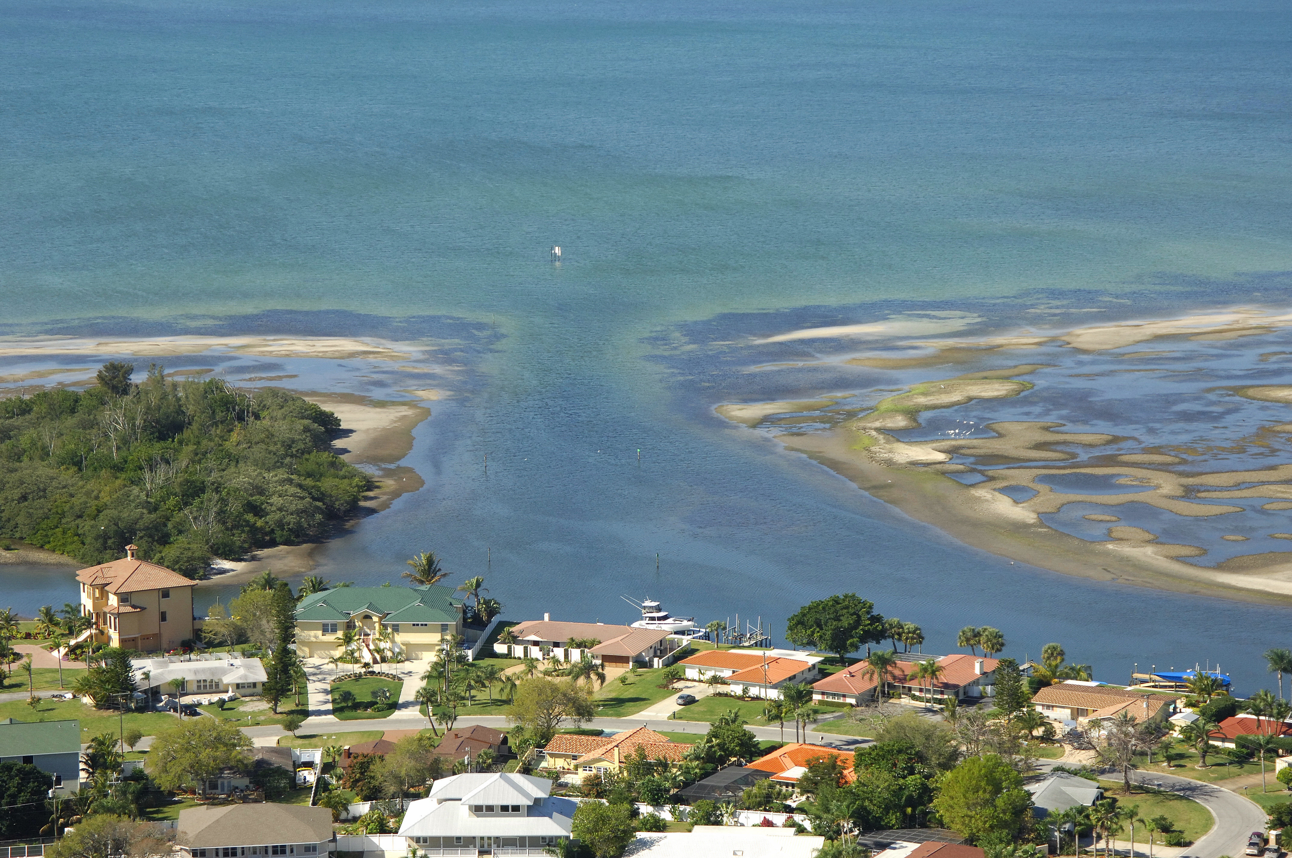
The image above is a view into Bowlees Creek from the south looking north over the creek entrance. Around the turns in the creek to the port and starboard is a collection of four marinas with varying levels of service. Off to port shortly after entry south of the West 14th Street Bridge are Bowlees Creek Marina and Boathouse on Longboat Key. Only Bowless Creek marina takes transient slips; the other facility is private.
Off to starboard farther back in the image above is the Holiday Inn Airport Marina (the Sarasota Bradenton Airport is nearby). Here you can find gas and diesel fuel, transient slips, laundry, pool and restrooms/showers.
Navigating the Water:
Use NOAA Chart 11425.
From the Gulf Intracoastal Waterway at red daybeacon 16. set a course of 41 degrees for about 1.5 miles to intercept red daybeacon 2 near the mouth of Bowlees Creek. From here, follow in green daybeacon 3, green daybeacon 5, red daybeacon 6, and then red daybeacon 8 into the creek and past the bend to port on entry. Follow the channel farther back to reach the aforementioned marinas.
Depths in the approach channel and Bowlees Creek itself average around five feet, though you will want to keep an eye on your depth sounder often, especially in the approach channel, as conditions can change.
Local Notices to Mariners:
Local Notices to Mariners are available online from the U.S. Coast Guard.