Manatee Pocket Inlet
| Port Salerno, Florida United States | |
| 27° 9' 46.08'', -80° 11' 31.92'' | |
| Manatee Pocket |


You might also consider...


About
Introduction:
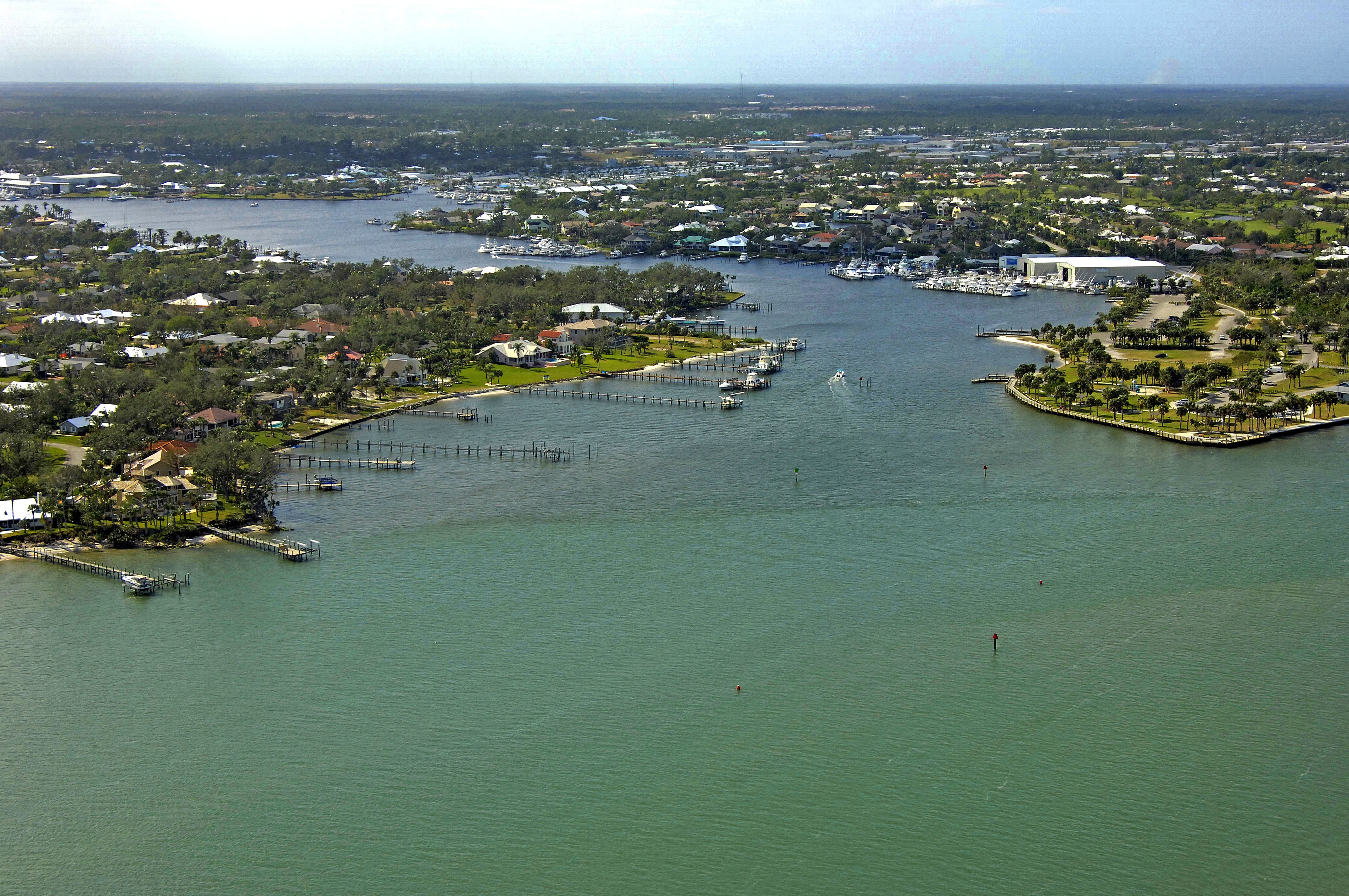
The image above is a view from the northeast looking southwest over Manatee Pocket and the town of Port Salerno. The entrance channel is clearly visible, starting with a mix of red daybeacons and red nuns, and then moving on to green daybeacon 1, and red daybeacon 2, which mark the official entrance into the area.
Just inside Manatee Pocket to starboard are the Sailfish Marina and Finest Kind Marina, the latter of which accepts transient guests (especially convenient to the Intracoastal Waterway for cruisers making a pit stop). Farther on are the Mariner Cay and Pirates Cove marinas, which have transient facilities as well. Hinckley Yacht services maintains a yard here with a lift for haul-outs and related repairs (a whopping 150-ton lift, by the way).
Anchorage is available up the creek, as long as you keep out of the main channel. Port Salerno has some excellent provisioning opportunities with a grocery store, drug store, liquor store and other specialty shops near the waterfront.
Navigating the Water:
Use NOAA Chart 11428.
To reach Manatee Pocket from the Intracoastal Waterway, you start out by picking up red daybeacon 2, which is located at the official beginning of the Okeechobee Waterway at Mile 0. Once you have picked up the red daybeacon, head farther west to intercept green nun buoy 3 red nun buoy 4, green nun 3A, green daybeacon 5, and then green daybeacon 1 and red daybeacon 2 at the entrance to Manatee Pocket.
Depths along the approach range from seven to nine feet, but be sure to careful honor all the marks, as depths can shoal quickly outside the marked channel. Once inside Manatee Pocket, you will find depths of four to six feet and little current once you are out of the St. Lucie River channel.
Local Notices to Mariners:
Local Notices to Mariners are available online from the U.S. Coast Guard.