Cuttyhunk Pond Inlet
| Cuttyhunk, Massachusetts United States | |
| 41° 25' 30.0'', -70° 55' 0.13'' | |
| Cuttyhunk Harbor |
You might also consider...


About
Introduction:
Cuttyhunk Island is located 12 miles south of New Bedford, MA, and is part of the Town of Gosnold. Cuttyhunk is a popular spot with boaters who wish to take a break from the active and often hectic pace of some of the other islands in the area. There are no night clubs, late night restaurants or traffic, but there is an idyllic calm that settles over the place every day at sunset that has to be experienced to be enjoyed.
There is excellent fishing here, too and there are a couple of charter operators that will gladly show you the local waters and gamefish that lurk beneath.
Navigating the Water:
Use NOAA Charts 13230 and 13229.
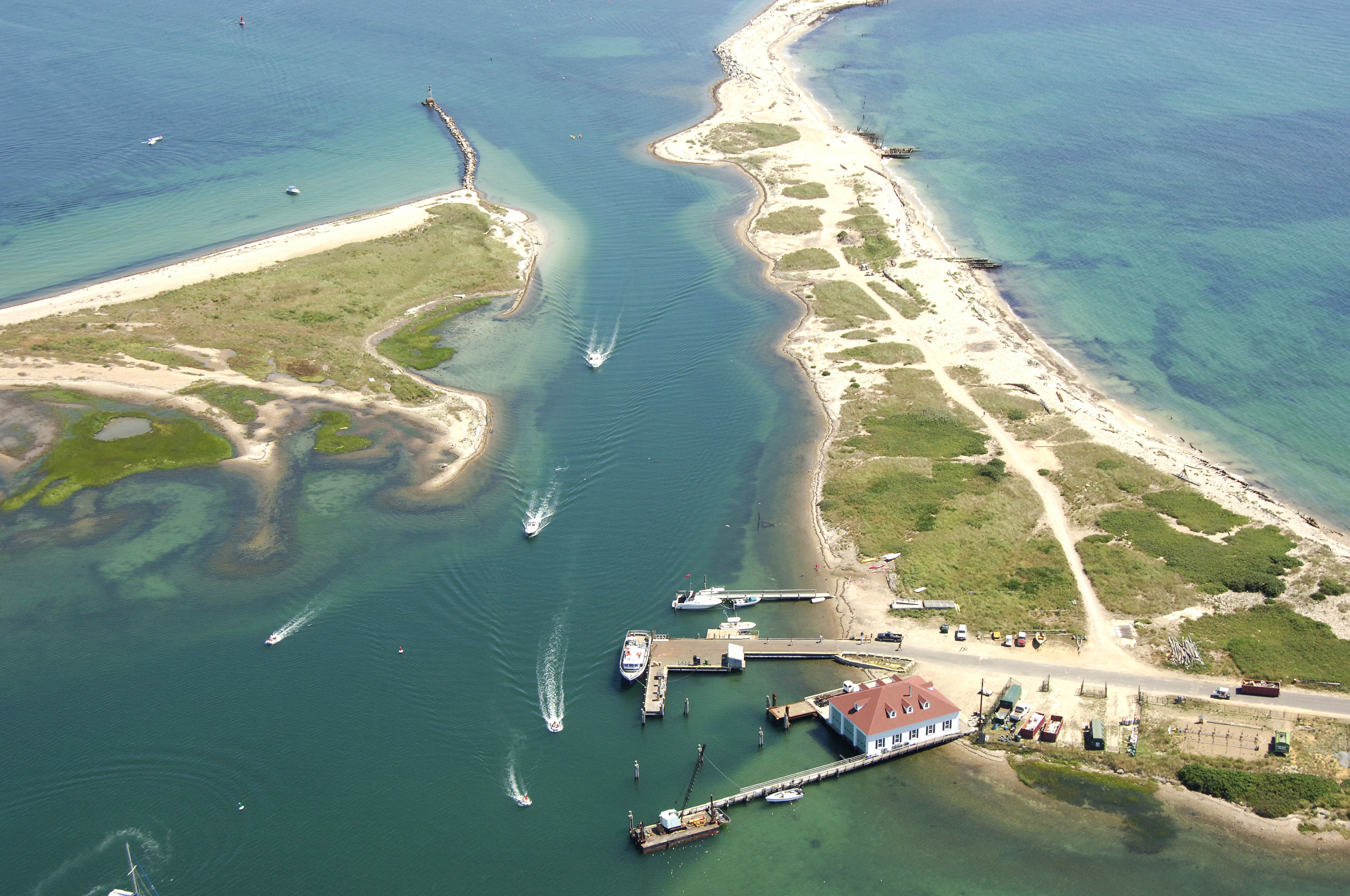
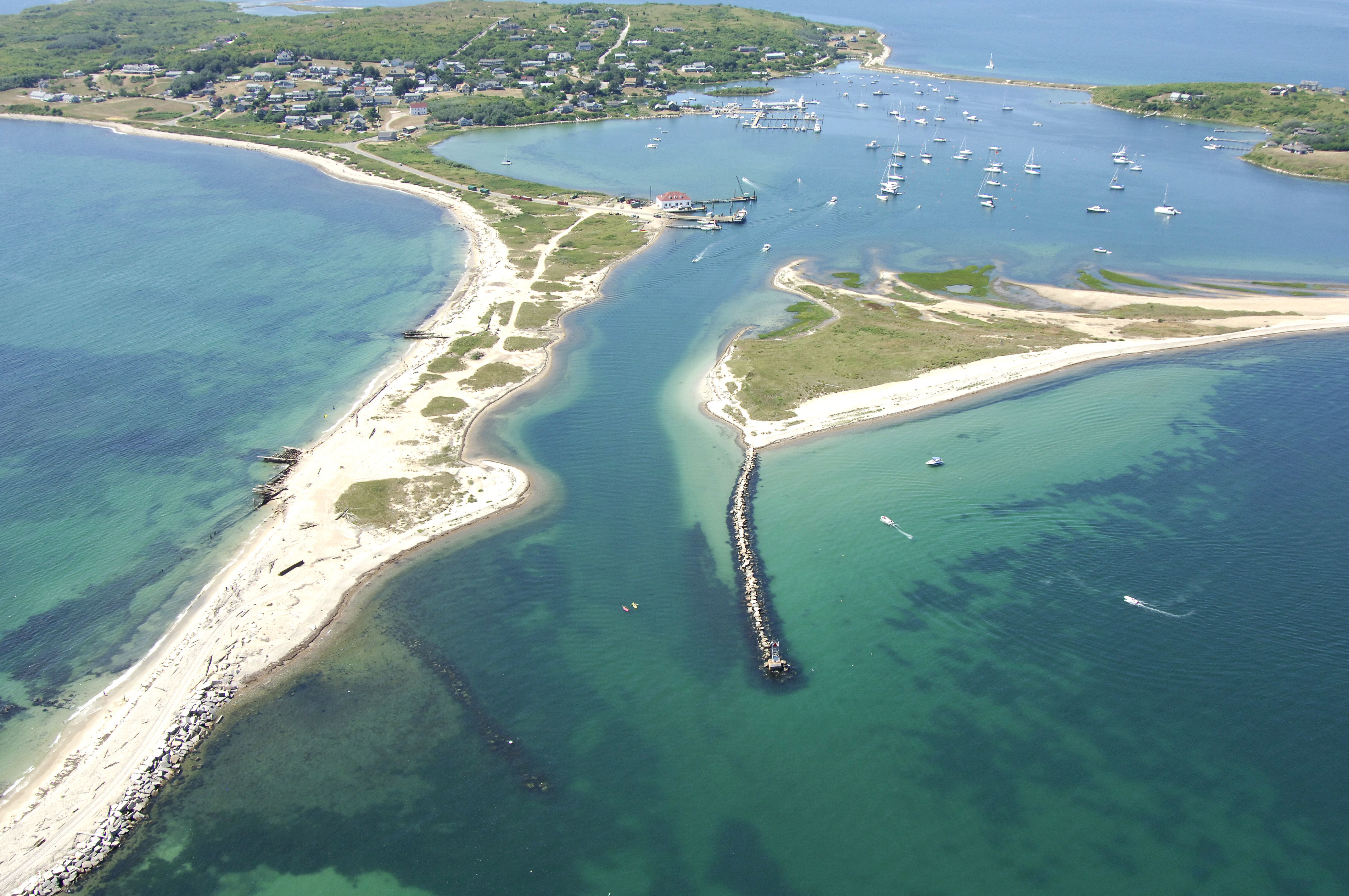
There are three passages that allow access to Cuttyhunk Pond: two from the north at Buzzards Bay, and one from the south through Canapitsit Channel. We will discuss the main entry into Cuttyhunk north of Nashawena Island.
The main entrance into Cuttyhunk is marked with red and white Morse (A) buoy "CH," which is located due north of Nashawena Island. Once you have picked up the red and white Morse (A) buoy, proceed westward to red nun "2E" and green can "1E" farther in towards Cuttyhunk Harbor. After you are well clear of Know Point on Nashawena Island, make a gradual southwest turn to green can "9" and red bell buoy "6" on the far side of Cuttyhunk Harbor. These are the initial buoys for Cuttyhunk Pond.
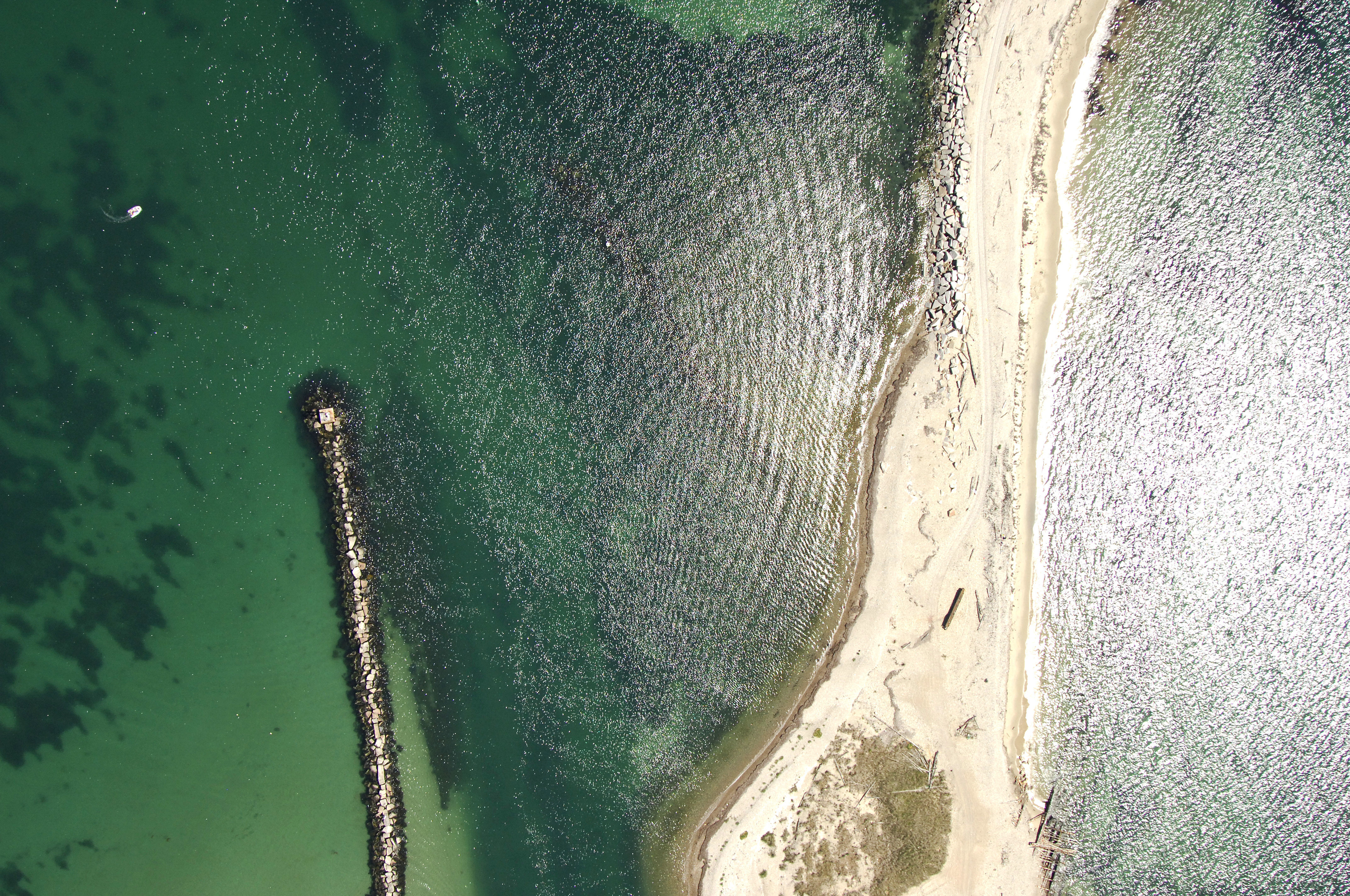
The narrow channel into Cuttyhunk Pond is dredged to a depth of nine feet and is quite reliable. Flashing red "8" is the only lighted aid into Cuttyhunk Pond and marks the north breakwall. (the north and south breakwalls are visible in the image above - the south breakwall is mostly submerged. Inside Cuttyhunk Pond is a large anchorage and mooring field along with two marinas.
Local Notices to Mariners:
Local Notices to Mariners are available online from the U.S. Coast Guard.