Kill Van Kull River East Inlet
| Staten Island, New York United States | |
| 40° 39' 6.84'', -74° 5' 6.0'' | |
| New York Harbor |


You might also consider...


About
Introduction:
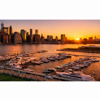
The Kill Van Kull Inlet is located off New York Citys Upper Bay west of the Anchorage Channel and south of Constable Hook. While many mariners do not enter or explore this area, there are marinas and facilities about three miles to the west of the eastern entrance that have transient slips available.
Navigating the Water:
Use NOAA Chart 12327.
From the Anchorage Channel on New York Citys Upper Bay about three miles north of the Verrazano Narrows Bridge, pick up flashing red and green RACON buoy KV, which is located right off the Kill van Kull entrance northeast of New Brighton. Once you have cleared the entrance buoy, you can head west into the river, making sure to honor all the well-placed aids to navigation while keeping an eye out for commercial traffic, which can be heavy here.
About three miles west of the eastern Kill van Kull entrance is the opening to Newark Bay, where you can find a couple of good marinas directly across from the Port Elizabeth Marine Terminal. There are transient facilities here, but unfortunately no facilities for haul-out or related services.
Local Notices to Mariners:
Local Notices to Mariners are available online from the U.S. Coast Guard.