Wildwood Canal Inlet
| West Wildwood, New Jersey United States | |
| 39° 0' 7.92'', -74° 49' 21.01'' | |
| North Wildwood |


You might also consider...


About
Introduction:
The Wildwood Canal, and connecting Post Creek and Ottens Harbor areas make up the second largest concentration of marinas and marine facilities in the Wildwood area. The first is near Ephraim Island a little farther south. Here you can access the facilities in Post Creek, or if you can clear under a five-foot fixed vertical clearance bridge, head north into the Wildwood Canal. The other entrance to the Wildwood Canal is at Grassy Sound, but you must draw less then three feet to clear it.
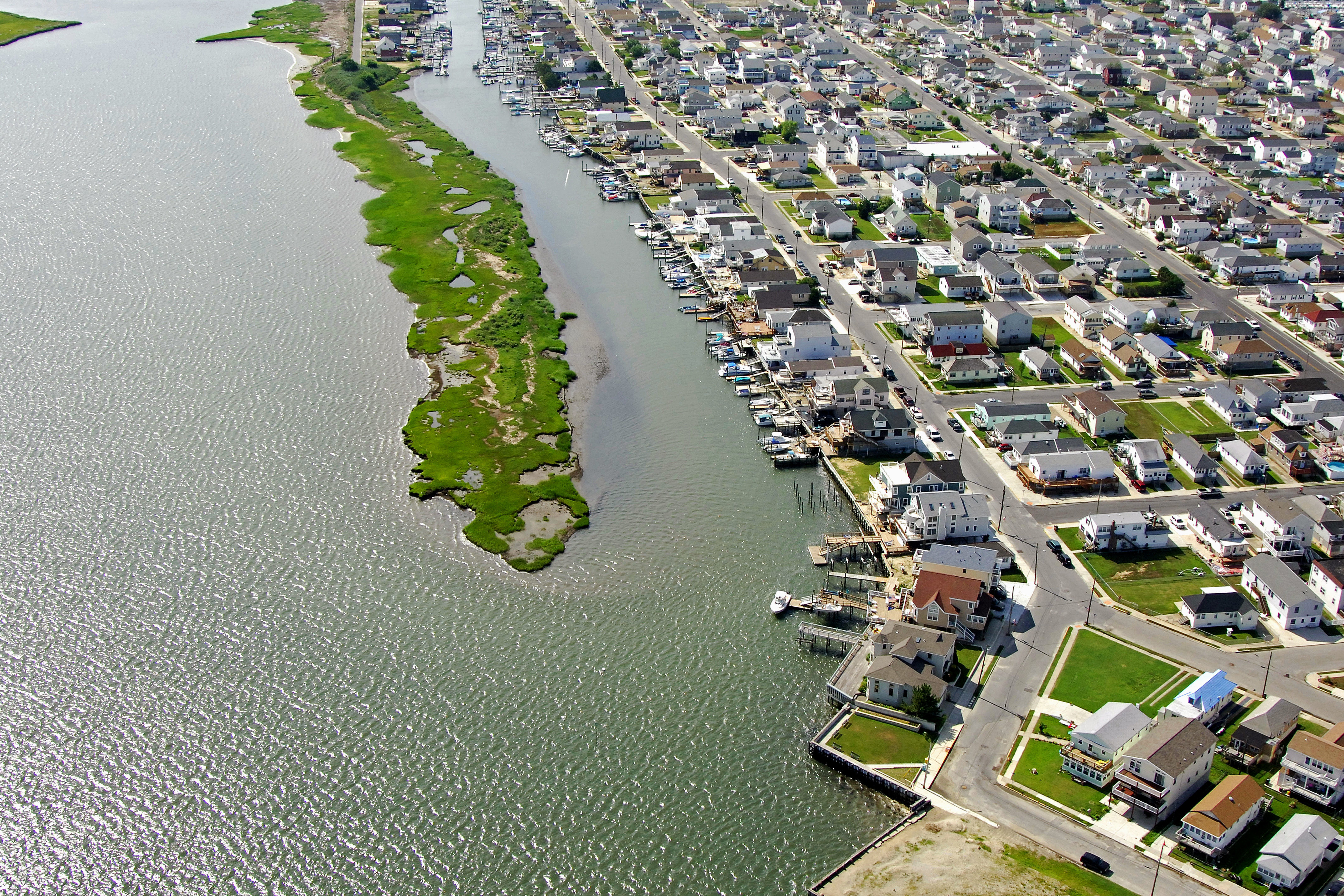
The image above is a view from the west looking east over the Wildwood Canal where it empties into Grassy Sound at the town West Wildwood. In the top portion of the image, the New Jersey Intracoastal Waterway (NJICW) route can be seen running through the old disassembled railroad bascule bridge where Grassy Sound Channel turns into Grassy Sound. The NJICW continues on to the right, heading northward toward North Wildwood and the Hereford Inlet.
Navigating the Water:
Use NOAA Chart 12316.
Keep in mind that the navigation instructions here describe an approach to the Wildwood Canal from the south at the Grassy Sound Channel and Post Creek. While this approach is deeper then the one at Grassy Sound, a five-foot fixed vertical clearance bridge limits travel into the canal. The image about is a view of the Wildwood Canal where it empties into Grassy Sound near red daybeacon 452. This entrance is shoal (two-foot depths) and should only be attempted in small craft with local knowledge and a shoal draft.
Keep in mind that the approach from the south through Post Creek into the Wildwood Canal is limited by a five-foot fixed vertical clearance bridge. As you are approaching from the south past Ephraim Island, you will first need to clear the 25-foot closed vertical clearance bascule bridge that crosses the route just south of Ottens Harbor. The last report from the Coast Guard indicated that this bridge opens on signal. Past the bridge, you will exit the NJICW route at flashing green 463, which is located at the mouth to Post Creek.
Farther up Post Creek, a fixed 5-foot bridge limits entry for moat boats into the Wildwood Canal, but south of the bridge, there are plenty of marine and marina facilities, and at least one caters to transient guests.
Local Notices to Mariners:
Local Notices to Mariners are available online from the U.S. Coast Guard.