Canapitsit Channel Inlet
| Cuttyhunk, Massachusetts United States | |
| 41° 25' 15.96'', -70° 54' 21.95'' | |
| Cuttyhunk Harbor |


You might also consider...

About
Introduction:
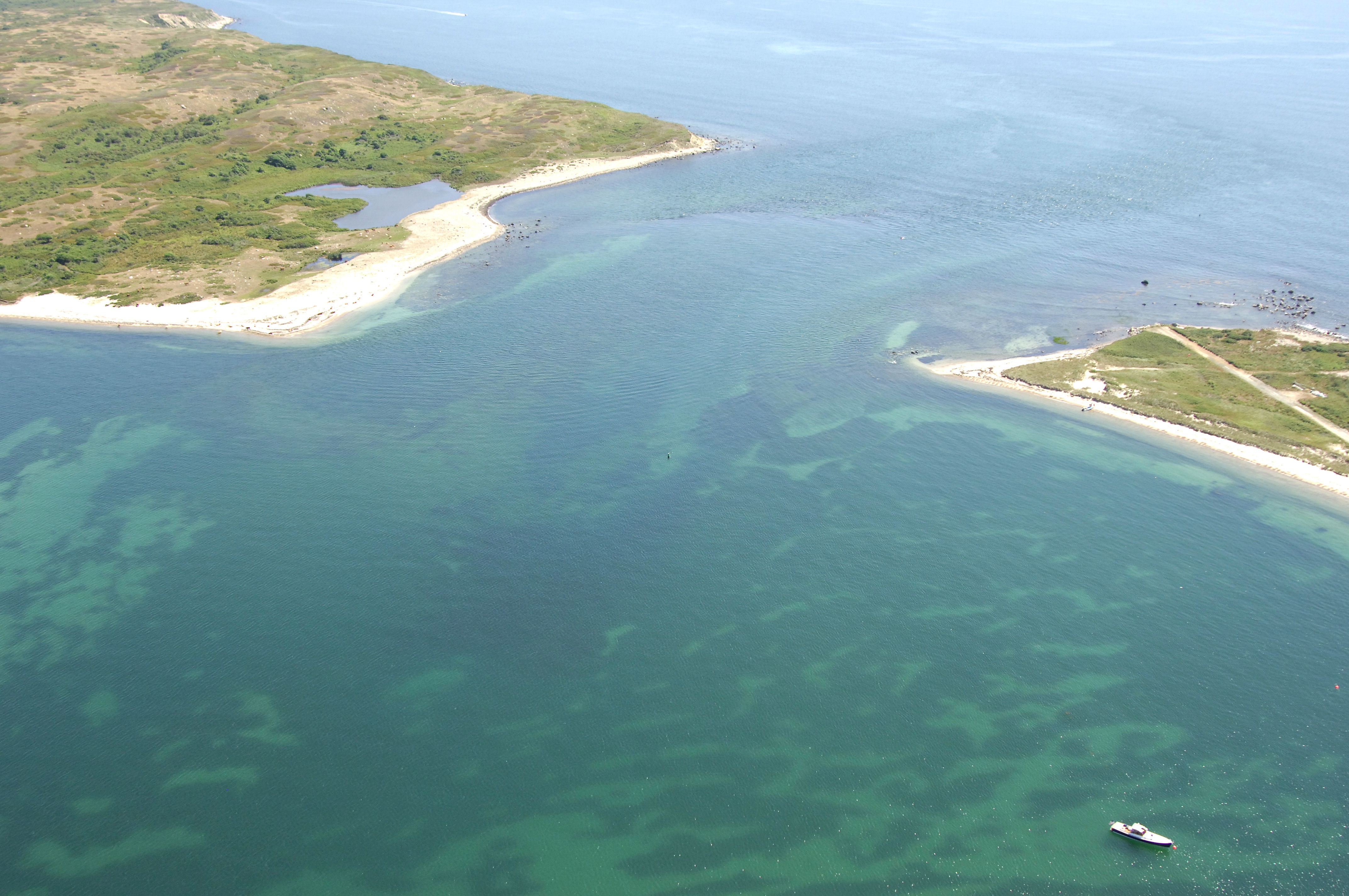
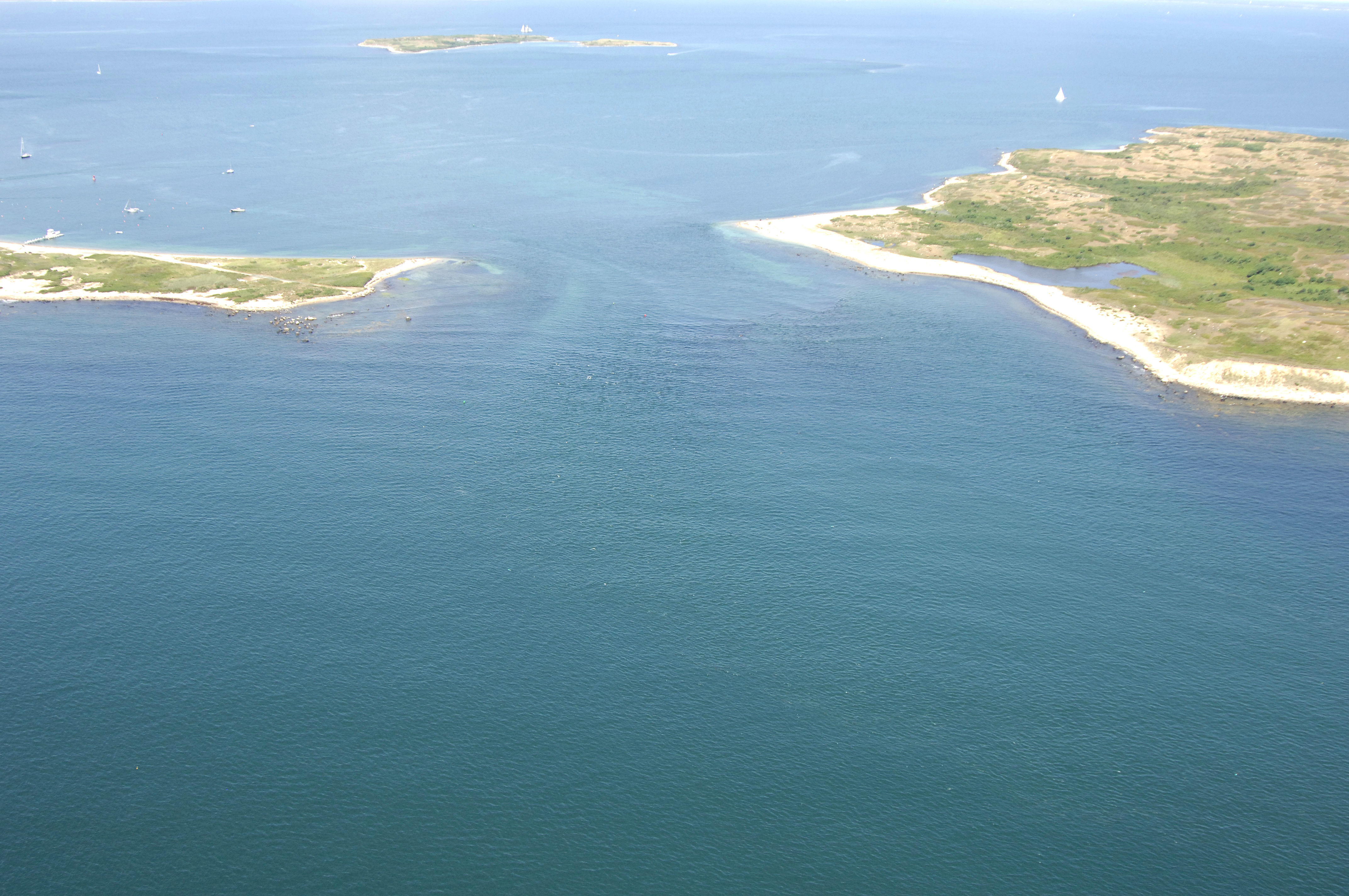
The image above is a view from the south-southeast looking north-northwest over the Canapitsit Channel. To the left (west) is the eastern tip of Cuttyhunk Island, while to the right (east) is the western end of Nashawena Island. In the upper portion of the image is Penikese Island, which is about two miles north-northwest of the Canapitsit Channel. Just around the corner to the left is the entrance to Cuttyhunk Pond and a turn toward the right (northeast) out of the channel leads to Buzzards Bay via Cuttyhunk Harbor.
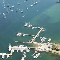
Cuttyhunk Pond has a good set of marinas (three), and the are moorings inside and outside of Cuttyhunk Pond. You will not want to use the outside moorings if the wind is strong out of the northeast or west.
Navigating the Water:
Use NOAA Chart 13229.
The Canapitsit Channel can be reached via Vineyard Sound from the south or Buzzards Bay and Cuttyhunk Harbor to the north and northeast. Depths inside the Canapitsit Channel range from seven to 11 feet; proceed accordingly depending on your draft. Currents in the area are fairly swift (up to three or four knots), so you may want to try and time your transit with a fair tide if possible (more important for auxiliary sailboats and underpowered vessels).
[b]Vineyard Sound Approach:[/b]
From Vineyard Sound, first set a course to red and white bell buoy CC, which is located near waypoint N41 25.015 W70 54.389. Once you have safely picked up red and white buoy CC, set an approximate course of 009 degrees magnetic for .2 mile to intercept green can buoy 1 on the south side of the channel. From here, change your course to about 021 degrees magnetic for .2 mile. You will find red nun buoy 2 and green can buoy 3 at this location. There is a small six-foot-deep shoal just south of red nun boy 2; keep an eye out for it. Past red nun buoy 2 and green can buoy 3, head off to the northwest a bit (the channel bends little east then northwest) and you will eventually come to green can buoy 5, which will lead you into Cuttyhunk Harbor.
[b]Buzzards Bay/Cuttyhunk Harbor Approach:[/b]
Coming south from Buzzards Bay, you can go around Penikese Island to the west or east. The eastern approach is the official channel, but there is also a marked channel to the west. Use either one to suit the shortest distance for your course. We will discuss the eastern entrance here.
Red and white Morse (A) buoy CH is located at an approximate waypoint of N41 26.568 W70 53.375. Once you have safely reached red and white Morse (A) buoy CH, set a course to the west for about .7 mile where you will find green can buoy 1E and red nun buoy 2E north of Knox Point. Clear of these buoys, set an approximate course of 225 degrees magnetic for about .9 mile until you are in the area of the northern side of the Canapitsit Channel. There is a shoal extending north from the east side of the channel that you will need to mind. Green can buoy 5 marks the entrance into the channel and will lead you south through the series of buoys described above (in reverse to get to Vineyard Sound.
Local Notices to Mariners:
Local Notices to Mariners are available online from the U.S. Coast Guard.