Wilmington River Inlet
| Priest Landing, Georgia United States | |
| 31° 56' 22.92'', -80° 58' 37.93'' | |
| Thunderbolt |


About
Introduction:
The Wilmington River leads northwest from Wassaw Sound to intersect the Intracoastal Waterway near ICW Mile 585. Though not particularly useful on its own as a waterway, the Wilmington River does allow boaters arriving from the Atlantic via Wassaw Sound a deep and well marked route to the Intracoastal Waterway.
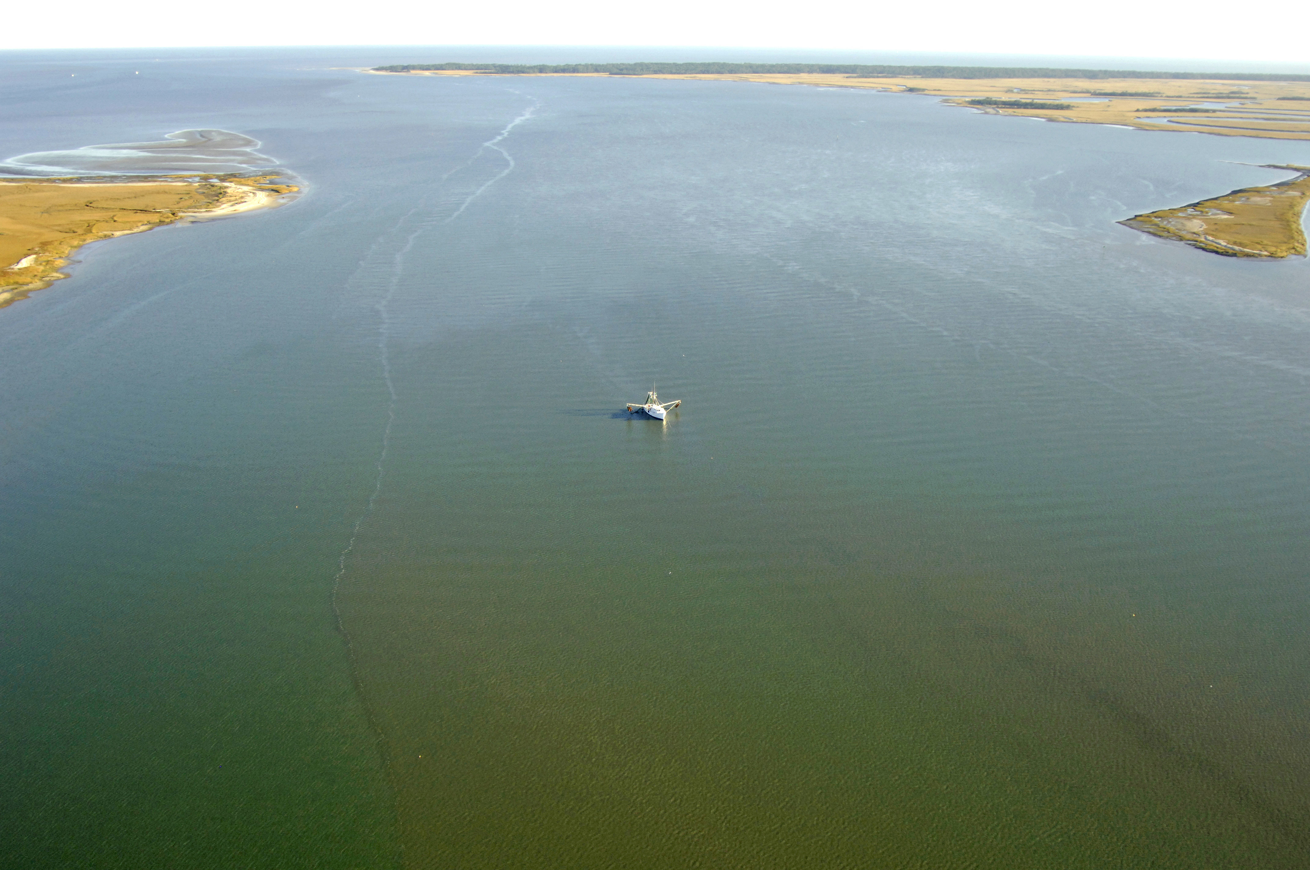
The image above is a view from the east looking west over the Wilmington River where it empties into Wassaw Sound. To the right (north) is Cabbage Island and a small creek called Tybee Cut, while Sister Island and Joes Cut can be seen to the left (south) as a small sliver of land with a tiny creek behind.
Navigating the Water:
Use NOAA Charts 11511 and 11512.
From Wassaw Sound north of Wassaw Island, first pick up flashing red 16, which is located in the area of waypoint N31 55.147N 80 56.731W. Once you have successfully located flashing red 16, set a course to the northwest and follow flashing green 17 (mind a shoal to the south), flashing green 19, and then red daybeacon 20 into the Wilmington River at Cabbage Island.
To reach the Intracoastal Waterway, simply proceed to the northwest until you meet flashing green 29 at the Skidaway River.
Local Notices to Mariners:
Local Notices to Mariners are available online from the U.S. Coast Guard.