Popponsett Bay Inlet
| Popponsett Island, Massachusetts United States | |
| 41° 35' 12.84'', -70° 27' 12.95'' | |
| Osterville Harbor |


You might also consider...


About
Introduction:
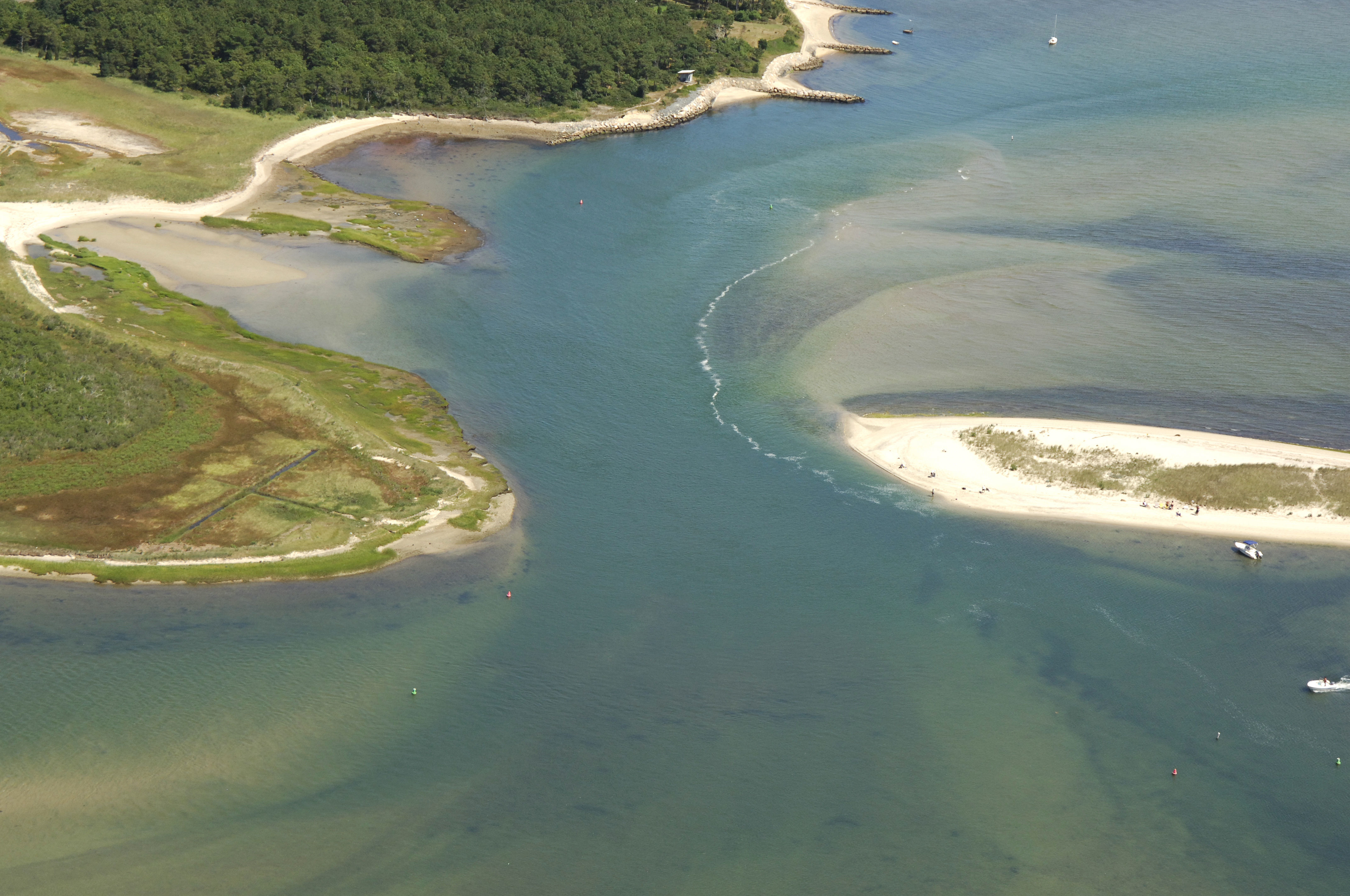
Poponsett Bay is better suited to dinghy exploration, but some very shallow draft boats do squeeze their way up into the bay. Reported depths are one foot in many portions of the inlet and bay. The entrance is almost completely shoaled over, but as can be seen in the image above, a string of privately placed aids marks what is supposed to be the deeper part of the entrance. Attempting this inlet is totally at your own risk.
The image above is a view from the southeast looking northwest over the inlet opening to Popponsett Bay. To the right (north) is Meadow Point, while to the left (south) is the northern tip of Popponsett Beach. Farther back in the bay (if you are adventurous and have almost no draft) are a couple of marinas, but the New Seabury Marina (around the corner past the top portion of the image above) does accept transient guests and has gas and diesel fuel.
Navigating the Water:
Use NOAA Chart 13229.
Local Notices to Mariners:
Local Notices to Mariners are available online from the U.S. Coast Guard.