East Brother Island Lighthouse


You might also consider...


About
Tour Schedule:
The lighthouse is now part of a Bed and Breakfast, which uses its profits to keep the lighthouse restored.
Weather:
Local Notices to Mariners are available online from the U.S. Coast Guard.
Introduction:
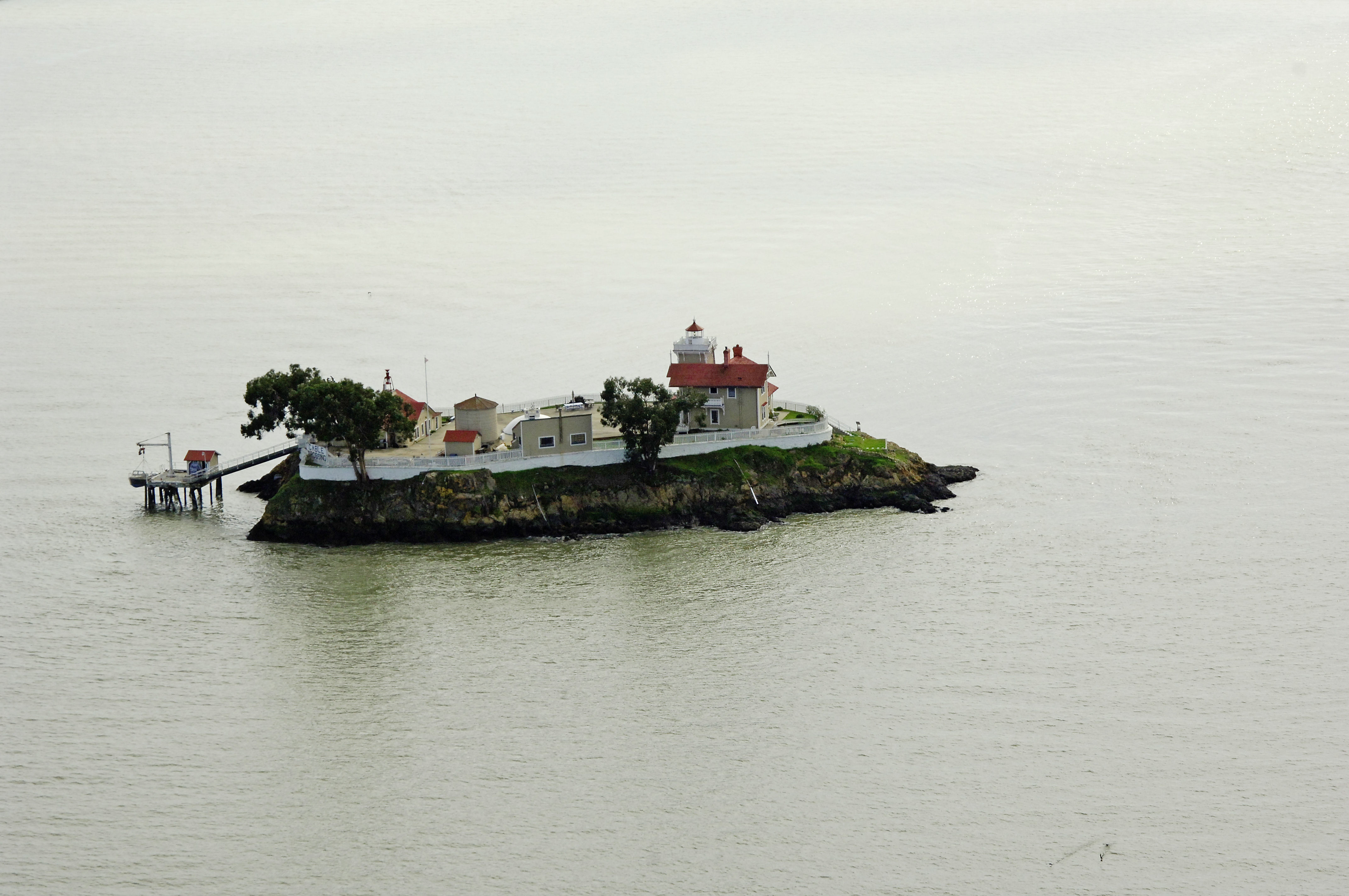
Seen sitting east (hence the name) of its westerly brother (pun intended), the East Brother Lighthouse Serves to mark the island just off of Point San Pablo Strait.
Casting a flashing white beam (horn with fog) 61 feet above San Pablo Strait, the light is only operable Oct. 1 through April 1.
History:
The station was first lit in 1874. The Victorian structure housed a fourth-order Fresnel lens in a 37-foot tower. A steam whistle, water cistern, oil house, water house, coalhouse, and small dock were also built.
In 1969, the station was automated and unmanned.
Navigating in and Around the Lighthouse:
San Pablo Strait can be very busy with commercial and recreational traffic at times, so a close lookout for traffic is always warranted. Approaching from the south, Invincible and Whiting rocks are marked with quick flashing red buoy 16 and flashing red bell buoy 18, respectively.
The lighthouse also serves as a Bed and Breakfast, and is accessible via a 10-minute boat ride from shore.