Point Sur Lighthouse
| California United States | |
| 36° 18' 21.96'', -121° 54' 7.2'' | |
| Monterey Harbor |


You might also consider...


About
Introduction:
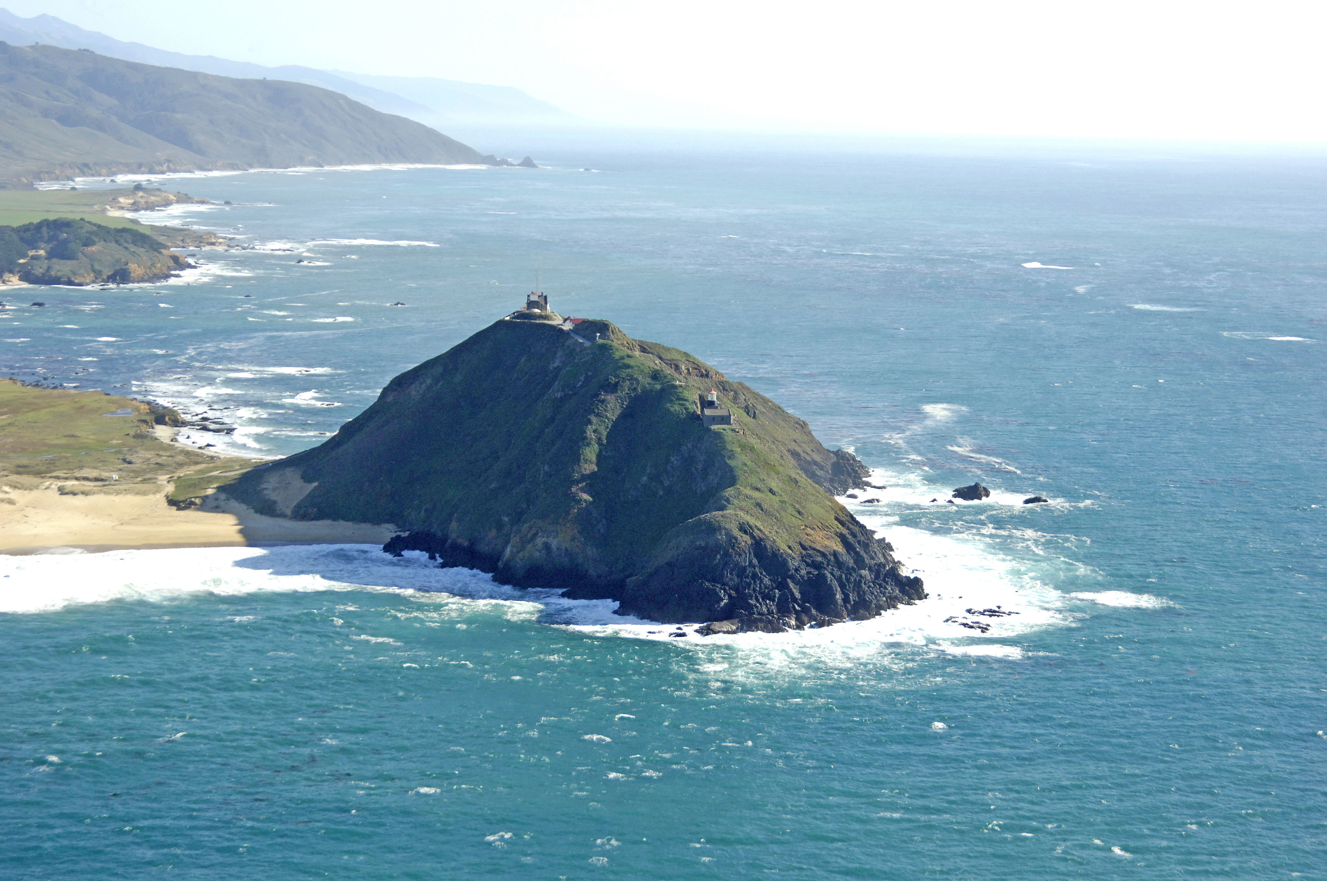
Perched atop 361-foot-high Point Sur Rock, Point Sur lighthouse is located about 19 miles south of the Monterey and the Monterey Peninsula region. This is one of the most beautiful stretches of coastline in the world, and a drive farther south from the lighthouse is worth the time.
History:
Work on the lighthouse was concluded here in 1889, some 14 years after the steamship Ventura wrecked nearby. The USCG automated the light in 1972.
Navigating in and Around the Lighthouse:
Use NOAA Chart 18696.
Characteristics: Flashing white every 15 seconds with a focal beam 250 feet above the Pacific Ocean.
Local Notices to Mariners:
Local Notices to Mariners are available online from the U.S. Coast Guard.
Tour Schedule:
Tours of the lighthouse and surrounding grounds are conducted on a highly variable schedule. Contact the Maritime Museum in Monterey for further details.