


Jacksonville Harbor
Florida United States
Marinas near Jacksonville Harbor
| Name | Reviews | Max LOA | VHF | Dock Depth | Gas / Diesel | Lift / Crane | Wifi | Amps |
|---|---|---|---|---|---|---|---|---|
| River City Marina | - | - | - | - | GYesDYes | - | - | - |
| Jacksonville Landing | - | - | - | - | - | - | - | - |
| Plaza Marina (Berkman) | - | 0.0 m | - | Low 0.0 mHigh 0.0' | - | - | - | - |
| Metropolitan Park Marina | - | 400.0' | - | Low 10.0'High 89.0' | GYesDYes | - | - | |
| Arlington Marina | 40.0' | 16 | Low 0.0 mHigh 0.0' | GYesDYes | LYes | 30, 50 | ||
| Port 32 Jacksonville | 75.0' | 16 | Low 6.0'High 75.0' | - | - | 50A 30A | ||
| Sadler Point Marina | 80.0' | 7 | Low 5.0' | G$4.999/galD$5.099/gal | LYes | 30 | ||
| Huckins Yacht Corp | - | - | - | - | GYesDYes | - | - | - |
| Lamb's Yacht Center Inc | 120.0' | 16 | Low 0.0 mHigh 45.0' | GYesDYes | LYes | 30, 50, 100 | ||
| Lakeshore Dry Storage | - | 0.0' | - | Low 0.0 mHigh 0.0' | - | - | - | - |
| The Florida Yacht Club | - | 68 | - | - | - | - | - | |
| Seafarers Marina | - | 0.0' | - | Low 10.0'High 0.0' | - | - | - | |
| Light House Marina | - | - | - | - | - | - | - | - |
| Epping Forest Yacht Club | - | 0.0' | 16 | Low 0.0 mHigh 0.0' | - | - | - | 30, 50, 100 |
| Jacksonville Zoological Gardens | - | - | - | - | - | - | - | - |
Introduction:
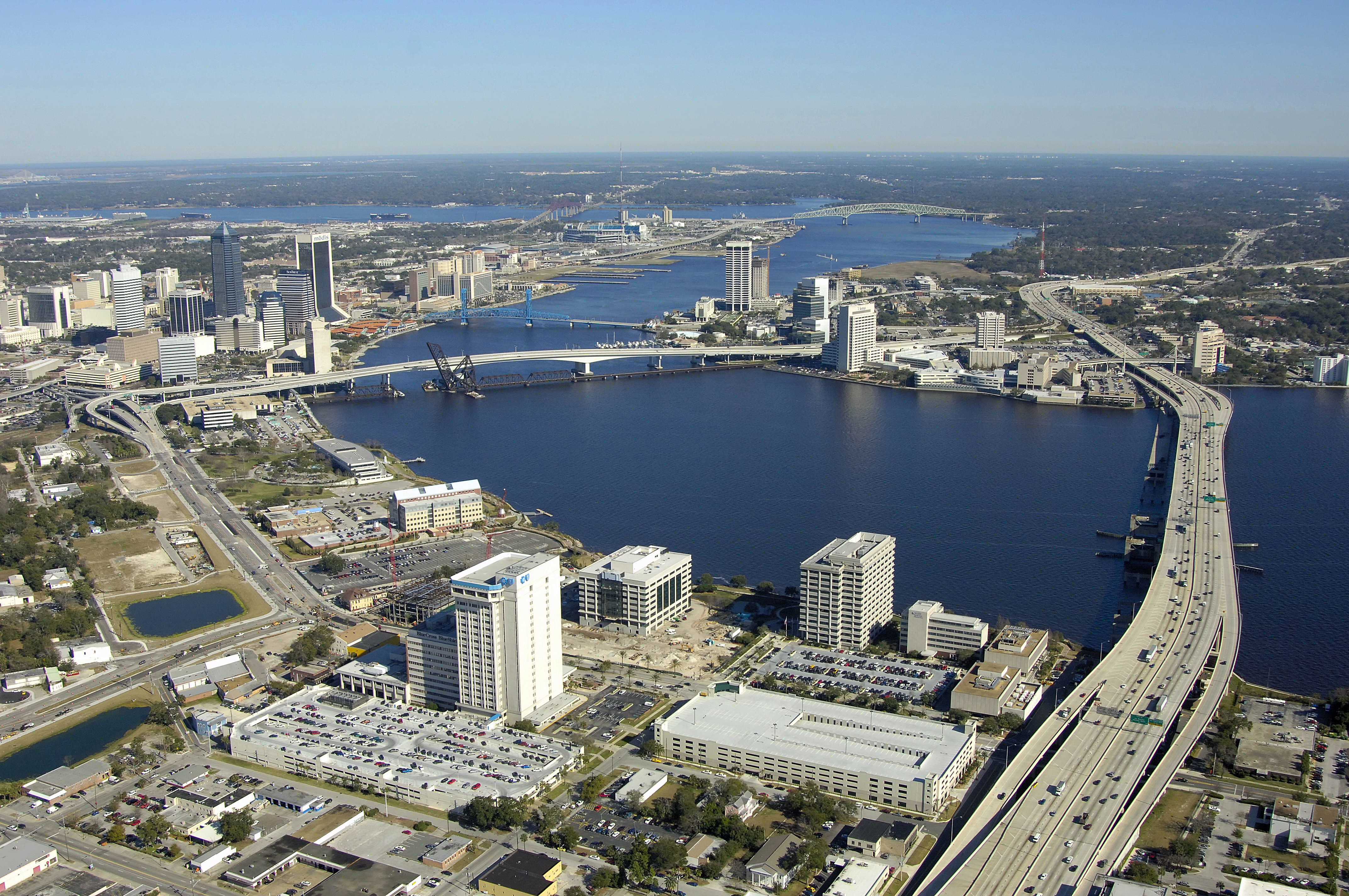
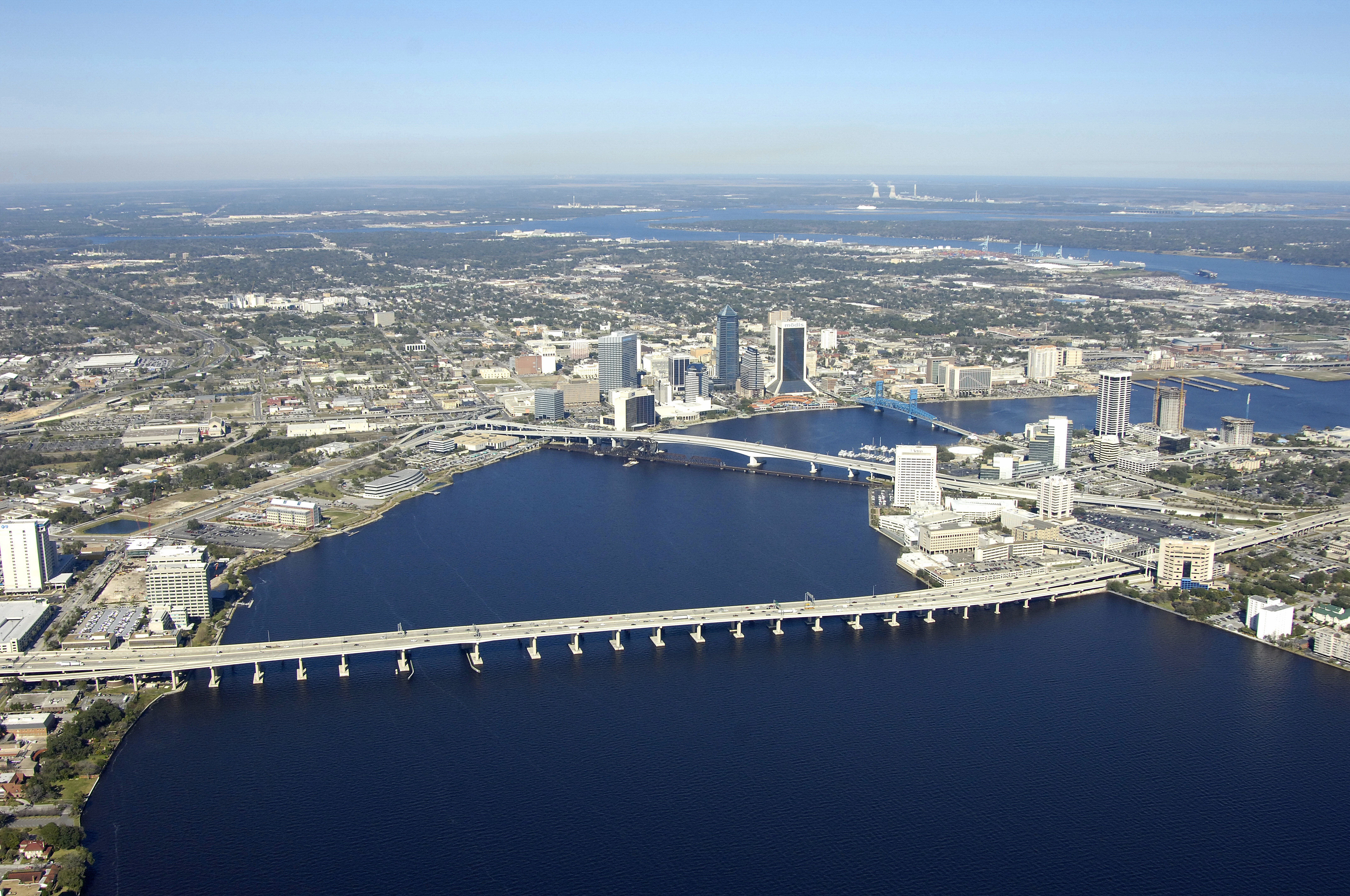
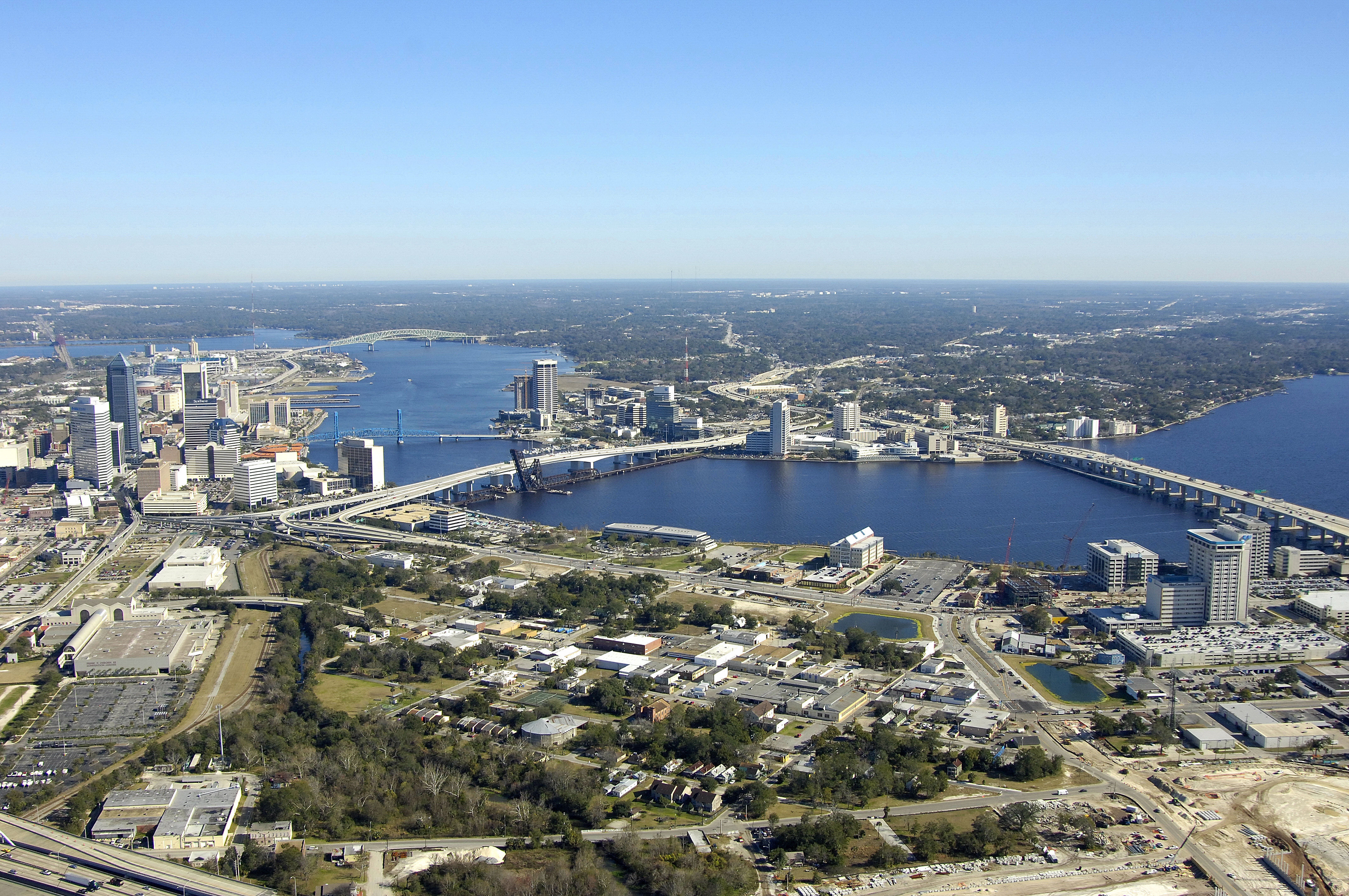
Located in Northeast Florida at the crossroads of two interstate highways on the Saint Johns River, Jacksonville is the largest city in the contiguous United States in land area, a major port, the insurance and financial center of the state, site of U.S. Navy bases and the home of the National Football League's Jacksonville Jaguars.
Easily accessed from the Atlantic Ocean via the Saint Johns River Inlet, or from the Intracoatsal Waterway (ICW) via the Saint Johns River, Jacksonville is a popular stopover spot and active recreational boating and fishing area.
[i]Information Courtesy Jacksonville Chamber of Commerce[/i]
History:
Long ago, Northeast Florida was first inhabited by Timucuan Indians who lived along creeks and waterways. The Spanish came into the area in 1513, led by Juan Ponce de Leon. He named the area La Florida and, in doing so, established the region's rich tradition of history and heritage.
During the mid-to-late 19th century, Jacksonville was billed as the "winter city in summerland" and became a haven for those seeking respite from colder northern climes. The warm, sunny climate, beautiful beaches, a major shipping port, and the busy waterways drew tourists from around the world.
A raging fire in 1901 destroyed 2,368 downtown buildings but launched a renaissance which set the city on its modern-day course. For the next 25 years, Jacksonville's river and its ocean port again served as the lifeblood of the area, attracting many new residents, businesses and visitors. The city quietly evolved into a major business center of the South. In 1993, the quiet ended. The National Football League awarded a franchise to Jacksonville, pushing the city into the national spotlight and toward a new destiny.
[i]Information Courtesy Jacksonville Chamber of Commerce[/i]
Navigating the Water:
Use NOAA Chart 11491.
Jacksonville is located 18 miles inland form the Atlantic Ocean, and about 12 miles form the ICW route. The Saint Johns River is an extremely busy commercial area, and when combined with the swift current of the Saint Johns, a close lookout is warranted.
There are several bridges and ferries that cross the Saint Johns in various places, but most of the bridges are high-vertical clearance fixed bridges, or railroad bascule spans that are left in the open position unless rail traffic is approaching. All other bridges answer VHF CHannel 09.
Local Notices to Mariners:
Local Notices to Mariners are available online from the U.S. Coast Guard.
Transportation:
Jacksonville International Airport is located about 12 miles north of the city and has frequent service from major carriers. The Jacksonville Transportation Authority provides bus service in, around and to the beaches of Jacksonville on regular schedules. See the links below for more information or schedules.
Helpful Links:
Jacksonville Chamber of Commerce
Jacksonville Convention and Visitors Bureau
Jacksonville Calendar of Events