


Moss Landing Harbor
California United States
Marinas near Moss Landing Harbor
| Name | Reviews | Max LOA | VHF | Dock Depth | Gas / Diesel | Lift / Crane | Wifi | Amps |
|---|---|---|---|---|---|---|---|---|
| Gravelle's Boat Yard | - | - | - | - | GYesDYes | - | - | - |
| Woodwards Marine | - | 0.0' | - | Low 0.0'High 0.0' | - | - | - | - |
| Moss Landing Harbor District | - | - | - | - | - | - | - | - |
| Elkhorn Yacht Club | - | 0.0' | - | Low 0.0'High 0.0' | - | - | - | - |
| Soquel Cove Mooring | - | 0.0 m | - | Low 0.0 mHigh 0.0' | - | - | - | - |
| Capitola Boat and Bait | - | - | - | - | - | - | - | - |
| Monterey Marina | - | - | - | - | - | - | - | - |
| Monterey Bay Boatworks | - | - | 9 | - | - | - | - | - |
| Breakwater Cove Marina | - | 0.0' | - | Low 0.0'High 0.0' | - | - | - | - |
| Monterey Fisherman's Wharf | - | 0.0' | - | Low 0.0 mHigh 0.0' | - | - | - | - |
| Monterey Municipal Marina | - | - | - | - | - | - | - | - |
| Monterey Peninsula Yacht Club | - | - | - | - | - | - | - | - |
| Santa Cruz Harbor Fuel Dock | - | - | - | - | GYesDYes | - | - | - |
| Santa Cruz Harbor | - | - | - | - | - | - | - | - |
| Santa Cruz Yacht Club | - | - | - | - | - | - | - | - |
Introduction:
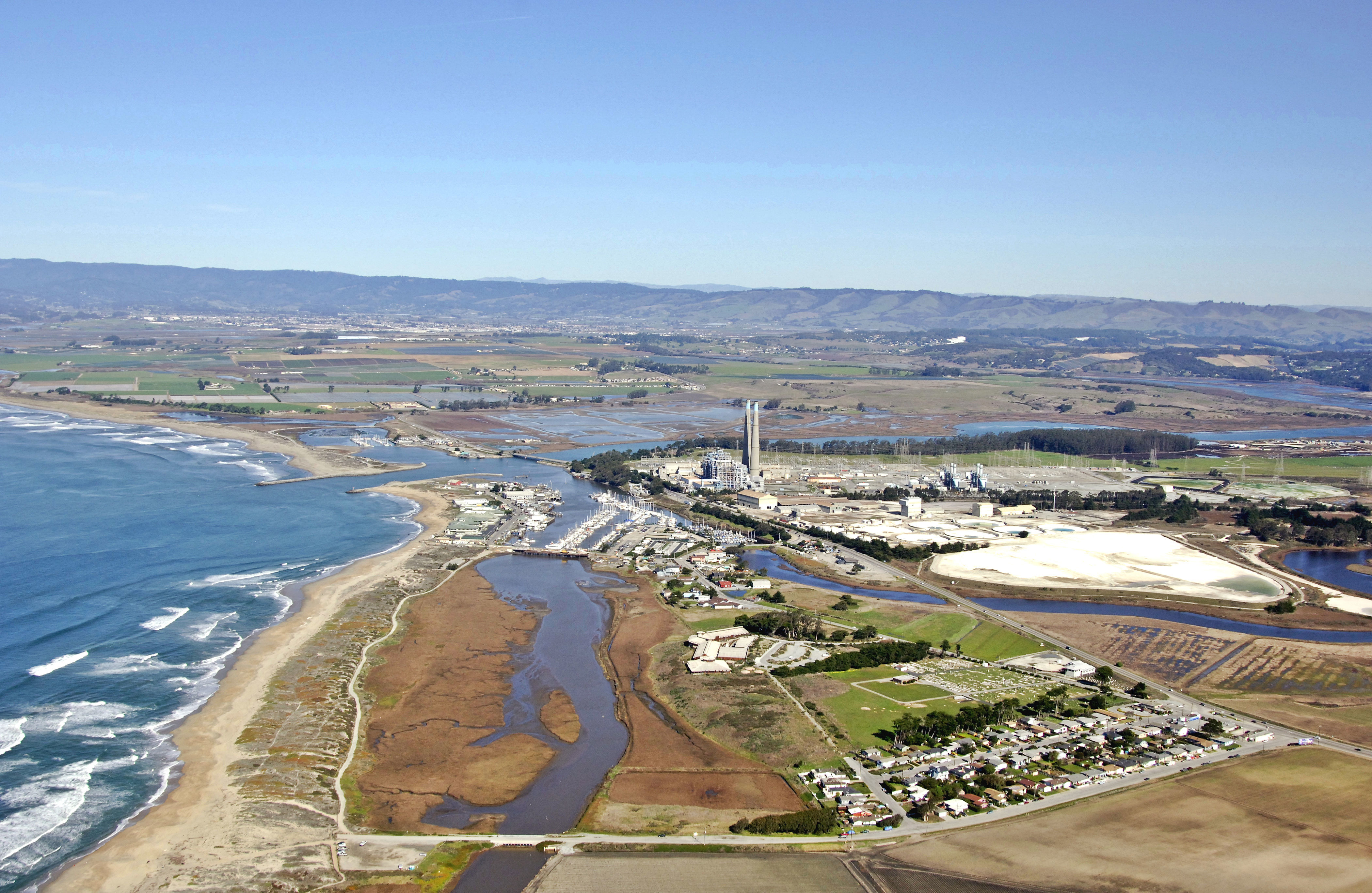
Located at the head of Monterey Bay, Moss Landing is home to much of the commercial vessels that fish the Pacific Waters outside of Monterey Bay, and scientific vessels that research the life inside of it.
Just north of Monterey, a half-hour south of Santa Cruz, and a day-trips distance from San Francisco, Moss landing is a convenient stop for marine service and repairs, yet conveniently located to several northern California attractions.
Navigating the Water:
Use NOAA Chart 18685.
Moss Landing has a deep inlet that is well break watered on both sides, but with no parallel protection from incoming swells, entry and exit can sometimes be challenging.
Although the large stacks from the local power plane make an excellent offshore landmark, it will be flashing green 3 and flashing red 2 that will guide you in past the breakwaters. An entrance range is also available to help keep you in mid-channel. Once inside, the entrance channel makes a hard break to the right toward the marina facilities near an 8-foot-high fixed vertical clearance bridge that limits travel up shallow Elk Slough. Mind the green can buoys on your way south in the inner channel and expect six- to eight-foot depths in the marina basin itself.
Local Notices to Mariners:
Local Notices to Mariners are available online from the U.S. Coast Guard.