


Port Sonoma Harbor
California United States
Marinas near Port Sonoma Harbor
| Name | Reviews | Max LOA | VHF | Dock Depth | Gas / Diesel | Lift / Crane | Wifi | Amps |
|---|---|---|---|---|---|---|---|---|
| Port of Sonoma Bait Shop and Fuel Dock | - | 0.0 m | - | Low 0.0'High 0.0 m | - | - | - | - |
| Mira Monte Landing | - | - | - | - | - | - | - | - |
| Gilardis Lakeville Marina | - | 0.0 m | - | Low 0.0 mHigh 0.0' | - | - | - | - |
| Buck's Launching | - | 0.0 m | - | Low 0.0 mHigh 0.0 m | - | - | - | - |
| China Camp State Park | - | - | - | - | - | - | - | - |
| Petaluma Marina | - | 0.0' | - | Low 0.0'High 0.0' | GYesDYes | - | - | - |
| Safe Harbor Loch Lomond | - | 16 | - | - | - | - | 30/50 | |
| Loch Lomond Yacht Club | - | 0.0' | - | Low 0.0'High 0.0' | - | - | - | - |
| Marin Yacht Club | - | 0.0' | - | Low 0.0'High 0.0' | - | - | - | - |
| Rubicon Yachts | - | - | - | - | - | - | - | - |
| Western Boat & Tackle | - | - | - | - | - | - | - | - |
| Marin Boat House | - | - | - | - | - | - | - | - |
| San Rafael Yacht Club | - | 0.0' | 68 | Low 0.0 mHigh 0.0' | - | - | - | - |
| Lowrie Yacht Harbor | - | - | - | - | - | - | - | - |
| San Rafael Yacht Harbor | - | 0.0 m | - | Low 0.0 mHigh 0.0' | - | - | - | - |
Helpful Links:
Petaluma Area Chamber of Commerce
Introduction:
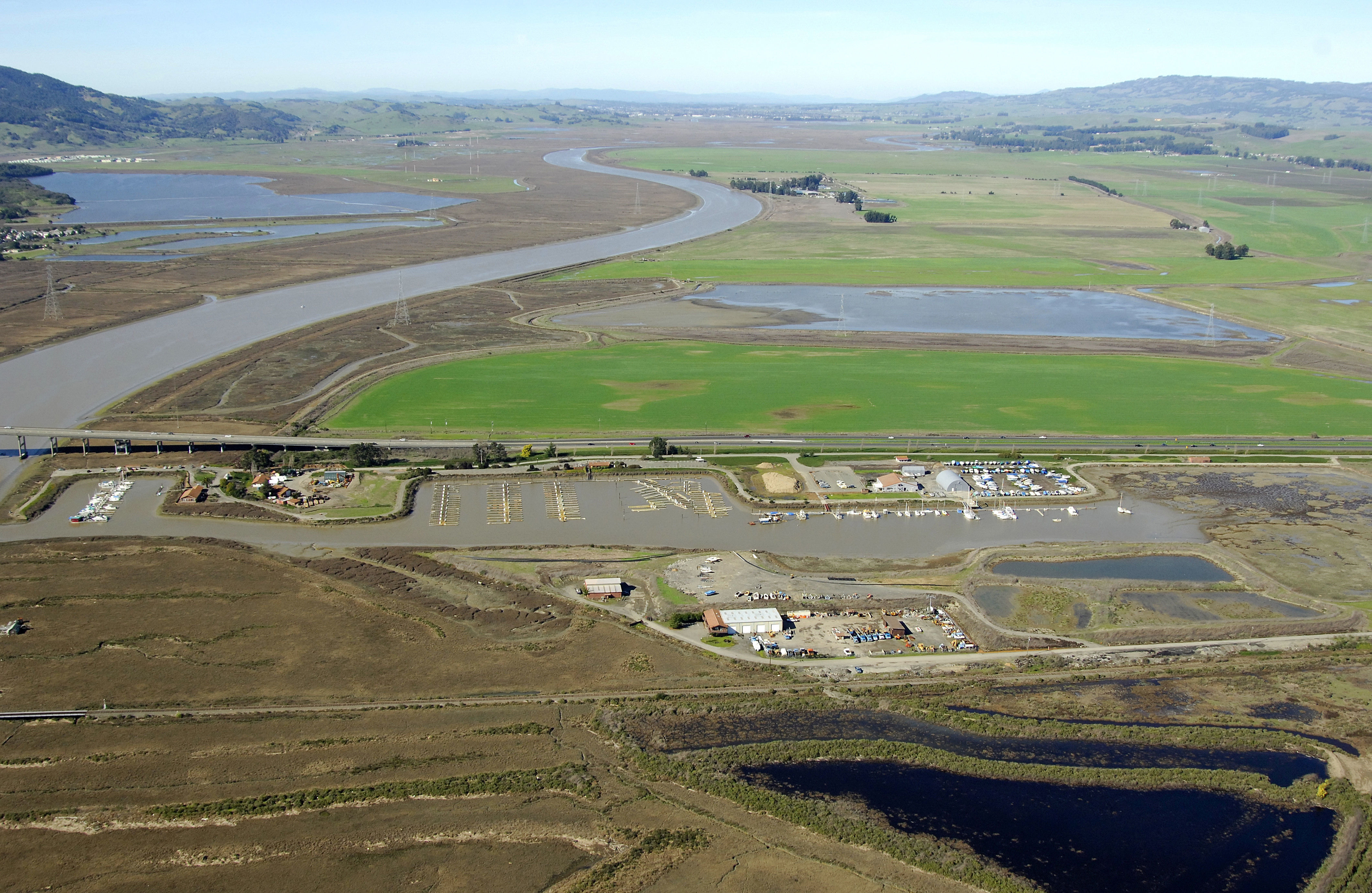
Located downriver from the city of Petaluma, Port Sonoma lies on the Petaluma River, which empties not far away into San Pablo Bay, north of San Francisco. Novato is the closest town (to the west), but has little in the way of facilities.
Navigating the Water:
Use NOAA Chart 18654.
Approach from the south. Port Sonoma is reached via a long, narrow channel that starts with flashing red 2 in San Pedro Bay a good two miles south of Port Sonoma. The channel is reported to have six-foot depths and a width of 15 feet, so it is advised that you pay close attention to the numerous closely spaced marks.
Things get a little tricky at the mouth of the Petaluma River around green daybeacon 15 and flashing red 16, as the channel makes a westward bend toward the facilities at Port Sonoma. Depths deepen once inside the river, but shallow again in the marina here, which has depths of about four to seven feet.
Local Notices to Mariners:
Local Notices to Mariners are available online from the U.S. Coast Guard.