


Redwood City Harbor
California United States
Marinas near Redwood City Harbor
| Name | Reviews | Max LOA | VHF | Dock Depth | Gas / Diesel | Lift / Crane | Wifi | Amps |
|---|---|---|---|---|---|---|---|---|
| Redwood Landing Marina | - | - | - | - | - | - | - | - |
| Sequoia Yacht Club | - | - | - | - | - | - | - | - |
| Port of Redwood City Municipal Marina | - | 16 | Low 7.0'High 15.0' | - | - | - | ||
| Blu Harbor by Windsor | - | - | - | - | - | - | - | |
| Bair Island Marina | 75.0' | - | Low 0.0'High 0.0' | - | - | - | 30, 50 | |
| Peninsula Yacht Club | - | 0.0 m | - | Low 0.0'High 0.0' | - | - | - | - |
| Docktown Marina | - | 0.0 m | - | Low 0.0'High 0.0' | - | - | - | - |
| Westpoint Harbor | - | - | Low 8.0' | G$6.95/galD$7.05/gal | - | 30/50/100 | ||
| Coyote Point Marina | 75.0' | 16 | Low 6.0' | G$6.75/galD$7.50/gal | - | - | ||
| Coyote Point Fuel Dock | - | 0.0 m | - | Low 0.0'High 0.0 m | - | - | - | - |
| Coyote Point Yacht Club | - | 0.0 m | - | Low 0.0'High 0.0 m | - | - | - | - |
| San Leandro Marina | - | 0.0 m | - | Low 0.0 mHigh 0.0' | - | - | - | - |
| Fremont Sailing Club | - | - | - | - | - | - | - | - |
| Oyster Point Fuel Dock | - | 0.0' | - | Low 0.0'High 0.0' | GYesDYes | - | - | - |
| South Bay Yacht Club | - | - | - | - | - | - | - | - |
Introduction:
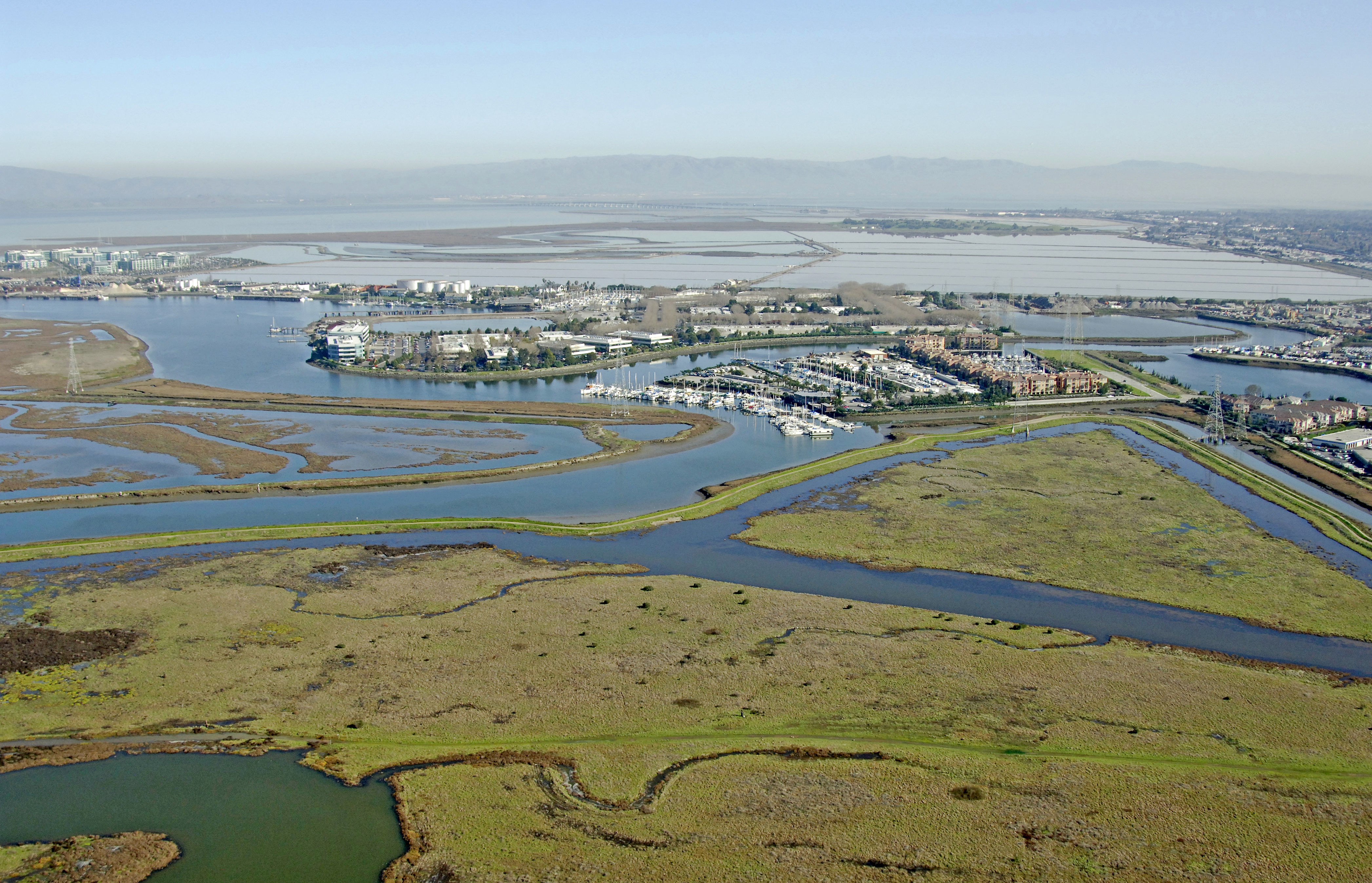
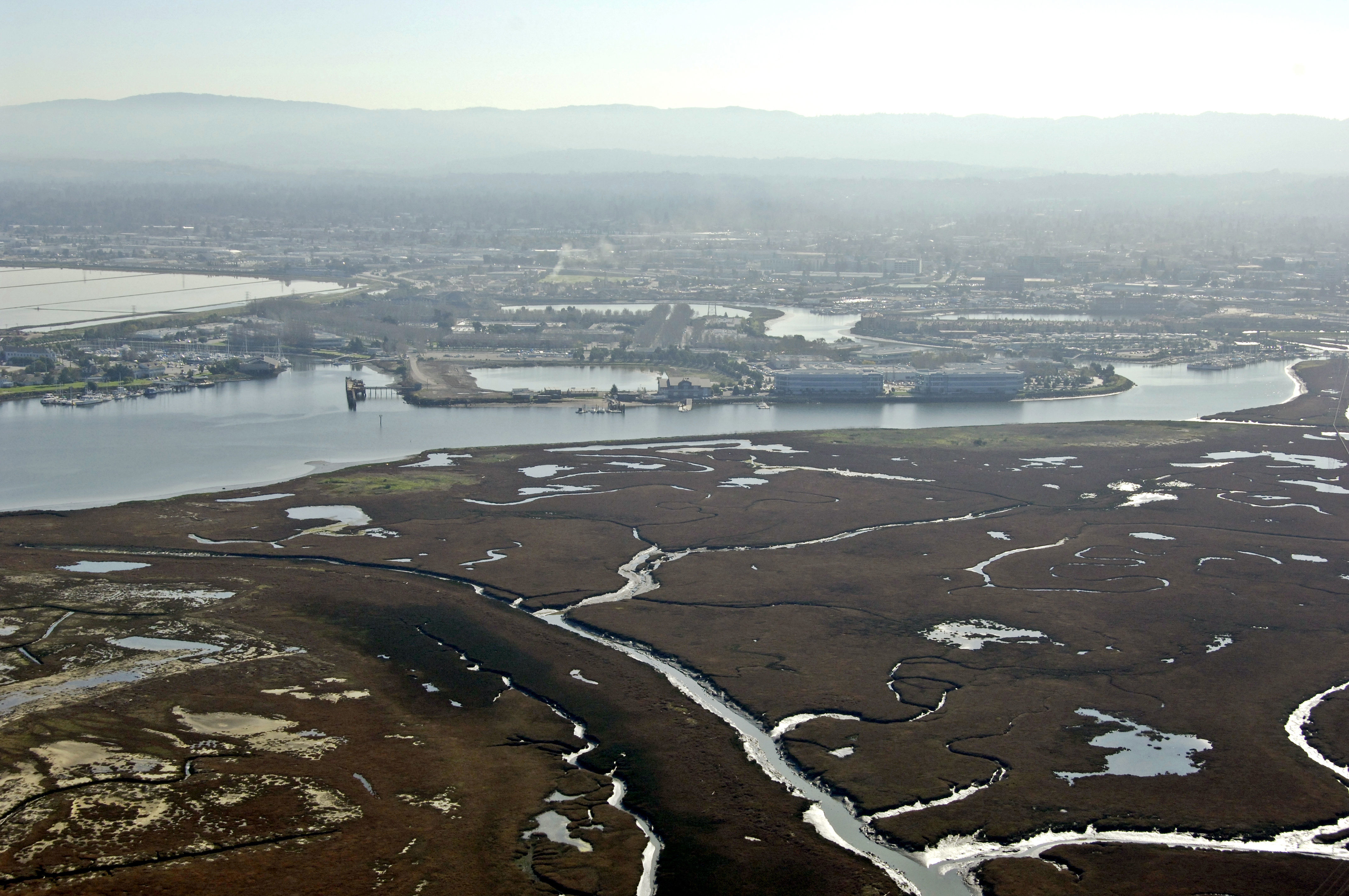
Redwood City is located off the 101 in the southern portion of San Francisco Bay, south of San Francisco and north of San Jose. Though marina facilities are somewhat limited here, Redwood City makes a convenient stop off point from which to explore San Jose, Cupertino, or make a jaunt north to San Francisco. Monterey and Big Sur are only a couple of hours away by car, and auto rentals are available in town.
Navigating the Water:
Use NOAA Chart 18651.
Approach from the north. Redwood Creek if the main entrance into Redwood City and has a deep and fairly wide channel. Quick flashing red 2 marks the beginning of the channel into Redwood Creek and is followed by flashing green buoy 3. From here, a series of flashing fixed marks guide you past Redwood Point, Corkscrew Slough, Westpoint Slough and onto the municipal wharf and yacht harbor areas. Depths are fairly consistent at 28 feet throughout.
Local Notices to Mariners:
Local Notices to Mariners are available online from the U.S. Coast Guard.