


Bakers Bay
Great Guana Cay, Abacos Bahamas
Marinas near Bakers Bay
| Name | Reviews | Max LOA | VHF | Dock Depth | Gas / Diesel | Lift / Crane | Wifi | Amps |
|---|---|---|---|---|---|---|---|---|
| Baker's Bay Golf Club & Marina | - | - | - | Low 12.5' | - | - | 50, 100 | |
| Guana Hideaways Marina | - | - | - | - | - | - | - | - |
| Orchid Bay Yacht Club & Marina | - | 0.0 m | 16 | Low 13.0'High 0.0 m | GNearbyDNearby | - | - | |
| Treasure Cay Resort, Marina & Golf Course | 130.0' | 16 | Low 0.0'High 0.0' | G$5.19/galD$5.35/gal | - | 30/50/100 | ||
| Pineapple Point Resort | - | - | - | - | - | - | - | - |
| Roberts Dock and Cottages | - | - | - | - | - | - | - | - |
| Roberts Marine | - | - | - | - | - | - | - | - |
| Edwin's Boat Yard #1 | 0.0 m | - | Low 0.0 mHigh 0.0 m | - | - | - | - | |
| Black Sound Marina | 0.0 m | - | Low 0.0 mHigh 0.0 m | - | - | - | - | |
| Beach Weekend Bahamas | - | 16 | - | - | - | 30, 50, 100 | ||
| Edwin's Boat Yard #2 | - | 0.0 m | - | Low 0.0 mHigh 0.0 m | - | - | - | - |
| Man-O-War Marina | 115.0' | 16 | Low 8.0'High 7.5' | GYesDYes | - | 30A, 50A, Double 50A | ||
| New Plymouth Public Dock | - | 0.0 m | - | Low 0.0 mHigh 0.0 m | - | - | - | - |
| The Other Shore Club | 0.0 m | - | Low 0.0 mHigh 0.0 m | - | - | - | - | |
| Abaco Yacht Services | - | 0.0 m | - | Low 0.0 mHigh 0.0' | - | - | - | - |
Introduction:
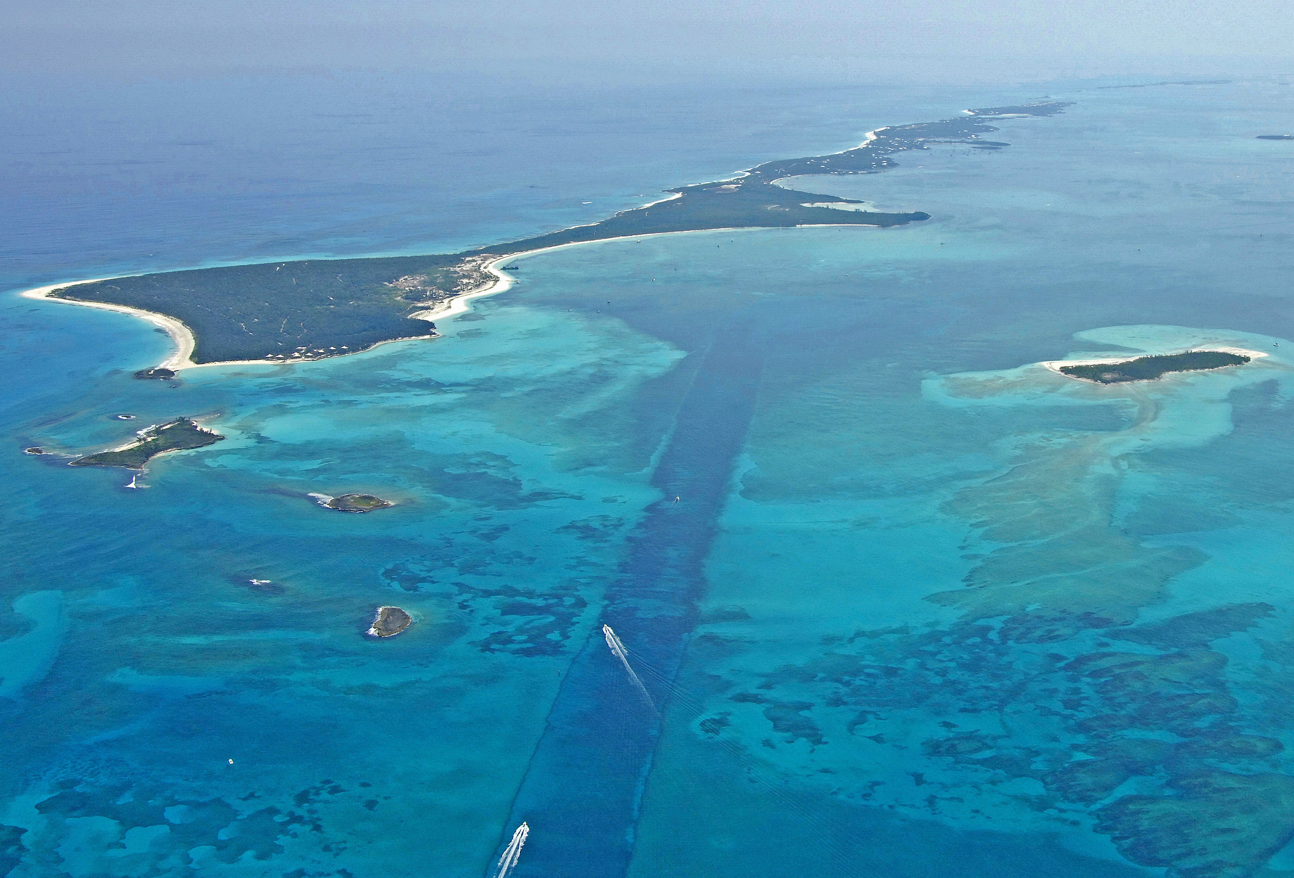
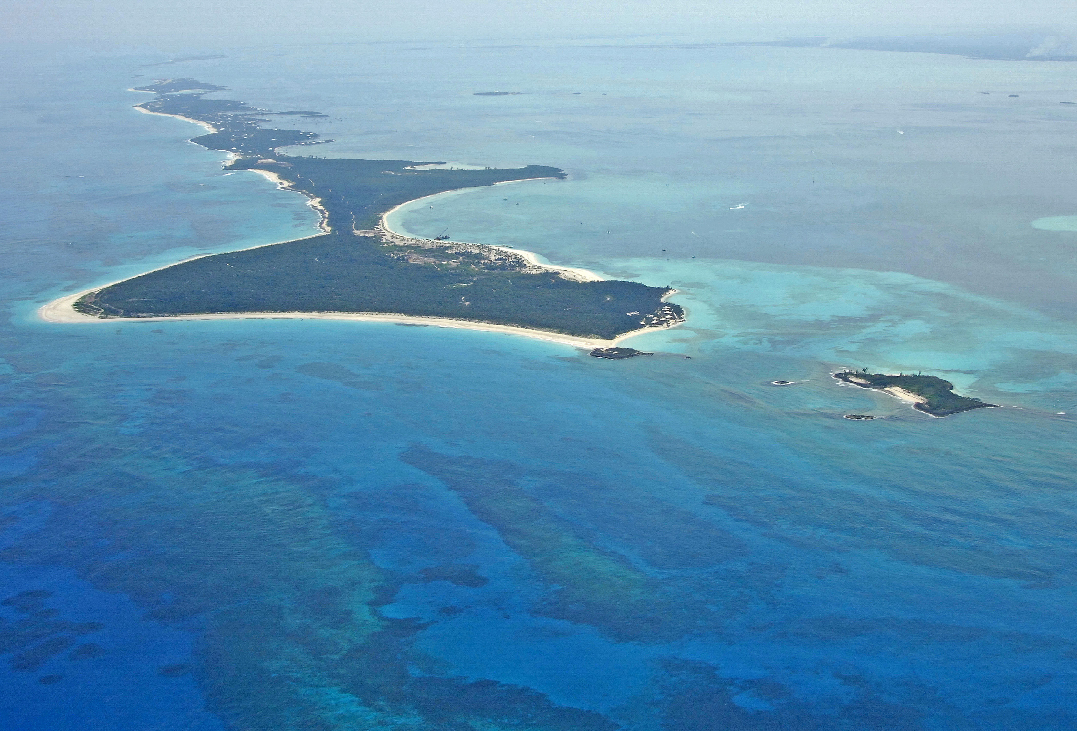
Originally a cruise ship depot, Bakers Bay is now a protected anchorage that is located on the far northwest end of Guana Cay in the Abacos island chain. The cruise depot has been abandoned for at least 16 years. The surrounding area on Guana Cay is ripe with development with many residential upscale developments taking foot here recently.
Navigating the Water:
Bakers Bay is very easy to enter from either the west or southeast. In the image above, the cut leaving Bakers Bay to the northwest can be seen, and Bakers bay lies just at the end of it to the left (northeast) in the small indentation into Guana Cay. Approaching from the northwest end of Guana Cay is not recommended, due to the multitude of reefs and islands that jut out around Gumelimi Cay.
Depths in Bakers Bay average 6 to 9 feet, and there is good protection from most direction sans the south and southeast. Development is afoot at Bakers Bay, with a marina, golf course, waterfront homes and other amenities planed as part of a large-scale development. If you have a penchant for shells and beach combing, the sandy shores here are among the best for finding that perfect take home collectable.
Local Notices to Mariners:
See our Local Notices to Mariners blog for updates on the latest conditions and advisories for this area.