


Crab Cay Harbor
Abacos Bahamas
Marinas near Crab Cay Harbor
| Name | Reviews | Max LOA | VHF | Dock Depth | Gas / Diesel | Lift / Crane | Wifi | Amps |
|---|---|---|---|---|---|---|---|---|
| Spanish Cay Marina | - | - | - | - | GYesDYes | - | - | - |
| Murray's Service Station (Esso) | - | - | - | - | - | - | - | - |
| Fiddler’s Green Cottages and Marina | - | - | - | Low 0.0'High 0.0' | - | - | - | |
| Green Turtle Club & Marina | 0.0' | - | Low 0.0'High 0.0' | GYesDYes | - | - | ||
| Bluff House Yacht Club & Marina | - | 0.0 m | - | Low 0.0 mHigh 0.0' | GYesDYes | - | - | - |
| Dolphin Marine | - | 0.0 m | - | Low 0.0 mHigh 0.0 m | - | - | - | - |
| Abaco Yacht Services | - | 0.0 m | - | Low 0.0 mHigh 0.0' | - | - | - | - |
| The Other Shore Club | 0.0 m | - | Low 0.0 mHigh 0.0 m | - | - | - | - | |
| New Plymouth Government Dock | - | 0.0 m | - | Low 0.0 mHigh 0.0 m | - | - | - | - |
| New Plymouth Public Dock | - | 0.0 m | - | Low 0.0 mHigh 0.0 m | - | - | - | - |
| Beach Weekend Bahamas | - | 16 | - | - | - | 30, 50, 100 | ||
| Black Sound Marina | 0.0 m | - | Low 0.0 mHigh 0.0 m | - | - | - | - | |
| Roberts Marine | - | - | - | - | - | - | - | - |
| Roberts Dock and Cottages | - | - | - | - | - | - | - | - |
| Pineapple Point Resort | - | - | - | - | - | - | - | - |
Introduction:
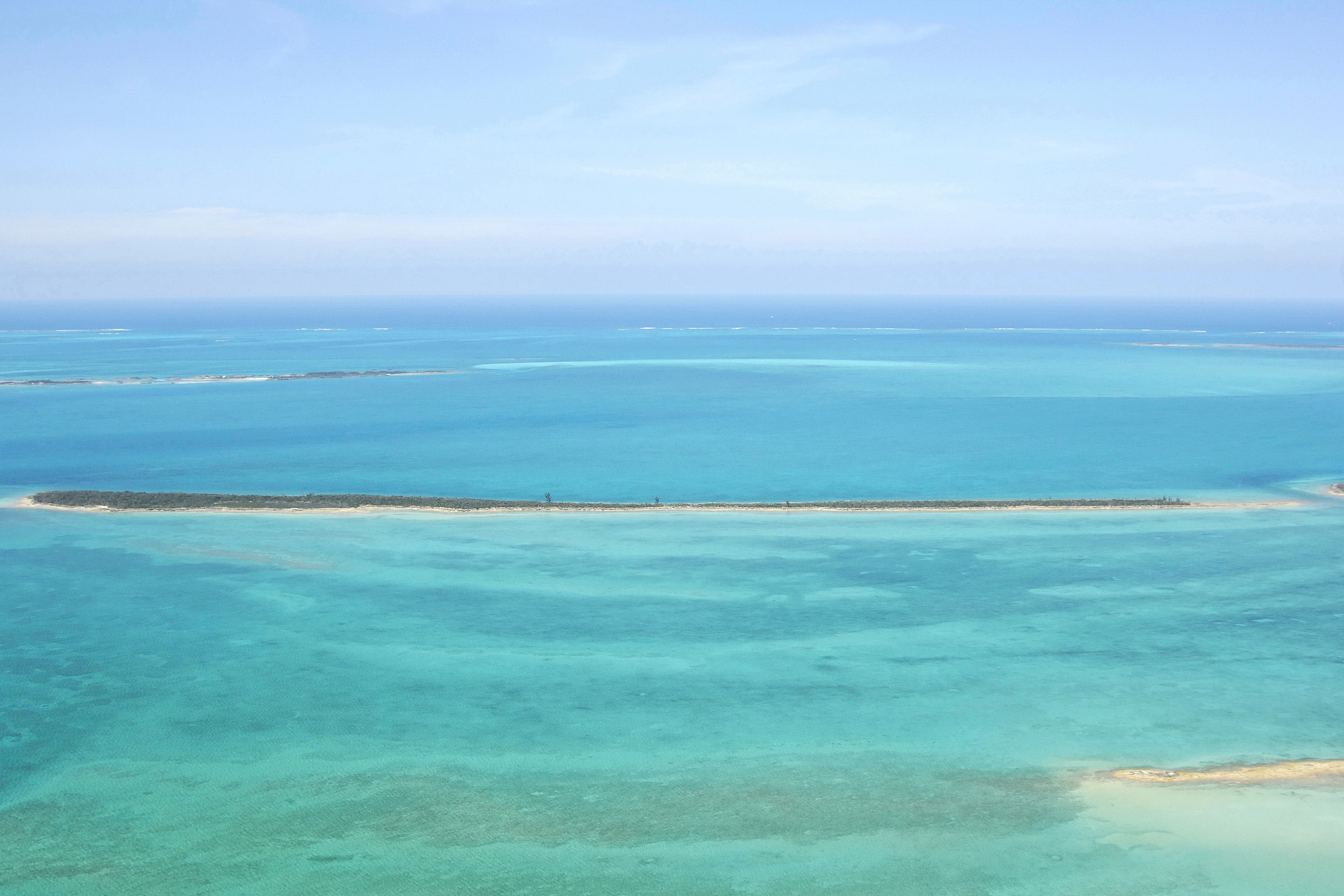
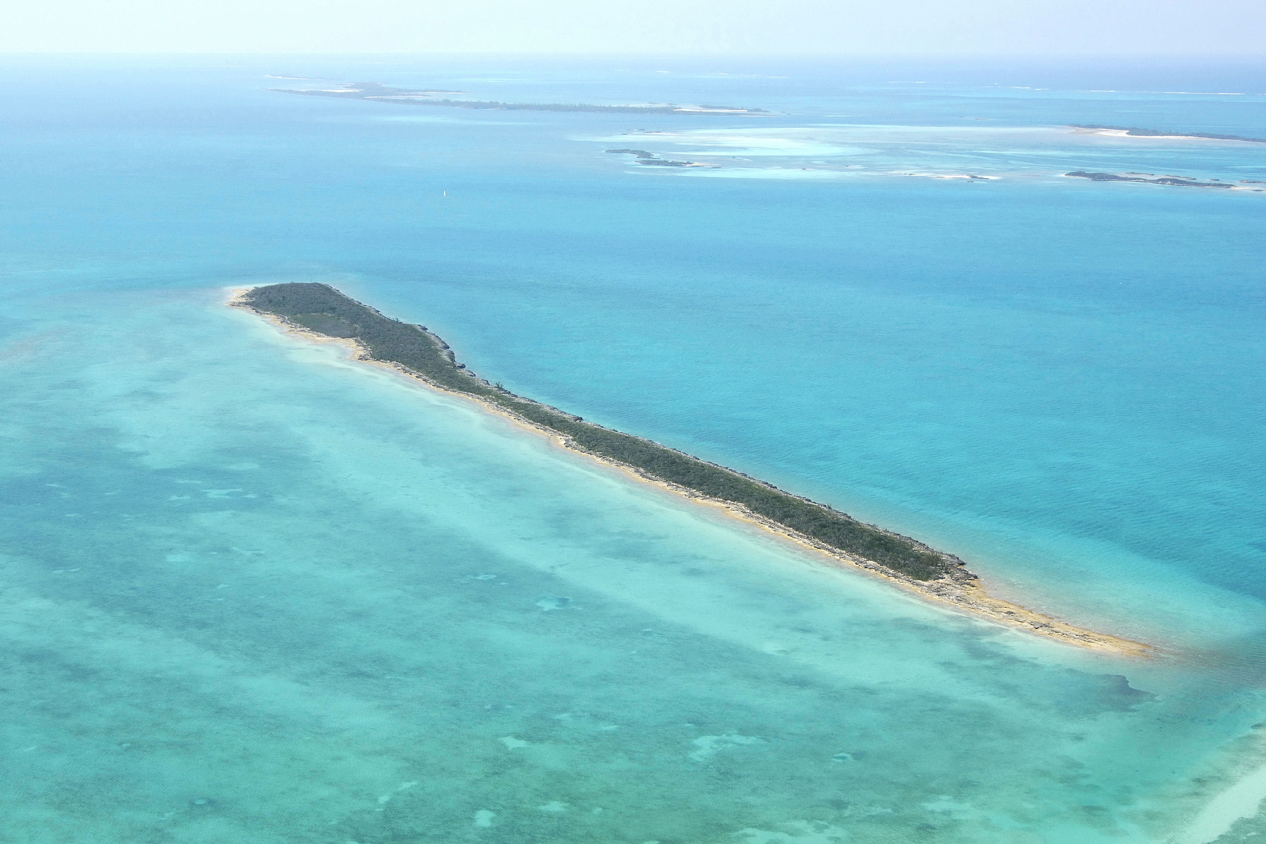
Crab Cay is located just off the extreme northwest end of Great Abaco Island near Anglefish Point. Crab Cay is 70 miles northeast of Freeport on Grand Bahama Island and 120 miles north of Nassau. The anchorage here is an excellent place to base your further exploration of other small cays in the area, but be advised that winds out of the northwest can make the area untenable.
Navigating the Water:
Crab Cay is visible in the image above in a view from the north. Just behind to the south is Angelfish Point and Great Abaco Island. The anchorage is on to the southwest of the southeast end of Crab Cay, and if you zoom in on the image above, you can see a black and white post that makes a good landmark day or night (flashing white every 5 seconds at night).
Local Notices to Mariners:
See our Local Notices to Mariners blog for updates on the latest conditions and advisories for this area.
Things To Do/Local Events:
Aside from snorkeling, beach combing, sailing, and other water activities, there is an active and vibrant calendar of other scheduled events in the Abacos. See our Helpful Links section below for a detailed calendar of events.
Transportation:
There is no airstrip on Crab Cay, so arriving here by boat is your only option. The two nearest airports are Treasure Cay Airport, about 18 miles to the southeast and Marsh Harbor Airport, about 42 miles away in the same direction.