


Cockburn Town Harbor
Cockburn Town, Turks and Caicos Islands
Marinas near Cockburn Town Harbor
| Name | Reviews | Max LOA | VHF | Dock Depth | Gas / Diesel | Lift / Crane | Wifi | Amps |
|---|---|---|---|---|---|---|---|---|
| Grand Turk Tourist Office | - | 0.0 m | - | Low 0.0 mHigh 0.0 m | - | - | - | - |
| Grand Turk Public Dock | - | - | - | - | - | - | - | - |
| Grand Turk Fishing Boat Dock | - | - | - | - | - | - | - | - |
| Grand Turk Marine Police Department | - | - | - | - | - | - | - | - |
| Salt Dock | - | - | - | - | - | - | - | - |
| Seaview Marina | - | - | - | - | - | - | - | - |
| East Bay Dinghy Landing | - | - | - | - | - | - | - | - |
| Fish Plant | - | - | - | - | - | - | - | - |
| North Caicos Yacht Club & Marina | - | - | - | - | - | - | - | - |
| Blue Haven Marina | - | - | 16 | - | GYesDYes | - | - | |
| Turks & Caicos Yacht Club | - | 0.0 m | - | Low 0.0 mHigh 0.0' | - | - | - | - |
| The Marina at South Bank | - | - | - | - | GYesDYes | LYesCYes | - | - |
| Southside Marina | - | 0.0 m | - | Low 0.0 mHigh 0.0 m | - | - | - | - |
| Turtle Cove Marina | - | 0.0 m | - | Low 0.0 mHigh 0.0 m | - | - | - | - |
| Public Dock At Watkin Park | - | - | - | - | - | - | - | - |
Introduction:
Grand Turk Island is the political capital of the Turks and Caicos Islands, and Cockburn Town is the seat of government (the Turks and Caicos Islands are a British territory). Founded by salt harvesters about three hundred years ago, the island has a typical Bermudan feel to it and the local architecture is heavily influenced by British style.
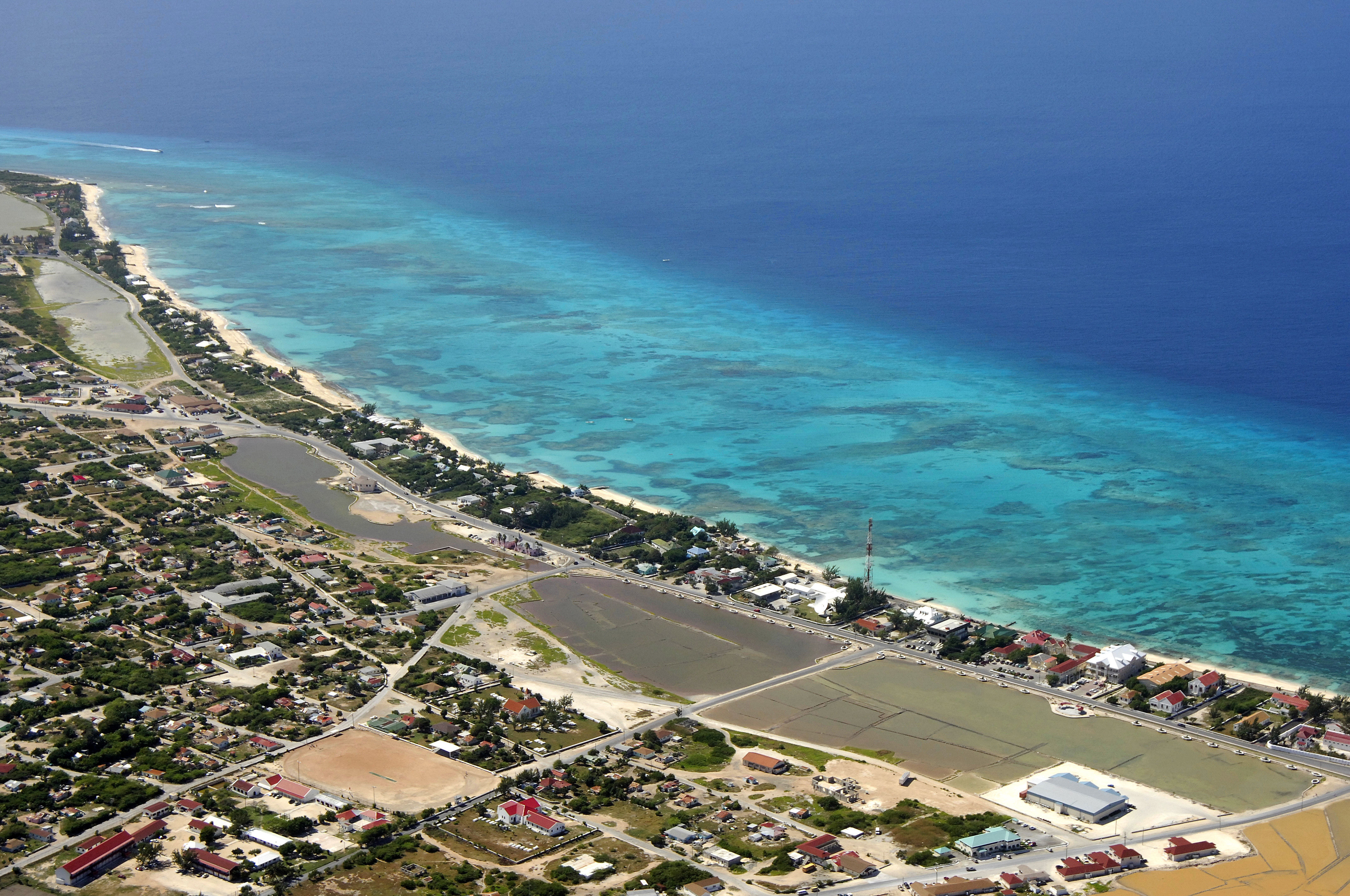
The image above is a view of Grand Turk Island and Cockburn Town looking south toward Grand Turk International Airport. Along the shore east of the cruise ship are several breaks in the reefs where cruisers can anchor.
Navigating the Water:
There are several breaks in the reefs surrounding the west side of Grand Turk near Cockburn Town, and cruising boaters can take advantage of the protected areas to find anchorage. From Pillory Beach (protected, no anchoring here) south to Boaby Rock Point, you can find three separate anchorages off Columbus Passage.
Once you have cleared the reefs and entered the shoreside anchorages, you will usually find 7- to 11-foot depths with good holding in a sand bottom. Westerly winds can result in an uncomfortable ride here.
Local Notices to Mariners:
See our Local Notices to Mariners blog for updates on the latest conditions and advisories for this area.