


Southern Providenciales Island Harbor
Turks and Caicos Islands
Marinas near Southern Providenciales Island Harbor
| Name | Reviews | Max LOA | VHF | Dock Depth | Gas / Diesel | Lift / Crane | Wifi | Amps |
|---|---|---|---|---|---|---|---|---|
| The Marina at South Bank | - | - | - | - | GYesDYes | LYesCYes | - | - |
| Turks & Caicos Yacht Club | - | 0.0 m | - | Low 0.0 mHigh 0.0' | - | - | - | - |
| Blue Haven Marina | - | - | 16 | - | GYesDYes | - | - | |
| Southside Marina | - | 0.0 m | - | Low 0.0 mHigh 0.0 m | - | - | - | - |
| Turtle Cove Marina | - | 0.0 m | - | Low 0.0 mHigh 0.0 m | - | - | - | - |
| Public Dock At Watkin Park | - | - | - | - | - | - | - | - |
| North Caicos Yacht Club & Marina | - | - | - | - | - | - | - | - |
| West Caicos Marina | - | - | - | - | - | - | - | - |
| Fish Plant | - | - | - | - | - | - | - | - |
| East Bay Dinghy Landing | - | - | - | - | - | - | - | - |
| Seaview Marina | - | - | - | - | - | - | - | - |
| Salt Dock | - | - | - | - | - | - | - | - |
| Grand Turk Public Dock | - | - | - | - | - | - | - | - |
| Grand Turk Fishing Boat Dock | - | - | - | - | - | - | - | - |
| Grand Turk Marine Police Department | - | - | - | - | - | - | - | - |
Introduction:
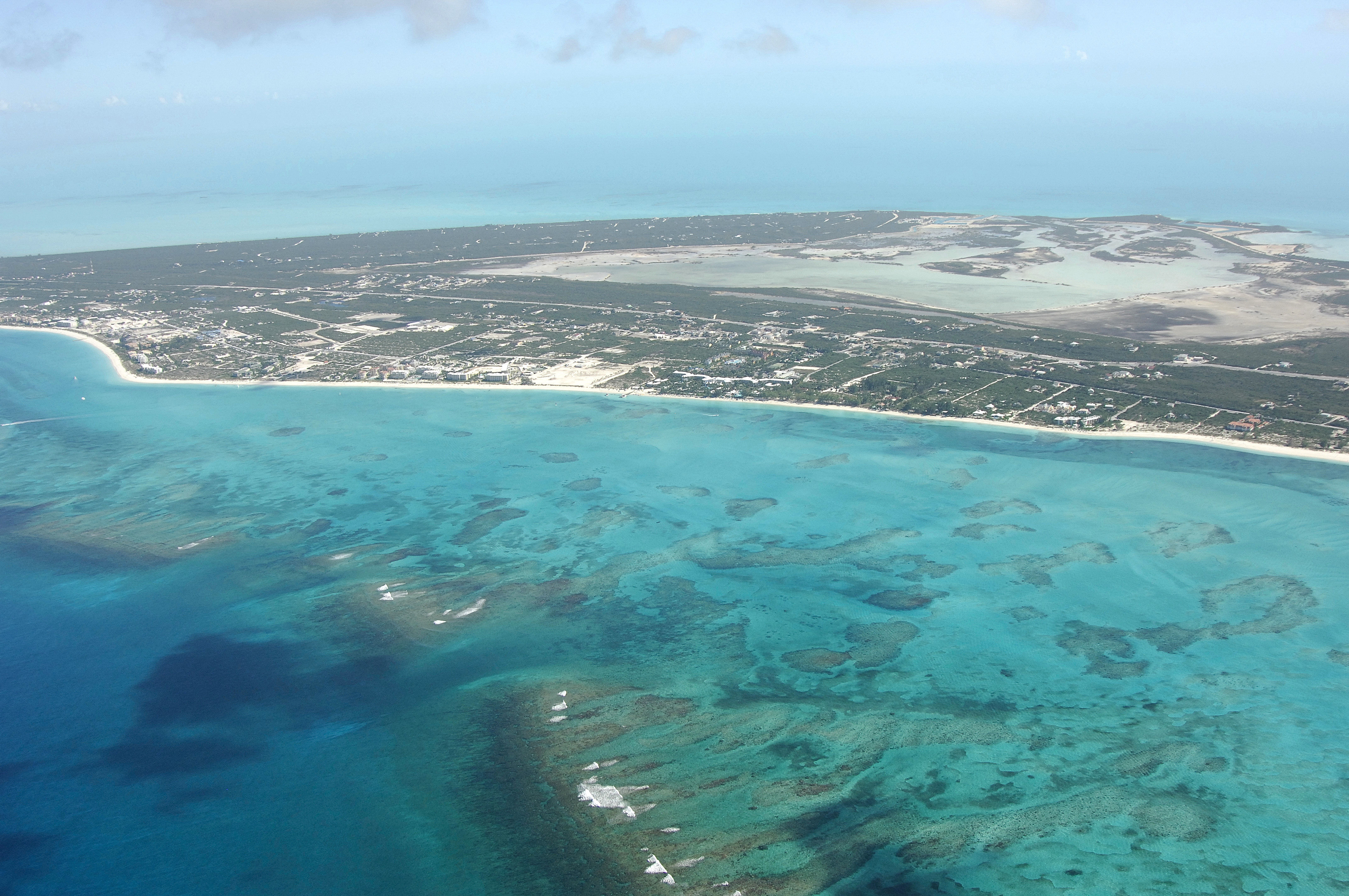
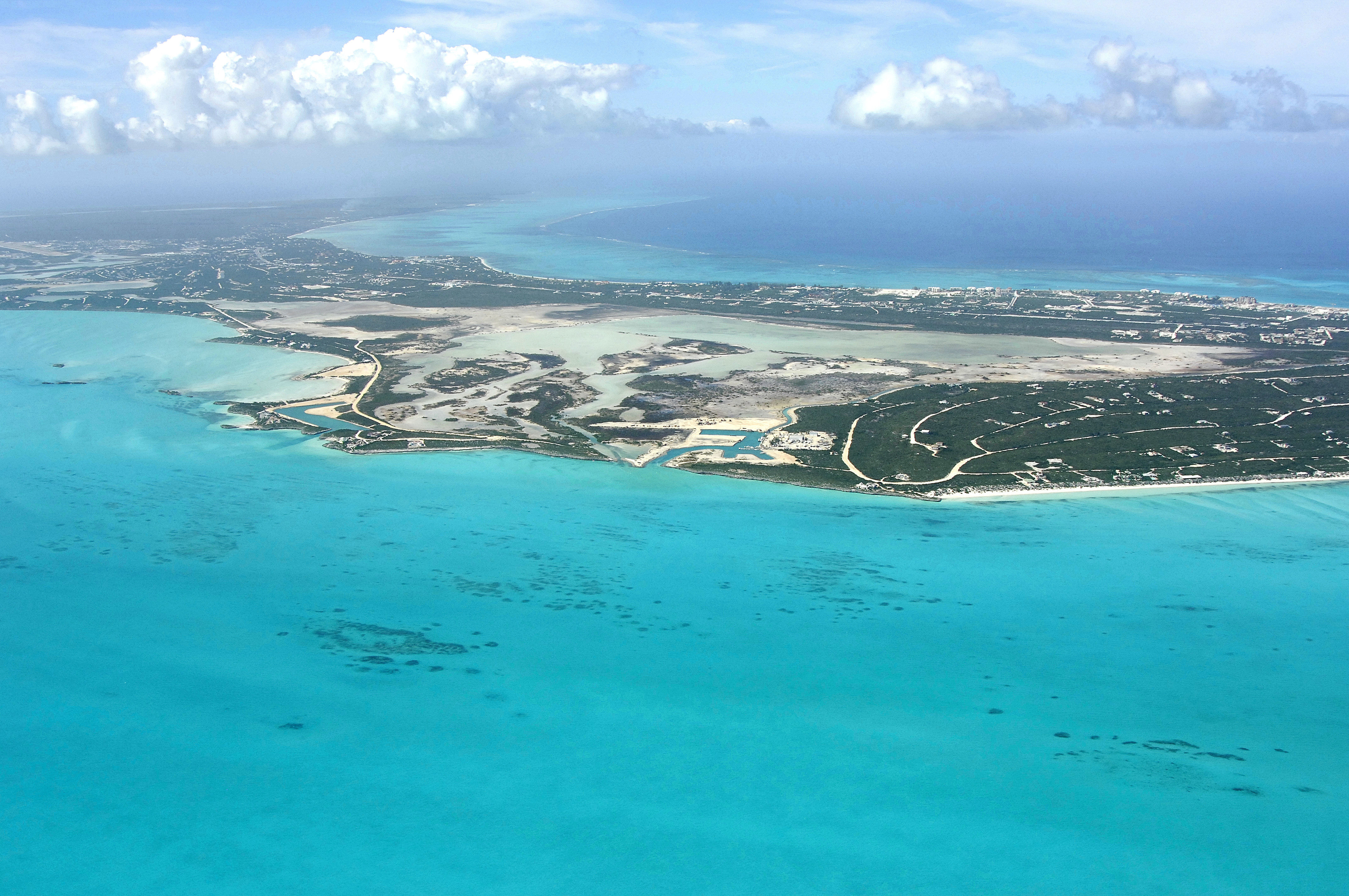
Although there are four man-made harbors that cut into the South Shore of Providenciales Island, only two of them contain marine facilities. The first (traveling east along Sapodillas Bay) is the South Side Basin Marina in Discovery Bay, and the second is farther east at Juba Point Creek, about 3 miles away. Of particular note is the marina at Juba Point Creek, where they have the only haul-out facilities in the entire island chain.
Navigating the Water:
The South Side Basin Marina is located in Cooper Jack Bight, an area that is more commonly referred to as Discovery Bay. Discovery Bay is located off Sapodilla bay in the southwest quadrant of Providenciales Island and is approached from the south via a locally marked passage east of Cooper Jack Rock (5-foot depths).
The Caicos Marina and Shipyard is located in Juba Point Creek, which is visible near the middle of the image above. Juba Point Creek is 5 miles southwest of Leeward Going Through and 3 miles east of the aforementioned South Side Basin Marina at Discovery Bay. Here you can arrange for a haul-out and related repair services - the only place in all of Turks and Caicos that can do so. This marina has an easier entrance with 7- to 9-foot depths (an no coral heads).
Local Notices to Mariners:
See our Local Notices to Mariners blog for updates on the latest conditions and advisories for this area.
Helpful Links:
Turks and Caicos Islands Tourism
Guide to Providenciales Island